by Robina McNeil and Richard Newman
With contributions by Mark Brennand, Bernard Champness, David Cranstone, Peter Davey, Andrew Fielding, David George, Elizabeth Huckerby, Christine Longworth, Ian Miller, Mike Morris, Michael Nevell, Caron Newman, North West Medieval Pottery Research Group, Peter Ryder, Sue Stallibrass, Nick Thorpe, Ruth Hurst Vose, Kevin Wilde, Ian Whyte and Sarah Woodcock.
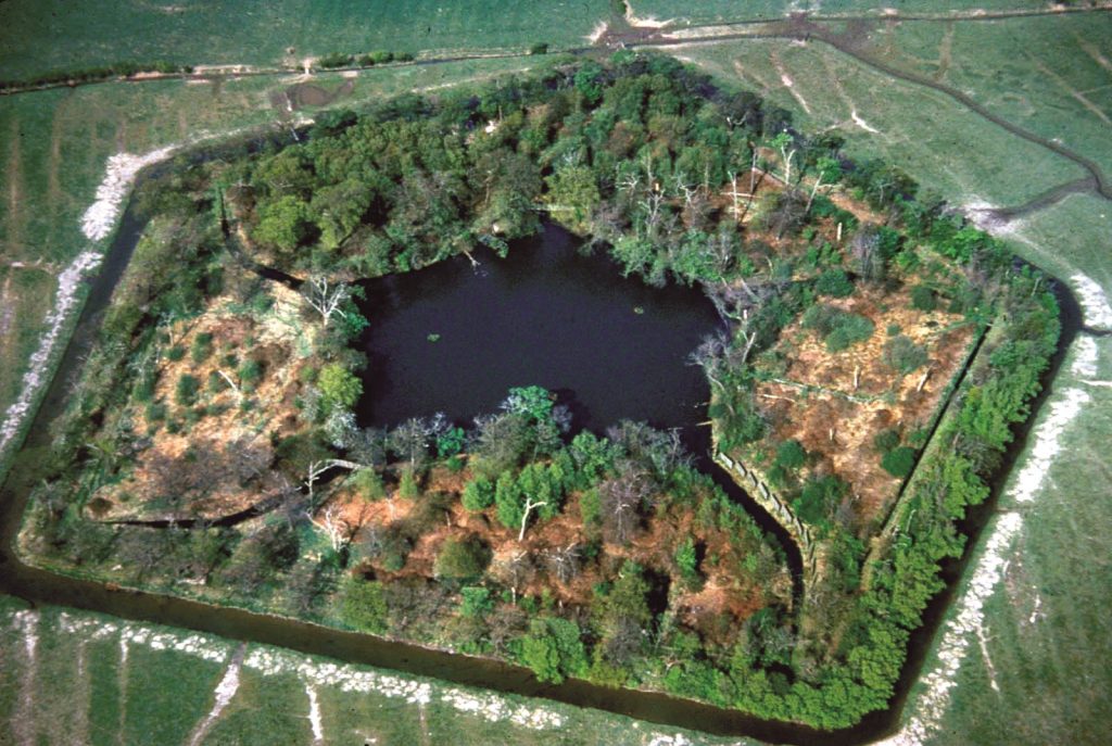
The Reformation is often seen as the dividing line between the Medieval and Post-Medieval periods. Beyond the redistribution of land from ecclesiastical to secular owners that the dissolution of the monasteries, brought about and the consequent economic and landscape changes, the material cultural impact of the Reformation (Fig 6.1) can be elusive to characterise beyond its effects on the fabric of church buildings (Gaimster & Gilchrist 2003). Yet, there was a long period of cultural transition, perhaps beginning at the end of the 14th century and culminating in the mid-17th century, when the Medieval world gave way to something more recognisably modern (Gaimster & Stamper 1997). Key features of this period were the impact of Renaissance learning and classicism on art and design, the rise of capitalism and consumerism and their effects on material culture (Johnson 1996), and the impact of more widespread overseas trade. Within the North West there are disparities, with the impacts of national developments having a variable significance and chronology dependent on area and social class. For example, there is a convincing argument to be made for the division between Medieval and Post-Medieval in the northern borderlands to begin in 1603 with the Union of the Crowns (Frodsham 2004, 111), whereas in the Welsh borders it would be marked much earlier.
The larger part of the period falls within the latter stages of the so called Little Ice Age (16th to 19th centuries) with initially colder conditions and later more rainfall (Lamb 1977). Severe storms caused coastal erosion, and sand blows onto agricultural land and settlements, notably along the Wirral and Fylde coasts. Increased rainfall is thought to have been instrumental in causing what are described in documentary sources as bog bursts. Leland writing in 1533 described the eruption in 1526 of Chat Moss (GM) (Crofton 1902, 140-1; Hall et al 1995, 125-131) and in 1633 Earl Cowper of Derbyshire described the eruption of White Moss (GM) (Crofton 1902, 140-1; Hall et al 1995, 125-131). In the 18th century it is reported that Pilling Moss (L) erupted (Sobee 1953, 153) and Thomas Patten writing in 1774 described an eruption of Solway Moss (C) in the early winter of 1771 (McEwan & Withers 1989; Hodgkinson et al 2000, 121). The consequences of these bog bursts were devastating, causing both loss of life and the destruction of property, but are yet to be identified in the archaeological record.
Until the later 18th century direct involvement in agriculture formed at least part of the employment of the majority of working people. Until the middle of the 19th century most of England’s population lived in a predominantly rural environment. The importance of the rural environment to the study of Post-Medieval archaeology has long been recognised in the Society for Post-Medieval Archaeology research agenda (1988) and has recently been revised and restated (Newman 2005). However, this has not been reflected generally in archaeological research into the Post-Medieval agrarian landscape. There has been a lack of excavation (Fig 6.2) and survey work on Post-Medieval rural sites and there is a need to investigate improvements in plant and animal varieties through the use of palaeoenvironmental remains. Regional or county based archaeologies deal with Medieval rural society, seldom straying beyond the 15th century. Where the Post-Medieval appears it is usually urban and industrial. The Archaeology of Lancashire (R Newman 1996b), passes from Medieval settlements to industrial archaeology with only the slightest detour to examine the Post-Medieval use of Medieval buildings. The recent assessment of Yorkshire’s archaeology (Manby et al 2003) limited the Post-Medieval period to a review of industries though set within a social context (Cranstone 2003). A recent overview of the development of Post-Medieval archaeology acknowledged the lesser prominence of rural in comparison to urban research (Courtney 1999, 6). This is exemplified in the otherwise excellent set of essays edited by Tarlow and West (1999) which ignores rural and agrarian issues completely (Newman 2005, 205).

The most common archaeological research undertaken in relation to Post-Medieval agriculture is the study and recording of farm buildings. One example of research focusing on surviving earlier Post-Medieval rural buildings is Nina Jennings’ (2003) study of the Solway Coast clay dabbins, an exceptional local vernacular building type. Elsewhere in the region, while few buildings predating the mid-18th century appear to survive in the rural building stock, the few detailed local building archaeology studies that have been undertaken indicate there is better survival than superficially appears, for example in Lancashire and Merseyside (Watson & McClintock 1979; Chitty & Coney et al 1987; Burke & Nevell 1996). For parts of the region the sequence of farm building evolution is reasonably well understood, most notably in Cumbria, largely as a result of the work pioneered by Ronald Brunskill (2002), and the vernacular building studies of the National Trust (Denyer 1991). Tyson has also carried out some farm building recording projects in Cumbria, including the identification of the mid-17th century Low Park Barn, Rydal (1979), and Messenger undertook a survey of the Lowther estate farm buildings (1974). More recently, a pilot thematic study of farmsteads in Cumbria was carried out by Wade Martins, in which the nature and distribution of listed farm buildings was analysed. Most of the buildings were shown to be barns, with an unusually large number being pre-19th century in date, in comparison to the national average. The level of recorded detail was, however, considered to be poor (Wade Martins 1999). In Lancashire recent farm building recording, undertaken in the context of development control, has included recording of a late 17th-century barn at Bolton-by-Bowland. In Greater Manchester the local development of yeoman and gentry farms has been set within its social context through a combination of documentary research, excavation and standing building survey (Nevell & Walker 2002).
Much data relating to the archaeology of upland and upland-marginal areas from Post-Medieval times are available in unpublished survey reports for example in the National Trust surveys of Lake District valleys (Maxwell 1993; 2002; Lund 2000; 2001) and for the Lake District National Park (Quartermaine & Leech forthcoming) and North West Water/United Utilities catchment areas (eg LUAU 1997e; 1997f). Systematic mapping of upland landscape features, however, has been low beyond the limits of the in bye land or within the head dyke in areas where the intensity of landscape use in recent years has been limited. An indication of the richness of the detail that can be mapped is demonstrated by the work of Roberts in Cumbria (1993b). Ridge and furrow ploughing dating from periods ranging from Medieval to early 19th century and sometimes above the limits of later improved land is a frequent sight in upland fringe areas but systematic mapping even for small areas has been limited.
The uplands aside, the rural areas that experienced greatest Post-Medieval landscape change in the North West were the lowland mosses. Projects examining wetland reclamation have generally been multi-period investigations but the best have provided significant insights into the development of Medieval and Post-Medieval regional rural landscapes. The North West has benefited from the North West Wetlands Survey, a major review and assessment of the archaeological potential of its lowland mires. Early Post-Medieval reclamation was limited to the moss margins and was a piecemeal process, often as a result of peat-cutting (Middleton et al 1995, 208), with the conversion of moss rooms into enclosures and sometimes crofts. Large-scale reclamations in the North West began later than in the south, not occurring until the 18th century and included the draining of Marton Mere, the largest lake in Lancashire. In Cheshire early Post-Medieval reclamation was piecemeal and linked to the abandonment of moss rooms.
In the last few years the completion of the Historic Landscape Characterisation (HLC) programme for Lancashire, and the commencement of similar programmes elsewhere in the region, have stimulated the archaeological analysis of the rural landscape. The chronology and character of Post-Medieval enclosure in upland marginal areas have formed a major part of these characterisation exercises, where the period and form of enclosure are still visible in today’s landscape. These studies begin to show the complexity of Post-Medieval enclosure history in different parts of the region. They also reveal that mapped characteristics cannot always be attributed to one particular type of enclosure event. For example, the area known as the Champion near Slaidburn (L), was enclosed from moorland in 1622 (Porter 1980, 34) into highly regular and straight-sided fields that could easily be mistaken for later parliamentary enclosure.
A rough chronology and typology of Post-Medieval upland enclosures includes intakes from common pastures by local farming families, often with the approval of manorial lords, and more temporary squatter intakes during the period of high population in the late 16th or early 17th centuries (Appleby 1978). One of the most significant of the officially sanctioned intake events was the enclosure of large tracts of moorland in east Lancashire in the early 17th century brought about by agreement in 1608 between the Crown and its tenants in the former forest lands of the Duchy of Lancaster (Porter 1980, 31). Between the 16th and 18th centuries individual farmers or small groups of farmers created enclosed cow pastures on the lower slopes of Pennine commons, as around Colne (L). Similar activity led to fellside intakes in the Lake District (Winchester 2000a; Denyer 1991). These areas were then subdivided by private agreement or acts of parliament during the 18th and 19th centuries. Most common arable fields throughout the region had been enclosed by agreement well before the mid-18th century, indeed in Cheshire it is considered that the enclosure of common arable lands may have been largely complete by the 17th century.
In addition to landscape archaeology, various forms of archaeological science can be used to reveal changes in aspects of farming. A recent review of the recovery of plant and animal remains from archaeological sites in northern England showed that few studies of Post-Medieval samples of plant and animal remains had taken place in the North West (Huntley & Stallibrass 1995). Revisions of this review currently in progress indicate that the situation is improving slightly (Hall & Huntley in prep; Dobney & Stallibrass in prep). Even so, Huntley’s view that that ‘no synthesis of any sort is possible at the moment and every opportunity to retrieve well stratified and well sampled material should be taken’ (1995, 81) is still valid today. Analysis of discrete data can still be useful. It is known that archaeological evidence can be more accurate than surviving documentary evidence for shedding light on the development of regional types of domestic livestock (Davis & Beckett 1999). Yet in the North West the only scientific investigation of a complete Post-Medieval animal carcass was of a young sheep that died in Solway Moss (C) (Hodgkinson et al 2000, 130). The analysis of the preserved fleece of this animal suggests that it was an early form of longwool, the staples bearing a close resemblance to woollen textiles in the late 18th-century Kendal pattern book (Ryder 1990). The animal itself is considered to be an ancestor of the Herdwick, the distinctive sheep breed of the Cumbrian fells.
While Parry’s (1978) study in south eastern Scotland identified a progressive retreat from the uplands from the 14th to 19th century, recent studies have shown markedly different trends, such as the maintenance of cultivation of cereal crops at relatively high levels in the Cheviots throughout the Little Ice Age (Tipping 1998). The colder and wetter conditions associated with the Little Ice Age are demonstrated in the pollen and plant macrofossil record from northern Cumbria, with reductions in agricultural indicators. Within the North West different chronologies of settlement expansion and retreat can be identified at local scales (Appleby 1978) but more research is needed to establish broader regional patterns. Particularly severe runs of bad weather at the end of the 17th century seem to have resulted in widespread starvation and some farm abandonment in the southern uplands of Scotland (Whyte 1981) but the effects of this period have yet to be investigated fully for northern England.

Palaeoenvironmental evidence has to date contributed little to our understanding of Post-Medieval woodland management and exploitation in the region. If anything the 16th and 17th centuries witnessed a reduction in woodland, though this assertion has not been demonstrated by palaeoenvironmental evidence, but is indicated by documentary evidence at least from Cumbria (Kipling 1974). The 16th and 17th centuries seem to have experienced a general intensification in woodland exploitation (Rackham 1980). The iron industry especially may have encouraged the development of coppice woods in Furness and also the Arnside/Silverdale area (Marshall & Davies-Shiel 1969, 14-15; Newman forthcoming). The manufacture of potash for the expanding 16th and 17th century woollen industry also would have had an impact on woodland management (Davies-Shiel 1974). The importance of the archaeological remains of Post-Medieval woodland industries in Cumbria especially has long been recognised (Marshall & Davies-Shiel 1969, 161-179) and a recent survey of the iron industry in Furness examined some of these remains (Bowden 2000). In Lancashire, the HLC for the county mapped the distribution of ancient and Post-Medieval woodland, noting an unsurprising but strong correlation with the location of bobbin mills, with 23% of this monument type associated with historic woodland, a character type that only comprises 2% of the total land cover of the county (Ede with Darlington 2002, 78-83).
Much woodland in Cheshire and Lancashire, especially new plantation, was contained within landscaped parks. As expressions of landed wealth and power, designed landscape and parks were widely spread throughout the region, and there is a particular concentration of great parks to the south of Manchester in Cheshire (Smith 2001). As well as symbols of prestige, these areas were functional parts of the agrarian landscape. Few survive fully intact but their legacy of landscape features can still be recognized. Frequently associated in location with a Medieval deer park, the direct link between deer and landscape park is often more complex than the direct evolution of one to the other as recent work at Rufford (L) and Dalton (C) has revealed. National Trust studies have been undertaken at a number of the larger surviving parks around their country houses but remain largely unpublished. More studies examining the relationship of deer parks with later landscape parks and of the conversion of farmland and woodland to parkland would help inform not only the processes of Post-Medieval landscape change, but help to elucidate the ways in which power relationships were reflected in and mediated through the landscape. A good example of this approach is research into the development of the park at Lathom (L), from the 13th to 18th centuries (Keane & Kelsall 1969; N Neil pers comm).
Beyond the evidence for farming, woodland management and designed landscapes, it is important that the remains of what Williamson has termed ‘intermediate exploitation’ (Williamson 1997), duck decoys (Fig 6.3), fish traps and the other paraphernalia of hunting, fowling and fishing are recorded. There have been occasional local studies of such features like the duck decoy at Wet Holsome in Lancashire (Coney 1992) but much awaits systematic study, from fish traps in Morecambe Bay to the fox hounds kennels of the great estates.

By the mid-19th century the North-West was an area of predominantly dispersed settlement (Roberts & Wrathmell 2000a; 2002b). It is claimed that this is a reflection of the Medieval settlement pattern but this assumption has been brought into question. The Post-Medieval period witnessed much change in the layout and organisation of the landscape and whilst broad regional distinctions may not have been affected by Post-Medieval landscape changes, local variations undoubtedly were (Williamson 2000, 116). This calls into question the validity of advocating significant time-depth within historic landscape characterisation programmes. There can be no doubt that over much of the region the settlement pattern of the mid-19th century was very different from that of the early 16th century. At the end of the Medieval period the North West was still very sparsely settled in many areas. The wetlands of the region were for the most part undrained and uncolonised. Over the extensive uplands, beyond the head garth and away from the vaccary centres (see Medieval Chapter above), the land lay unenclosed and settled by only seasonally occupied shielings. Large areas were held as forest, including potentially good agricultural land, which inhibited the development of anything other than squatter encroachments. Delamere Forest in Cheshire was not enclosed and made available for agricultural and settlement development until 1819 (Hey 2000, 203). Consequently, the settlement geography of the North West in the early 16th century consisted of islands of settled and agriculturally developed land set in, if not seas, then at least lakes of unenclosed, agriculturally undeveloped land, lacking in permanent settlements (Whyte 2003, 5). These areas are generally known by the collective term of waste and the expansion of settlement into them is the main feature of the settlement history of the region in the Post-Medieval period
The early Post-Medieval situation is a marked contrast with that depicted on Yates’ 1786 map of Lancashire which, in the area of present day east Lancashire and Greater Manchester especially, depicts a busy dispersed settlement landscape full of hamlets and isolated farmsteads. As Porter has argued for the Forest of Bowland, the process of leasing Medieval vaccaries, and their eventual conversion and subdivision into leased farms, resulted in a settlement pattern of scattered farms and small hamlets (1994, 55-8). This process was aided in 1507 by the disafforestation of the forests of Lancashire, when many of the vaccaries were subdivided for letting as copyhold tenanted farms. The idea that this opened up Lancashire’s forests for settlement influenced much early writing but is a misguided view. Most vaccaries would have consisted of more than one family and dwelling place and their Post-Medieval subdivision only intensified an already existing settlement pattern. Indeed in Accrington in the early 16th century the New Hold, as the ex-forest lands were termed, had a greater population than the Old Hold, the non-forested ancient tenanted and enclosed land (Tupling 1927).
In the Cumbrian Pennines too, the settlement density in the uplands was considered remarkable in the later 16th century (Winchester 2000a, 16). In Lancashire, the intensity of settlement meant that many holdings were small and woollen textile production grew as a means of generating extra income for small-scale farmers on marginal farmland (Tupling 1927). Elsewhere, mining provided an alternative income. Winchester’s recent documentary based survey of upland settlements and landscapes in the 15th to 17th centuries, clearly reveals how this density of settlement was unsustainable. Only in areas of bi-employment did it continue but elsewhere there was a retreat from the uplands. In the Lake District in the 17th century farms amalgamated into fewer, larger units (Winchester 2000a, 17). Little archaeological work has been done to examine this phenomenon, though the Medieval farmsteads excavated near Tebay and Sedbergh, which both continued into the 16th century, may have been victims of this rationalisation (Lambert 1996; Addyman et al 1963). A deserted Medieval vaccary identified at Gillerthwaite (C) is another rare example from the survey programme commissioned by LDNPA for Ennerdale Forest (LUAU 1995c). At Stephenson Scale (C) the latest rectangular farmhouse was occupied during the 15th to 16th centuries, with a semi-circular animal enclosure on one side. A substantial ditch to the outside of the building contained grey or green reduced ware pottery jugs of probable local manufacture, similar to material representing the final occupation within the house. Probable Post-Medieval shielings have also been excavated on the site, of both square and rectangular plan.
The enclosure of unenclosed land, especially wastes, either through agreement or encroachment had been underway since the Medieval period. Outside Cheshire the region did not have many of the haphazard squatter and green-side settlements which grew on wastes in woodland areas like Kent and the Forest of Dean, but other types of settlement grew which showed evidence of pressure on the waste. At Holcombe Moor (GM; Fig 6.4) farms apparently of early Post-Medieval date, though only excavation would confirm this, were built against the head dyke wall which marked the division between the enclosed and unenclosed lands. These farms appear to have been active in illegally enclosing parts of the open moor in the 17th century (Egerton Lea 2001a). Similar linear arrangements of farms or cottages on the edge of the waste developed on the margins of wetlands as at Haws Side near Blackpool.
The fabric of these rural settlements has mainly been studied through standing buildings, the majority of which date to after the Restoration. Studies of dated stone buildings especially have shown that for the yeoman and lower classes rebuilding in stone in much of the region did not take place until the later 17th century at the earliest (Watson & McClintock 1979; Nevell & Walker 1998). Throughout the region 16th and early 17th century rural settlements were dominated by structures built of timber and or clay with thatched or turfed roofs. Recent work on the Lancashire Extensive Urban Survey (EUS) has indicated that the situation was similar in contemporary towns.
Our understanding of the archaeological significance of the Post-Medieval urban environment has been recently improved by the English Heritage EUS and HLC projects carried out in Cheshire, Cumbria, Lancashire and Merseyside. The only completed EUS is for Cumbria (Cumbria County Council 2002), which is light on detail and analysis and pays little attention to development after 1750. The Cheshire Historic Towns Survey is nearly complete and, as with Cumbria, an assessment of the resource and a strategy for future work for each town was undertaken (Cheshire County Council 2002b). Within these assessments each town was divided into plan components and in the accompanying strategy an Area of Archaeological Potential was identified, comprising a number of Archaeological Character Zones, each defined by its historical or archaeological characteristics. These zones, in combination with accompanying maps, are one of the most successful aspects of the survey as they allow consideration of the focus and character of Post-Medieval settlement. The Cheshire survey was inevitably broad-based and concentrated on below ground archaeology. The survey is perhaps more detailed than that for Cumbria and less restricted to period type, but concentrates in the main on the potential of the Medieval town. For a Post-Medievalist this failure to examine the above ground archaeology is one of its greatest limitations, but it is a weakness that has been addressed in the more recent assessments undertaken for Lancashire.
One of the main documentary sources for pre-18th century towns is maps, particularly Speed’s maps from the early 17th century (Nicholson 1995), for Carlisle, Chester, Kendal and Lancaster. Combined with other surveys, such as Brawn’s plan of Chester of c 1580, the wonderfully detailed map of Ormskirk of 1609, and maps of Kendal (1614), Stockport (1680) and Cuerden’s maps of Lancaster and Preston (1684), they reveal something of the nature of early Post-Medieval town development. These provide a picture of the density and extent of urban settlement and the distribution of principal buildings. Where maps can be compared, such as Speed’s and Cuerden’s for Lancaster, they reveal a remarkable lack of development during the 17th century, encapsulating the typical late Medieval town and showing urban centres before they were transformed by Georgian rebuilding, industrialisation and modern developments. The early Post-Medieval town, in the main, was tiny by modern standards and had few streets. The maps demonstrate the lack of growth during this period and the continuation of the Medieval pattern of urban space into the later 17th century. Though this pattern was radically altered in some towns from the early 18th century as in Chester, Liverpool, Manchester (Fig 6.5) and Preston, the majority remained little altered until much later. For the most part in Cumbria towns of Medieval origin experienced much less pre-20th century Post-Medieval development than is usual in the majority of similar towns elsewhere in the region. Consequently, the plan forms of these towns remained recognisably Medieval into the 20th century and in many cases continue to be so today. Appleby, Egremont, Kendal, Penrith and Ulverston still retain their Medieval layouts. Carlisle retained its Medieval plan form within its town walls well into the 19th century. Only Workington experienced 19th century urban expansion similar to that witnessed in east Lancashire and Greater Manchester. Mapping the towns of the North West must be one way to understand the development of the urban landscape and as such should be integral to any research agenda.

In the 16th and early 17th centuries the region was sparsely populated, lacked large towns, and only had two cities, Carlisle and Chester (Fig 6.6). The remainder of its towns were small, often two-row settlements with a back street, retaining their Medieval form and function as local market centres. Of these, the Cheshire salt towns like Middlewich, Nantwich and Northwich were distinctive because of their connection to a specialised activity, salt production, and even this had a long history and retained its Medieval association with the towns.
Other than Chester and the Cheshire salt towns, only Carlisle exhibited particularly special characteristics. This town retained its distinctive regional function as a fortress guarding the Scottish border. The town walls were maintained and formed an impediment to expansion until their demolition in 1813 (Towill 1996, 49; Perriam 1976). Building recording has shown that this was only a partial demolition with substantial fabric remaining to be incorporated into later structures. In most instances Medieval town defences did not constrain Post-Medieval development (Newman 2001, 140-1), so the fact that they appear to have done so in Carlisle, seems to be a consequence of its border location. Beyond some standing building recording there has been only limited archaeological investigation of Post-Medieval Carlisle, in comparison with the city’s Medieval and Roman deposits. As in many towns that underwent significant 18th and 19th century development, there is poor preservation of deposits from the earlier Post-Medieval phases. This is noted elsewhere in the region as in Kendal, Lancaster, Ormskirk (L), Preston and Prescot (M), where 16th and 17th-century street frontage deposits have been destroyed by later cellaring (Philpott 1988, 33). The EUS for Lancashire has suggested that much of the evidence for Medieval and early Post-Medieval towns has been lost through redevelopment, as a consequence of industrialisation. This is also indicated in towns like Preston and Accrington (Egerton Lea 2001b; Egerton Lea 2004d). In Preston, excavations have indicated that later 18th and 19th century developments have, for the most part, removed earlier Post-Medieval deposits and features. In Blackburn, however, earlier Post-Medieval fabric has been found to survive in the cellars of later Post-Medieval buildings (UMAU 1999b).

Little archaeological work has been undertaken on early Post-Medieval towns in much of the North-West. Aside from in Blackburn there has been no relevant archaeological work carried out in the towns of east Lancashire. Truncation has prevented worthwhile results from Preston and work in Ormskirk has been limited to date. In Liverpool the situation, outside of the docks (OA North 2003b) is little improved from that noted by Philpott in 1988. With the exception of a limited investigation at Cleveland Square (Matrix Archaeology 2001), the only significant archaeological work to examine the Post-Medieval urban fabric is still the South Castle Street excavation (Davey & McNeil 1980; Philpott 1988, 40). Excavations at China Street (Penney 1980) and at the Mitchell’s Brewery site in Lancaster have revealed 18th century remains while publication of work in Carlisle, Kendal and Cockermouth is awaited. A notable study is that of the Rows in Chester, a long term project to research these unique walkways (Brown 1999; Carrington 1994). Chester is also fortunate because there has been much research on the infilling of plots behind the Rows and refacing of the timber-framed buildings in brick (Carrington 1994, 77-95) as part of the Post-Medieval rebuilding of the city. The early Post-Medieval archaeology of some of the towns of Greater Manchester has been better researched and published than much of the rest of the region, primarily through standing building recording. Publications on the archaeology of Stockport, Tameside and Trafford have examined surviving 16th and 17th century buildings (Arrowsmith 1997; Burke & Nevell 1996; Nevell 1991b; Nevell 1997) and put them in the context of the ‘Great Rebuilding’.
These studies in Chester and Greater Manchester highlight two significant, but commonplace themes, in the development of early Post-Medieval towns in the North-West; the rebuilding of timber buildings in more durable materials and changes in and the intensification of the use of space as represented by building sub-division, extensions and the infilling of back plots. These changes started to take place in some towns in the south of the region during the early 17th century but in the north did not happen until the later 17th or even 18th century.
As with the so-called ‘Great Rebuilding’ in the countryside, more durable buildings, exhibiting a break with the Medieval tradition of house layout, were introduced at different times in different areas and for different classes (Newman 2001). In Lancaster, physical fabric was transformed from vernacular in timber and thatch to classical-style in stone during the mid-18th century (White 2000b, 1). Similarly in Carlisle, Hutchinson, writing in the later 18th century, recorded that at the beginning of that century buildings were mostly built of wood, clay and lathe (Towill 1996, 143). Elsewhere in Cumbria there are indications of a similar reliance on less durable materials in some town buildings before the 18th century. Limited building investigations in Prescot (M) and Ulverston (C) have revealed that behind 18th century facades and encased in later stone walls are earlier timber frames, some of which may even be Medieval in origin. Timber buildings in urban contexts were susceptible to fire which often acted as a stimulus to rebuilding (Newman 2001). Much of Flookborough (C) was burnt in 1686 for example (Dickinson 1980). In Kendal, rebuilding of the town’s Medieval fabric in stone appears to have occurred in the 17th century. On investigation, many of the buildings on the street frontage prove to be 17th century in origin, as at 68 Highgate (Newman 1991), and some still survive relatively intact and identifiable. One town within the region that reversed the trend from timber to stone or brick was Northwich (Ch). Here, there was a return in the 19th century to light-weight, timber-framed structures for building, which could be dismantled and re-erected and had an improved performance in withstanding subsidence, a particular problem in the town because of salt extraction (M Leah pers comm).
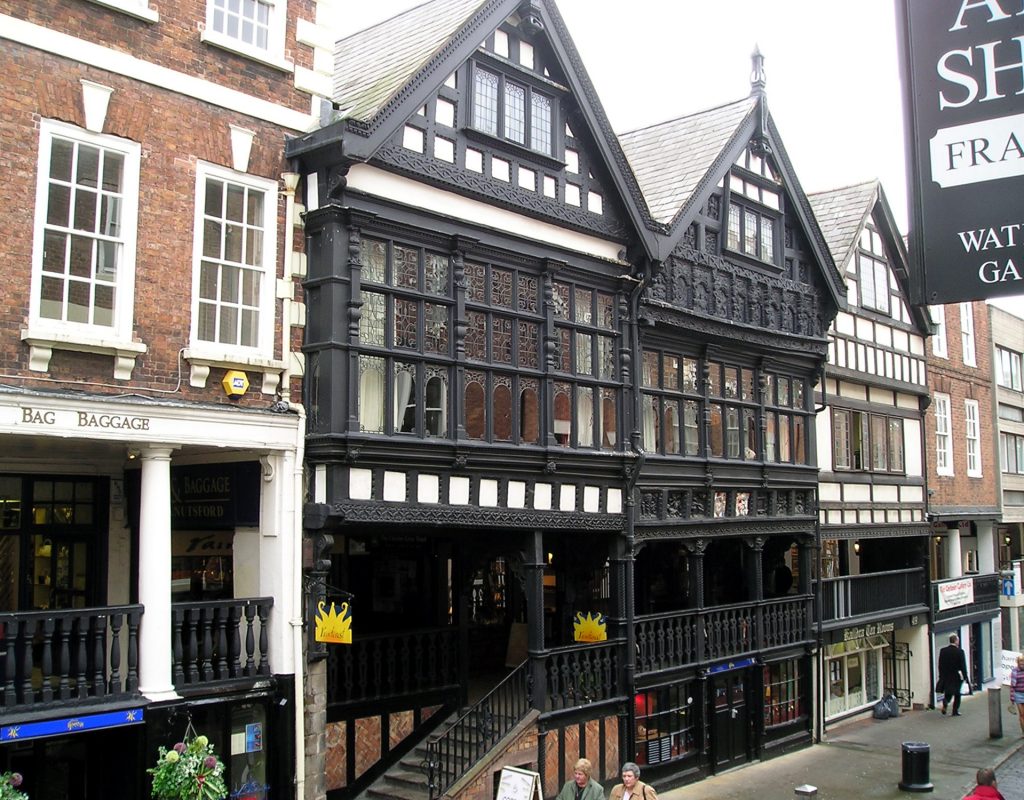
The significance of studying the use and increasing specialisation of spaces within Post-Medieval houses, has been demonstrated in recent years, especially by Johnson (1993 & 1996). Few studies of this type have been undertaken in the North-West, despite a relatively high level of building survey, although, one theme that is beginning to be addressed is the analysis of multi-functional uses within one complex or group of buildings. For example, Chester is remarkable for its survival of commercial premises at two levels, the undercrofts at street level and above them the Rows (Fig 6.7), continuous galleries giving access to shops and booths at first floor level (Brown 1999; Carrington 1994; Grenville 1997). An analysis of the interleafed domestic and commercial space in a typical Rows building indicated that commercial space occupied a considerable volume, nearly 50% of the total. Staircase House in Stockport is now seen as a rare survival of an intact merchant’s house with integrated warehousing on one tenement, a strategically-planned whole whose rooms and spaces were to remain little altered for some 400 years (McNeil 2003).
Infilling of back plots was a common feature of all English towns in the later 17th and 18th centuries. In Cumbria for example, physical expansion of the towns limits was minimal. Egremont doubled in size, Penrith grew by two thirds, Ulverston by about a half and Alston a third, whereas in Appleby and Kendal expansion was almost non-existent (Cumbria County Council 2002). Nevertheless, all these towns experienced considerable growth in their populations. In Kendal, population expansion was accommodated by the infilling of the rear ends of burgage plots from the late 17th century with rows and courts of mixed domestic and small-scale industrial developments accessed by alleys (Marshall 1975). The alleys and some of the ‘yards’ survive though many of the buildings have been demolished. Some of these have been recorded in recent excavations ahead of development and await publication (Newman 1988b; LUAU 1988). Similarly, in Carlisle before the early 19th century, expansion was largely accommodated by infilling.
Rebuilding of urban fabric and infilling of back plots were common features in all English towns in earlier centuries. Before the late 17th century, there was nothing to distinguish urban development in the region from anywhere else in England. Whilst the development of proto-industrial communities began to make some towns distinctive and acted as seeds for later industrialisation, before the later 18th century, it was trade that was the engine behind the earliest significant changes in the North-West’s urban development.

After the Restoration the port of Liverpool began to expand rapidly as a result of trade with the West Indies, attracting merchants from London to settle (Liverpool City Council 2003, 104). This led to the development of industries like sugar refining and clay tobacco pipe making. By 1702 Liverpool was the third trading port in England. During this late 17th-century growth Liverpool ceased to be a sub-Medieval town, as physically represented by the demolition of its castle. New streets were built; by 1698 there were 24. Wealth from trade with the West Indies endowed the town with good buildings and the best urban facilities of the day so that Celia Fiennes could describe it as ‘London in miniature’ (Liverpool City Council 2003, 104-5). The town’s entry into the slave trade around 1700 fuelled further growth. During the 18th century the population grew tenfold. The Pool from which the town took its name was in-filled and developed (Davey & McNeil 1980, 27-9).
By 1756 Liverpool had 222 streets, and by 1800 it was the most important port in the country after London and perhaps the second most important town in the British Empire (Liverpool City Council 2003, 106-7; Newman 2001, 147). The growth of the town is vividly revealed in illustrations, of which the most informative is the Buck Brother’s engraving of 1728, and maps such as those by Chadwick (1725) and Eyes (1765 and 1785). Virtually nothing, except the street layout, survives above ground of the town mapped by Chadwick and depicted by the Buck Brothers, although recent excavations (Fig 6.8) have begun to explore archaeological deposits relating to this key phase in the economic and urban development of the North West (Alan Lupton pers comm). Liverpool’s historic waterfront was inscribed as a World Heritage Site in 2004 for its significance as ‘an international seaport from the early 18th century to the early 20th century and the surviving urban landscape that testifies to that role’ (Liverpool City Council 2003).
Along with Liverpool, the ports of Lancashire grew as a consequence of the Atlantic trade. Poulton-le-Fylde benefited from its River Wyre ports, and participated as a creek of Preston in the slave trade, as well as operating as an importer of flax, much of which was taken to Kirkham for sailcloth making. Lancaster became the fourth most important slaving port in Britain between 1750 and 1775 (Schofield 1985, 74), and this influx of wealth not only led to the growth of the town, but to the establishment of industries and the rebuilding of the town in the mid-18th century (White 2000b). Beyond some building recording little archaeological work has been undertaken in Lancaster and none in the other ports. The increased wealth from Atlantic trade also aided the urban growth and specialisation of other settlements, especially Chester and Preston which continued as lesser ports and became provincial centres for elite society.
The potential profits from the Atlantic trade encouraged the speculative development of new ports and motivated the relocation of existing ones, exemplified in the migration of Lancaster’s commercial quayside from the town centre south to Glasson Dock, as the tidal waters of the Lune estuary gradually silted up. One of the North West’s distinctive urban features is the number of new towns that appeared in the Post-Medieval period. In Cumbria three of these are excellent examples of 18th century planned towns, Longtown, Maryport and Whitehaven. Comparable to Medieval seigneurial boroughs, they were founded by aristocrat industrialists. The earliest was Whitehaven developed as a port in the 1660s by Sir John Lowther to facilitate the development of his coal and salt interests. It has many fine buildings dating to the late 17th and earlier 18th centuries, which have been the subject of a systematic, detailed survey (Collier 1991). A similar study could be profitably undertaken for Maryport, which, like Whitehaven, was a planned town based on a grid design but which dates to the mid-18th century. To date the only archaeological projects focused on the town have been the excavation of the coke blast furnace (Miller 2000) and an investigation of the site of the 19th century market hall in Fleming Square (NPH 2003b). In Longtown two recent evaluations have examined evidence of 19th century courts that grew up in the rear of this late 18th century planned town (Masser 2005; NPH 2003a). Longtown was founded in an attempt to stimulate trade and industry in a similar manner to the late 18th century planned settlements in southern Scotland (Newman 2001, 133), with which it shares a number of topographical and architectural similarities.
The relatively large size of the region’s Medieval parishes, the low density of population in many areas and the dispersed nature of much of the settlement pattern ensured that in the 16th century much of the North West had only a scattering of parish churches. Some Medieval chapels, therefore, took on parochial responsibilities. At Hornby (L; Fig 6.9), the private church of Hornby Castle was rebuilt in the 16th century to become the town’s church following the closure of the local priory, which had previously served the community (Egerton Lea 2003b).
There are examples of Medieval monastic houses being converted into non-monastic churches following the Reformation, the most notable being Chester Cathedral, but for the most part the Reformation led to a huge loss in ecclesiastical fabric. In Warrington the friary continued to be used for burial, but by the 19th century the site was redeveloped, in part as a candle factory (Heawood 2003). The Reformation, and its associated periodic iconoclasm in the 16th and 17th centuries, led to the loss of Medieval church decoration (Nevell & Hradil 2005a) and to the removal of wayside crosses and the abandonment of the maintenance of holy wells.

Church rebuilding also took account of liturgical and doctrinal changes, as well as the decay of Medieval fabric. At Chester Cathedral, large-scale excavations revealed evidence for internal alterations in the Post-Medieval period following conversion from an abbey, including a sandstone floor and associated burial markers (Ward 1998).
From the late 17th century dissenting communities began leaving established churches to set up their own premises for worship. The early meeting houses were often in adapted buildings, or simple, purpose-built vernacular-style buildings, such as Society of Friends’ meeting houses (Butler 1978), at Lancaster, Yealand Redmayne and near Sedbergh. A domestic appearance reflected the humble nature of worship (Newman 2001, 32-3).
There is a large corpus of 17th century burial memorials within the region with characteristic dedications in relief. Most are relatively simple and lack the elaborate iconography favoured in some other areas, perhaps a reflection of puritanical religious leanings. Ribchester parish church has an interesting example of the arrogation of Medieval cultural material where a 17th century dedication is incised onto a Medieval tombstone. Blackburn Cathedral precinct includes an important and vulnerable group of earlier Post-Medieval church monuments removed to the churchyard in the 19th century when the Medieval parish church was demolished. In Prestwich churchyard a flat slab grave marker of 1641 records the deaths of a family’s three children within a fortnight of each other. Much other evidence of social history, cultural affiliations and spiritual beliefs can be gleaned from more intensive study of the period’s surviving grave markers.
Private display through the construction of grand houses and landscaped grounds has been an area of recent study for archaeologists in the region. As well as the National Trust’s detailed surveys of estates such as Dunham Massey and Tatton Park (Ch), there have been other studies examining the relationship between great house, grounds and the wider world. Excavation and survey work in Cheshire at Vale Royal Abbey (McNeil & Turner 1988) and Norton Priory (Greene 1989) showed how a Medieval ecclesiastical building was reshaped and reinvented to meet the secular needs of its new owners following the reformation and the transference of the building into private ownership.
At Whalley Abbey (L) the post-Dissolution house remains in use as a diocesan centre and its evolution was recently reinterpreted as part of its conservation plan (Lloyd Evans & Prichard 2002). A variety of research has been carried out at many of the National Trust properties within the region, with architectural surveys on most of its major houses combined with research on the contents, the gardens and the wider landscape and grounds.
Before the late 17th century, the nature and organisation of industry within the region remained substantially the same as it had been in the Medieval period. Industry was craft-based, widespread rather than concentrated in specific locations, and distribution networks were local unless connected to the sea. Consequently, though numerous, industrial enterprises tended to be small-scale. Important Medieval industries remained significant into the 18th century, when market growth, greater capital investment and eventually improved transport links led to significant changes in even the most traditional industries.
One of the most archaeologically identifiable industrial products is pottery. Pottery dating from the 16th and 17th centuries is not found in prolific amounts throughout the region, however (Fig 6.10). Consequently, in parts of the region such as Merseyside, it has been claimed that there is a lack of archaeological evidence for the Post-Medieval use of ceramics except in higher status households (Lewis 2002, 72). In the 16th century local forms of wares present in the Midlands and Yorkshire, such as Cistercian Ware, Midland Purple and Midland Yellow become more common in the south of the region although no production sites have yet been identified. In Cumbria and north Lancashire Northern Reduced Greenwares were produced from potteries at Silverdale and may have been produced at Caton (OA North 2003a) and in Carlisle. No kiln complexes have been properly excavated and the role of the region in the technological development of these wares is unknown. In the 17th century production sites were more widespread, generally confined to areas on the Coal Measures and often operated as ‘cottage’ industries. Documentary evidence from the Eccleston area in Merseyside for example, indicates that potting was a secondary occupation undertaken by farmers (Glynn & Meredith 2002, 209). A number of production assemblages have been studied, but no kiln structures.

Liverpool became a major producer and exporter of tin-glazed wares and porcelain during the 18th century and the industry continued there into the 19th, with the last works closing in 1840. There seems to be a correlation between the establishment of 18th century factory-scale potteries and ports, presumably because of a connection with the Atlantic trade, though this remains to be investigated. An industry developed at Whitehaven and a short-lived delftware works was set up on the quayside in Lancaster. Other not very successful attempts were made to introduce factory-scale pottery production in Chester, Kendal and Manchester. Of the factories, only the Lancaster delftware manufactory has received even limited archaeological examination (Price 1973).
There is a lack of archaeological evidence for the production of pottery in the region at all periods. With the exception of a mid-18th century coarseware site in Prescot and possible white salt-glazed stoneware production in Chester, no production units have been seriously investigated and published. Although a number of small production groups have been recovered from evaluation trenches in Liverpool, none of the sites have been subject to detailed archaeological investigation.
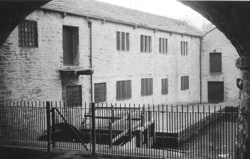
Unlike pottery production, leather processing and working seldom leaves much archaeological trace of its products, though its processing sites at least are identifiable. Documentary evidence of leather trades throughout the region is prolific. In 16th and 17th century Chester documents reveal that over a fifth of the craftsmen in the city were associated with leather trades. Between the 16th and 18th centuries the trades were controlled by guilds in both Chester and Preston. In addition to the main guild at Preston there was a smaller specialist one dealing with leather products. The processing of leather broke away from its traditional Medieval organisation during the 18th century becoming more centralised in larger complexes. Tanneries are associated with most larger settlements throughout the region, and excellent examples of rural tanneries partially survive as upstanding structures at places like Burton-in-Kendal and Rusland (C) (Howard-Davis 1987; Reeves 2002).
There has been little archaeological study of the Post-Medieval industry in the region outside Chester, where several excavations have uncovered evidence for Post-Medieval tanning. At Bridge St (Fig 6.14) a large assemblage of horn cores was deposited sometime in the late 17th to early 18th century which probably related to the tanning industry. Excavations at 148 Foregate Street in 1998 and an extensive probably late 18th to 19th century complex on the east side of Seller Street in 2001-02 both produced a variety of evidence related to tanning – large timber- and stone-lined pits, dumps of horn cores, insects related to tanning, remains of bark and some leather or hide remains. The location of these sites in the eastern suburb supports the map evidence for tanners in this part of the city, for example a tannery consisting of about 50 pits is shown on the 1875 OS map behind the Foregate St frontage. Overall the evidence largely relates to cattle hides but there is evidence for the tanning of horse hides too. The large samples of horncores from the three sites provide data for the approximate ages of the animals used for their hides. Apart from tanning there is little archaeological evidence of the Post-Medieval leather trades.
One of the region’s most historically important products is salt. Coastal workings have been documented in Cumbria, and around the mouths of the rivers Dee, Mersey and Wyre. Salt was produced by the ‘direct boiling’ process and by ‘sand washing’ or ‘sleeching’, whereby salt-impregnated tidal silts are filtered through a bed of turf or peat, and the resulting brine is boiled in small pans, often of lead. This technique is known to have survived around Morecambe Bay and the Solway into the 18th century, and the region also contained salt refineries using the ‘salt on salt’ process, whereby impure Cheshire rocksalt was dissolved in seawater and recrystallised. There is one site near Maryport (C) that has the remains of a large seawater tank and brine pond. The works continued until 1770 when the site was transformed into shipyard and rope works. There have been no archaeological investigations of the Wyre operations, though documents reveal the industry as active in the 17th century. Processing of rock salt was undertaken at Liverpool and Frodsham, where some initial survey has taken place. Similarly rock salt workings at Dungeon (Hale) have been recorded and workings on Hilbre Island are being investigated by National Museums Liverpool.
One of the distinctive features of the region was the availability of salt as an extracted mineral from Cheshire and near Liverpool. At inland works brine was usually drawn from natural brine springs, where brine pits were developed. Later, shafts or wells were dug by hand to the wet rock head. Pump trees were set up between headstocks or gallows to lift the brine by steam engine from the end of the 18th century, when John Gilbert purchased Boulton and Watt engines for his sites on the Trent and Mersey Canal at Lawton in 1788 and Marston in 1789. Brine was raised and stored in brine cisterns or tanks, where any solid material was allowed to settle before the brine was allowed to flow through brine pipes by gravity into the evaporating pans. There are 15 sites on the Cheshire SMR for inland salt production.
Following the discovery of rock salt near Northwich in 1670, a number of mines were established. These early mines were sunk to a depth of approximately 45m into the upper bed of rock salt, the lower bed remaining undiscovered at that stage. Despite the measures taken to prevent water entering the shaft, the top bed mines were prone to flooding and collapse. This left characteristic funnel-shaped hollows (usually flooded) at the surface. These ‘rock pit hollows’, as they were locally called, were mostly obliterated at a later date when widespread subsidence affected the area of the early workings. Around Northwich subsidence, as a result of brine extraction, has led to the widespread loss of surface remains.
Other than for corn milling, as in the Medieval period, the primary application of water power was for the fulling mill (Fig 6.11). Both grist and fulling mills were in part located near to their markets but the primary factor was the presence of a viable watercourse. In both instances the reliability of water supply was regulated by impounding water into millponds. This reliance on water power for larger scale manufacturing continued into the 18th century and was a major factor in the location and development of the early industrial centres. Woollen cloth and linen were produced for local markets in the North West in the 16th century and the two most significant production centres were Kendal and Manchester. Fulling mills for processing the yarn were distributed throughout the region, sometimes sharing the same building as a corn mill. Though later mills have been the subject of a number of surveys, there have been no comprehensive surveys of fulling mills. Mike Davies-Shiel’s documentary searches and fieldwork have identified many fulling mill sites in Cumbria and Rothwell’s industrial site surveys have recognised some in east Lancashire (1979a; 1979b; 1979c; 1980a; 1980b; 1981; 1985; 1990), but for much of the region sites still remain to be identified. Though some of these sites were redeveloped as later textile mills the relationship of the early water mills and the later water-powered textile factories has not been explored archaeologically.
Other than for textiles and corn, the other major user of water power in the 16th to early 18th centuries in the region was in the technological development of the iron industry. Cumbria especially is a nationally important area for examining the application of water power at bloomery forges in the 16th and 17th centuries, as the area experienced a late flowering of bloomery production. Excavation at sites such as Stoney Hazel forge (Cranstone 2001, 188), and more recently Cunsey forge (Fig 6.12; OA North 2004b; Miller 2005), are helping to elucidate the complex technological relationship between late water-powered bloomeries and the finery forges of the blast furnace industry. The Lake District and Alderley Edge in Cheshire (Timberlake & Prag 2005) are both nationally important areas for the study of Post-Medieval metal ore mining. The 16th century copper mines opened by the Mines Royal Company in the Caldbeck Fells are especially important as the first well documented large-scale copper mining operation in the UK, and the first to employ the advanced technological expertise of German miners. These mines are currently the subject of an exemplary above and below ground archaeological survey (Smith et al 2001)

The impact of international links was reflected in the growth of new industries based on foreign raw materials, and on the borrowing of skills and technology from abroad. New industrial skills and technologies were derived from the European mainland and their acquisition was a significant factor in the development of industry within the region. This began during the Elizabethan period when German workers were brought in to mine the ores of Lakeland. Also in the 16th century, French Huguenot migrants in London moved from Spitalfields to bring their skills and knowledge in the production of silk to Macclesfield (Ch).
Atlantic trade introduced new products that spawned new industries in the 16th and 17th centuries, and the region became especially important for industries based on tobacco and sugar. Clay tobacco pipes were produced in the region from at least the 17th century, though only in Chester and Rainford (M) is there direct archaeological evidence for early production. P J Davey’s extensive research in the field is significant in the region and internationally (Davey 1980; 1990). Although the earliest kiln material from Rainford is innovative, if not experimental, the regional makers appear to apply national norms of kiln design and mould technology in the production of regional styles. Study of the pipes in circulation suggests a significant number of makers in the south of Cheshire, probably based in the Nantwich/Crewe area, were highly influenced by the Broseley industry in Shropshire. From the Mersey valley northwards as far as the southern Lake District, south Lancashire forms and marks predominate. North of the Lakes local production is much more closely related to styles current in south-west Scotland and the north-east of England (Weatherill & Edwards 1971), reflecting cultural affiliations in the region, with Tyneside pipes appearing before the establishment of a local industry (Caruana 2005). Although such sub-regional styles can be identified, a study of excavated groups and documentary sources strongly suggests local production, certainly in Carlisle, Kendal, Lancaster Liverpool, Manchester, Nantwich and Warrington.
The first sugar refinery was built in Liverpool between 1670 and 1673, and was described as a five storey building (Chandler 1957, 332). Such a structure suggests that there should be substantial surviving remains on the sites of known refineries. Documentary evidence suggests that sugar refining was taking place in Chester from at least the end of the 1660s, possibly until the early 19th century. The location of several sugar houses in the city is known from maps and documentary sources. The first sugar house in Lancaster was established in 1684. By 1700 Liverpool had at least three sugar houses (Nicholson 1981, 28) and altogether at least seven sugar houses are recorded on maps of the city, as Liverpool became one of the three major centres in Britain for sugar refining. Sugar refining was also carried out in Manchester and Whitehaven from the middle of the 18th century onwards. To date, however, no structural remains of sugar houses have been examined in the North West and the exact nature of the early sugar refineries is unclear. The main evidence for the refining industry consists of associated artefacts such as sugar moulds and refining jars. In Chester a large number of sherds were found in a late 17th-century pit fill during excavations at 25 Bridge Street in 2001, but these appear to be rubbish brought in from elsewhere. Archaeological evidence from Merseyside consists of sugar refining pottery excavated at South Castle Street, dated to pre-1726 (Innes & Philpott, 1985, 117), and sugar refining pottery, typical of vessel types in standard use in the 17th and 18th centuries, from a kiln excavation site in Prescot (Brooks 1989,63). The South Castle Street finds could have come from the site of a nearby refinery, possibly in Derby Square, and further research may determine this question. Several fragments of sugar moulds have been recovered from excavations at Mitchell’s Brewery, Lancaster.
Glass production also benefited from international contacts. In the later 16th century the Medieval English tradition of glass-making was replaced by technically superior traditions introduced by French immigrants (Crossley 1990, 226). So successful was the adoption of foreign techniques that 17th-century England became a net exporter of glass and was in the forefront of European glass-making (Charleston 1984, 96). In the North West archaeological evidence for French influence comes from the excavated kiln at Bickerstaffe (L), where products included vessel glass with moulded and applied furnace decoration typical of products of French Huguenot glass-makers (Vose 1972; 1995; 1996, 286-336). The Bickerstaffe kiln is the only known wood-fired glass-making site in the North West from the late 16th/early 17th centuries (Vose 1995). Other archaeological studies of this industry include the excavations of the 17th century glassworks at Haughton Green near Denton (GM); the only example of an early 17th century coal-fired glasshouse in the North West. It had a monopoly for glass-making in this area up to 1642 (Vose 1994; 1996).

Archaeological evidence for trade links comes primarily from artefacts found during fieldwork, although there is a growing number of metal-detector finds (Fig 6.13). Consequently the lack of analysed large-scale excavation on Post-Medieval sites limits the potential for examining Post-Medieval trade outside of Chester and Liverpool. Additional archaeological evidence for the importance of trade to the region, especially overseas, as well as some evidence for contacts, can be found in a variety of structures, such as sugar houses and tobacco warehouses, that appeared in the Post-Medieval period. The historical evidence for the Medieval and Post-Medieval periods points to a wide range of objects entering Chester both by the port and overland, in addition to the movement of people. However, the archaeological evidence for these external contacts is relatively rare. Many of the goods were either perishable or raw materials which were converted to or used to produce other objects and materials. They included wine, foodstuffs, including grain, and animals, cloth, metal, pitch/tar and timber etc. The principal archaeological evidence for this trade consists of stone, glass, and most of all, ceramics. As noted elsewhere, the sources of traded ceramics do not reflect accurately a port’s trade, thus archaeological evidence alone will provide a skewed picture of domestic and overseas contacts (Allan 1999, 286).
Until the advent of canals, trade within the region was either highly localised or facilitated by coastal shipment. Early in the period, coarseware pottery produced in rural areas tended to be traded over a limited distance, unless like the Silverdale kilns north of Lancaster, the production site lay close to the coast. Even then it was only certain wares, from the larger producers, that were traded over substantial distances in any quantity. Though little work has been done into the distribution of Silverdale pottery in the early Post-Medieval period it seems to have been confined to south Cumbria and north Lancashire. This trading pattern remained true of ‘country potteries’ even after the increased specialisation and factorisation of the pottery industry and improvement in transport facilities during the 18th century (White 1989).
Other forms of intra-regional trade can be deduced from remains other than artefacts. The 16th to 18th-century iron industry of the Lancaster to Kendal area was located because of the local availability of charcoal, but it did not have a local supply of iron ore. Most of the manufacturing sites were close to the coast and the documentary record indicates they were being supplied with ore from Furness via coastal shipping around Morecambe Bay (Newman 2003). Other heavy raw materials are likely to have been moved around the coast in a similar manner. The remains of a quay of unknown date survives at Arnside (C), associated with a limestone quarry and limekiln indicating that the quarry’s products were being moved by sea. One of the most characteristic early Post-Medieval structures associated with trade is the market hall. The early market halls were small, vernacular in style and intimate, suited only to the supervision of local trade, unlike the large, architect designed, commercial emporia built in the major towns in the 19th century. Most, like that at Hornby (L), built in 1626, have been demolished or redeveloped and none have been investigated archaeologically. A few survive, such as the late 17th century example in Shap (C).
Pottery is again one of the principal artefacts for tracing trading links with other regions. For the most part, however, before the appearance of the canals it was only wares that could be exported by sea that were marketed over long distances. ‘Metropolitan’ slipwares from the south-east of England, dating to the 16th and 17th centuries, are found in excavations in Kendal and Lancaster (Howard-Davis 2001, 214). North Devon Gravel Tempered Ware found in ports like Liverpool testifies to links with the south-west of England in the 17th and 18th centuries. More locally, but probably still in part traded by sea, were the products of the Buckley kilns in north Wales, which were sold in Cheshire and Lancashire from the late 17th century (Davey 1975). Clay tobacco pipes were imported in large quantities especially from Broseley in south Shropshire, although they were also produced throughout the region.

In the late Medieval period Continental wares appear to be absent from pottery assemblages in Chester. This may be partly because there are few deposits which can be identified for this period. Political and economic reasons may also be responsible for a fall-off in trade with France (Davey & Rutter 1977, 21). Such wares do not re-appear in the archaeological record in Chester until the late 15th century when Iberian wares, Raeren stonewares and Saintonge wares appear. In the 16th century the sources of Continental pottery become more various; in addition to Saintonge wares other French imports appear including Beauvais and Martincamp wares, Rhenish stonewares from Cologne and later Frechen, Werra and Weser wares from modern day Germany, a range of Iberian wares including olive jars, lustrewares, tin-glazed wares and earthenwares, and tin-glazed wares from the Low Countries. It is possible that some of these wares were re-exported as happened with Rhenish stonewares from ports of south-western England (Allan 1999, 283) but this type of research into trade in ceramics from the ports of the south-west has not been undertaken in the North West.
In common with much of western Britain the main receptors for the North West’s overseas trade in the early Post-Medieval were Ireland, south-west France and the Iberian Peninsula. This is especially well illustrated by Chester’s leather trade where several excavations have uncovered evidence for Post-Medieval tanning in the city. Large numbers of skins and hides were imported from Ireland and tanned calf skins were the city’s main exportable commodity in the 16th and 17th centuries, sent particularly to France and Spain. There is useful cartographic information, and the documentary sources have been extensively studied, particularly for the 16th and 17th centuries when over a fifth of the craftsmen in the city were associated with leather trades. From the first half of the 18th century cabinetmakers Gillows of Lancaster exported products to the West Indies, the Americas, Europe and Asia, in return for local products and hardwoods (Dalziel 2001, 120).
Other types of perishable imports that nevertheless leave archaeological evidence of their trade include two of the trans-Atlantic staples, tobacco and sugar. In Bristol that town’s role as tobacco importer from the 17th century is considered to have led to the growth of its clay tobacco pipe industry. A link has also been suggested between the tobacco trade and the growth of pipe production in Chester and Liverpool (Davey 1980; Newman 2001, 150). The Atlantic trade in tobacco led to a number of regional tobacco-based industries, not only in the ports but in towns like Kendal, where there is still a surviving snuff works. The clay tobacco pipe is also a good indicator as an export, of the importance of the Atlantic and wider global trade to the North West’s ports from the late 17th century. Liverpool-marked pipes are the second most commonly recovered British product (after Glasgow pipes) found in North and South America, West Africa and Australasia. Like tobacco consumption, the importation of sugar is largely recognisable through the artefacts associated with its British-based processing industry.
The northern border of the region remained the backdrop of political feuding between England and Scotland, as well as localised power struggles and intermittent raiding and cattle rustling or rieving (Frodsham 2004, 98-111). Despite this, prior to the Civil War, large violent encounters within the region were rare, with the only open battle resulting in a Scottish defeat at Solway Moss in 1542, although archaeological work has failed to locate evidence for the encounter (Carlisle Archaeology 1999). The putative site of this encounter represents one of only three registered battlefield sites within the region, alongside Nantwich (1644) and Rowton Heath (1645). The region contains the sites of many other minor sieges and skirmishes, as at Winwick (Ch). A recent appraisal of Post-Medieval battlefield archaeology suggests that these more representative if obscure engagements may be the most worthwhile for archaeological investigation (Carmen 2005, 221).
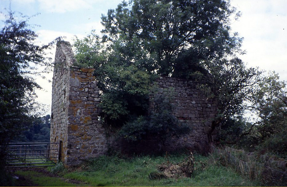
This legacy of political insecurity and the threat of violence continued to nurture architectural traditions with roots in strength and defence, in both practical and symbolic terms (Fig 6.15). Carlisle and Chester remained walled and defendable towns. The defences at Carlisle were improved under the direction of Stefan von Haschenperg around 1542, including the construction of a citadel at the southern end of the city and the addition of outworks, a breastwork and half-moon battery at the castle (McCarthy et al 1990, 172). At Chester the walls were periodically repaired and the gates maintained while in contrast, none of the Manchester castles continued as fortifications beyond the first half of the 14th century.
In the north of the region a number of ‘strong houses’, sometimes of manorial status, continued to be built. More common is the bastle house, small thick-walled farmhouses with domestic accommodation set above a basement byre. Although best known from Northumberland (which has 200 examples) around 60 were recorded in Cumbria in a survey carried out between 2000 and 2002 (Ryder 2002). In contrast to earlier defensible building types bastles are almost all of early Post-Medieval date and are built by tenant farmers rather than landowners. The building type appears c 1600 but in some areas, notably around Alston, related structures were still being built into the second half of the 18th century (Ryder 2002).
The Civil War period (1642-52) largely witnessed the re-use of existing Medieval fortifications, as at Beeston Castle (Ch), where evidence for refortification included a major ditch, the conversion of arrow slits for musket fire, and finds illustrating the life of the garrison (Ellis 1993). Buildings within the cathedral precinct in Carlisle were demolished to provide stone for the reinforcement of the city walls during 1645 (McCarthy et al 1990, 199). Chester was subject to a prolonged siege (Fig 6.16) that resulted in widespread damage to the economy and fabric of the city, leading to a period of retrenchment and rebuilding. There is considerable documentary and cartographic evidence for the Civil War siege works and skirmish sites in Liverpool and in Chester (Ward 1987). While archaeological evidence remains elusive for the former, in Chester survey and excavation data include earth reinforcement to the walls from the Abbey Green excavations, a Jack of plates recovered from the Debenham’s site and possibly outworks ditches from excavations near the Bars. The site of the armoury and mint at Chester Castle, dating to the late-17th century has also been excavated revealing the footings of the buildings lying on levelling deposits which included Civil War period occupation debris (Ellis 1996). Earthworks at Lathom Hall (L) may represent the site of siege works from this period.

Preston was the site of fierce fighting during the Second Civil War in 1648, after a Royalist army under the Duke of Hamilton invaded from Scotland and engaged a Parliamentarian force under the command of Olivier Cromwell. Fighting took place at Ribbleton Moor, Walton Hall, south of Preston, and finally at Winwick near Warrington, before the Scottish army surrendered. Beyond isolated finds of two swords and some cannonballs archaeological evidence for the campaign is scarce. A hoard of 300 coins discovered within the chimney of a house at Tenter Hill, Whittingham (Ch), dating from 1645-8, may have been deposited at this time. In 1715 Preston was again the site of a battle when Jacobite rebels were routed. Again, archaeological evidence for the engagement is scarce.
Traditionally in the North West the 16th to mid-18th centuries have been neglected largely, in an archaeological sense. This situation has altered in recent decades with major programmes of work looking at the later phases of use of monasteries and castles, regional patterns in vernacular architecture, reclamation and enclosure and the development of new consumer products such as the clay tobacco pipe. More recently still archaeological attention has turned to the development of towns in the period, including the appearance of rationally planned settlements and the growth of ports. It is in this area that the North West has some of the greatest potential for new research. Facing the Atlantic it was a core area for the development of new overseas trade with the consequent emergence of new towns, port facilities and industries. During the later 17th and early 18th centuries the North West was turned from a relatively impoverished backwater to a key region for understanding globalisation and the early stages of industrialisation.
The impact of increased prosperity may be seen in the new town houses and rural mansions erected throughout the region and in their associated landscaped grounds. Very recent work has shown the North West to have been in the forefront of innovative landscape design presaging its later importance for the development of the Picturesque and Romantic movements. The Post-Medieval period is a key period of archaeological study for observing the physical manifestation of changing ideas and world views. Above all it is the period that makes possible the rapid industrialisation of the later 18th and early 19th centuries. Archaeology has much to contribute to the understanding of the origins of the Industrial Revolution and nowhere is this truer than in the north-west of England.