compiled and edited by Matt Leivers and Andrew B. Powell with contributions by by Martyn Barber, Mark Bowden, Rosamund J. Cleal, Nikki Cook, Mark Corney, Paul Cripps, Andrew David, Bob Davis, David Dawson, Bruce Eagles, Jane Ellis-Schön, A. P. Fitzpatrick, Abigail George, Frances Healy, Katie Hinds, David Hinton, Ronald Hutton, Mandy Jay, Matt Leivers, Michael Lewis, Rebecca Montague, Janet Montgomery, David Mullin, Joshua Pollard, Melanie Pomeroy-Kellinger, Andrew B. Powell, Andrew Reynolds, Clive Ruggles, Julie Scott-Jackson, Sarah Simmonds, Nicola Snashall, Chris J. Stevens, Anne Upson, Bryn Walters and Sarah F. Wyles.
by Julie Scott-Jackson
The chalk downlands, which topographically characterise the Stonehenge and Avebury WHS in Wiltshire, stretch through 12 counties of southern England. Invariably these downlands are capped, on the highest parts, with deposits mapped as Clay-with- flints. Over the past 100 years or so, a great number of Lower and Middle Palaeolithic stone tools have been found in association with these deposits. The recorded evidence of the Upper Palaeolithic is almost non-existent but this may be due in part to misidentification of such artefacts with those of the Late Middle Palaeolithic and Early Mesolithic.
There has been lack of appropriate research and a general misunderstanding regarding both the archaeological integrity of the Palaeolithic artefacts from high-level sites on deposits mapped as clay- with-flints, and the geomorphological processes that have operated in areas of chalk downlands, on these specific deposits, over geological time. As a result, these high-level assemblages are poorly represented in the British Lower and Middle Palaeolithic archaeological record. Those Palaeolithic sites which are datable and/or provide the best examples of Palaeolithic industries must command the greatest attention. But site-specific data do not necessarily address the questions of Palaeolithic peoples’ habitat range and preferences, and their provision of resources across the landscape. If the behavioural organisation of these ancient hunter-gatherers is to be understood then the Palaeolithic landscape must be considered as a whole. Failure to do so will distort both the local and national archaeological record.
Sometime during the Pleistocene period, Palaeolithic people first arrived in what is now Britain. This geological period was one of glacial and interglacial cycles. Ice-sheets advanced or re-treated, sea-levels rose and fell. When sea-levels were high, Britain became an island but when sea-levels were low land linked southern England to continental Europe, thereby allowing the migration of animals and Palaeolithic people across the peninsula. The Wiltshire region was never affected by direct glacial activity as the area lay beyond the ice-sheets. But weathering processes operating during the Pleistocene glacial and interglacial cycles effected considerable changes to the topography of the Stonehenge and Avebury area (Kellaway 1991; 2002). The two geomorphological (weathering) processes which dominated in the Pleistocene were periglaciation, during cold periods, and that of solution when the climate ameliorated. Often the effects of periglaciation have been confused with those of solution (Williams 1980; 1986; Scott-Jackson 2000; 2005, 66–7; Geddes and Walkington 2005, 63–4) with the result that the archaeological integrity of the Palaeolithic find sites/spots, particularly on deposits mapped as Clay-with-flints, and the artefacts they contain have been academically devalued.
Significantly, it is the presence of ‘pipes’ and ‘basin- like’ features in the deposits mapped as Clay-with- flints (which are produced in response to the process of dissolution in the underlying chalk) that has been instrumental in retaining the Clay-with-flints deposits and the associated Palaeolithic sites and artefacts on the highest downland hilltops and plateaux, over hundreds of thousands of years (for examples see: Smith 1894; Scott-Jackson 2000; 2005; Harp 2005; Scott-Jackson and Scott-Jackson 2014). The importance of the Palaeolithic archaeological potential within the high-level Clay-with-flints deposits and also at lower levels (in a variety of soils, see for example: Richards 1990, 6–7; Findley et al. 1984) in the WHS of Stonehenge and Avebury needs due consideration. This is particularly true if embedded artefacts are found, as many of these finds have proved to be discrete assemblages that are indicative of in situ Palaeolithic sites.
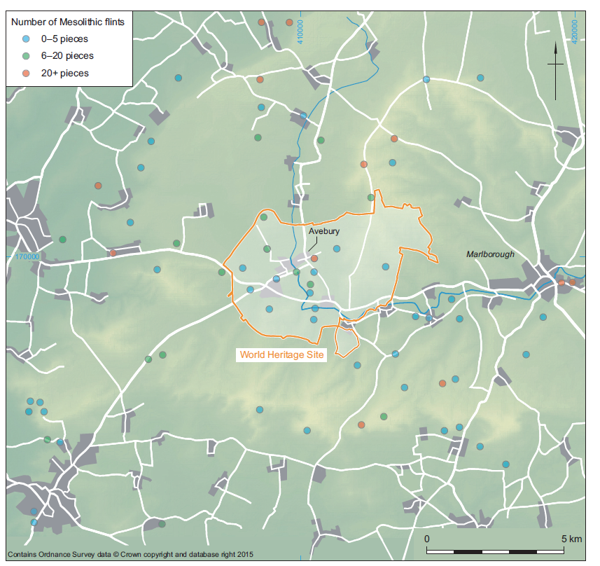
Detailed geological, geomorphological and archaeological investigations of Palaeolithic find- spots/sites across the Marlborough Downs and Avebury area (Fig. 10) have been carried out (Scott- Jackson 2000, 53–66; 2005, 67–76). Although the majority of these recorded artefacts can be viewed only as single isolated surface-finds, a number of find- spots appear to have a geomorphological relationship (eg, on top of a hill and on the slope of the same hill). This does not of course imply that there is an actual association between the artefacts but their geomorphological relationship may help to explain the processes through which each artefact assumed its recorded location, as for example on a slope, relative to its originating location, a knapping site on a hill-top (Scott-Jackson 2000, 16–18). There are in total 39 recorded Palaeolithic find-spots/sites across the Marlborough Downs. Of these, 14 find-spots/sites are within a 5 km radius of Avebury village (Fig. 10). Full entry details and discussions on all 39 find-spots/sites may be found in Scott-Jackson 2005 (67–76).

Most of these Palaeolithic artefacts are held in either the Devizes or British Museums; the whereabouts of the others remains unknown. The majority of the artefacts are reported as being single surface finds from the topsoil overlying the downlands (many sites may well have been lost as Palaeolithic artefacts, particularly waste-flakes, are not always recognised for what they are). The most important of the Lower and Middle Palaeolithic finds from the Avebury area (just outside the WHS) are those from the site on Hackpen Hill (SU 128726), a site which was excavated with great care by H. G. O. Kendall (see Kendall 1909; 1916); the artefacts were re-assessed by A. D. Lacaille (1971) and the site and artefacts reinvestigated by J. E. Scott-Jackson (2000, 53–66) whose investigation also corrected data distortions and addressed NGR anomalies.
A site outside the WHS (15 km east from Avebury village) also requires special mention. The low-level Palaeolithic site at Knowle Farm, Gravel Pit, Savernake, is situated in soliflucted head gravel. Investigated/excavated by Cunnington and Cun- nington (1903); Dixon (1903); Kendall (1909; 1911) and Froom (1983, 27–37) it produced over 2000 Palaeolithic artefacts, mainly handaxes (for detailed discussion see Scott-Jackson 2005, 71); Wymer (1993, 57) noted that ‘only sporadic finds have been made since’. More recently Palaeolithic artefacts (two handaxes and four flakes) have been discovered in shallow quarrying of valley gravels, in the valley opposite Knowle Farm, Little Bedwyn, Savernake, at SU 256 678 (A) (132 m OD).
Both ancient and modern river valleys, stream channels and (to a lesser extent) dry valleys have produced a great number of Palaeolithic artefacts. The associated river gravel, alluvium and valley gravel in these low-level downland areas include materials (and artefacts) that have been washed down from higher levels. Colluvium fills the dry-valleys, while much of the river gravel is of Pleistocene age, often overlain and replenished with reworked materials (including artefacts) of various origins and ages. Stone tools recovered both as surface-finds (ie, mixed in with the gravel) and from very shallow gravel deposits are therefore almost certainly in a derived context. Although the potential for the survival of in situ sites in river and valley deposits is high, few excavated sites have been found to be in situ, most of the artefacts being derived. Nevertheless, some of the most important Palaeolithic in situ sites in Britain have been found in a variety of low-level deposits (frequently gravels, but not specifically in downland areas (eg, Wymer 1999).
by Abigail George
This section covers the end of the Pleistocene during a period between the last glacial maximum at around 16,000 cal BC and the beginning of the Neolithic in Britain, around 4000 cal BC. It covers an initial period of climatic oscillation, between extreme cold snaps and rapid warming, followed by a gradual rise in temperature towards the so-called Climatic Optimum of the mid- to Late Mesolithic, and terminating with a slow amelioration during later prehistory.
There are 11 finds – all lithics – noted in the HER as being ‘Palaeolithic’ within 20 km2 around Avebury. However, none of these are assigned to the Upper Palaeolithic and at the present time there are no definite Upper Palaeolithic sites or findspots within the WHS (Scott-Jackson 2005; Pollard and Reynolds 2002; see Scott-Jackson, above). It is, however, possible that the Avebury area was exploited to some extent by human populations during the Late Glacial as there is clear evidence for sustained use of the lower River Kennet Valley (Froom and Cook 2005).
The Early Post-Glacial period refers to a time after c. 7750 cal BC when the tool technology began to change to a broad blade microlithic industry (Jacobi, 1976). Pollen and molluscan studies have indicated that closed woodland existed around the Avebury area (Evans 1972) although Allen (2005) suggests that within this woodland large natural clearing may have been the focus for settlement and community. Whittle (1990) proposes that the downland and upper dip- slope valley were seldom used and that the main base camps were likely to be outside the area, suggesting Cherhill and the Wawcott as possibilities. He suggests that a territory of at least this size is plausible – a distance of 40 km along the River Kennet.
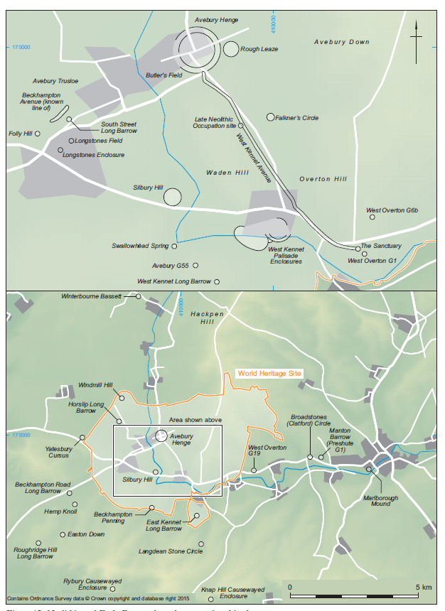
There are a small number of findspots and sites within the WHS (Fig. 11), only two of which (Rough Leaze and Avebury) can be described as minor (short stay) occupation sites. Again, it is possible that the Avebury area was exploited by human groups since there is a good deal of occupation evidence for Early Post-Glacial sites in the Kennet Valley (Froom 1963; 1965; 1970; 1972a; 1972b; 1976; Froom and Cook 2005; Sheridan 1967; Wymer 1962; Churchill 1962; Heaton 1992).
Whilst these sites are not local to the Avebury WHS, it is not inconceivable that these and other sites within a few days walking distance formed part of a wider Mesolithic territory around the lower and middle Kennet Valley. The importance of the River Kennet as a tributary of the River Thames should not be underestimated. The area around Avebury prior to 6550 cal BC was probably not a place in isolation, but was rather linked to the rest of southern England and the Continent via a Kennet–Thames–Rhine routeway. In addition, routes to the south coast via the Hampshire Avon and to the Severn Estuary in the west via the Bristol Avon all lead to key Upper Palaeolithic and Mesolithic sites in the Severn Estuary (Bell 2007) and at Hengistbury Head (Barton 1992).
According to Smith (1992), hunter/fisher/gatherer populations would have been of a very low density, perhaps as few as 20 people in a 200 km2 area at any one time, although Rowley-Conwy puts this at a higher density of between 45 and 120 people (Rowley-Conwy 1981). In order to annually sustain such group numbers various sections of the Avebury landscape would have been seasonally utilised. It is therefore essential that any future research agenda for this period encompass a much wider geographical area than the current boundaries of the WHS. For this purpose an area of 20 km2, with Avebury as its centre, has been taken to establish a more realistic perspective on the early prehistoric human exploitation of the landscape (see Fig. 11). This is still somewhat limiting as it does not include the Kennet Valley sites mentioned above. However, it is beyond the scope of this paper to encompass the full territory that may have been utilised, which may also have included sites along the River Og at Marlborough and those tributaries around Hackpen Hill and Aldbourne. These sites may be an important link between Avebury and the Wawcott sites and should be considered as part of a wider contextual assessment of the Wiltshire landscape.
Early land-use during the Late Upper Palaeolithic and Mesolithic may well have been preludes to the development of the later prehistoric landscape. A clear example of this is the large timber (‘totem’) posts that were discovered in the Stonehenge car park (Vatcher and Vatcher 1973; Allen 1995; and a more recent find at Amesbury Down, see Allen and Gardiner 2002; Powell and Barclay forthcoming). In addition, Mesolithic flints are often found under Neolithic monuments suggesting a history prior to the first pastoralists. However, the ephemeral nature of these finds is frustrating and until further well-stratified sites are discovered we can only speculate as to whether these are just residual finds or something more significant. Another approach, explored by McFadyen (2006) is to look at exploring the nature of such ephemeral finds in a more theoretical way: ‘spaces were actively being made … rather than simply inhabited as meaningful “places” ’; even small scatters of flint can tell us a great deal about the processes that people were undertaking, and the connections between the people and their environment (McFadyen 2006). Moreover, individual lithics and scatters can also say something about trade and exchange, power- relations between communities and the pathways they may have taken for these events to take place (Bradley 1993).
by Rosamund J. Cleal and Joshua Pollard, with Nicola Snashall and Rebecca Montague, and a contribution on Archaeoastronomy by Clive Ruggles
The archaeological significance of the Avebury landscape ultimately rests on the value ascribed to the great Late Neolithic monument complex that includes the Avebury henge, the West Kennet and Beckhampton megalithic avenues, the Sanctuary, West Kennet palisade enclosures and Silbury Hill. These monuments, along with earlier, 4th millennium cal BC, constructions such as the West Kennet long barrow and Windmill Hill enclosure are exceptional in scale and architectural complexity; and their presence is indicative of a social and religious pre-eminence to this region during the Neolithic on a par with that of the Stonehenge landscape (Fig. 12). These monuments continue to occupy a key position in our accounts of the period on a national and international scale because of their potential to inform us of aspects of social and economic organisation, belief, ceremony and the material worlds of their builders.
Chronological frameworks are discussed elsewhere in this volume by Frances Healy. It is sufficient here to note that the transition to Neolithic practices and ways of life in the Avebury area came later than that in the Lower and Middle Thames Valley and perhaps the Cotswolds, within the range 3975–3835 cal BC at 95% probability (Whittle et al. 2011). This provides the upper limit for the chronological span considered in this section, while the lower limit is given by the transition to the agrarian landscapes of the Middle Bronze Age at around 1500 cal BC. Both upper and lower limits, however, need to be treated as approximate.
Archaeological activity within the WHS was intense during the 20th century, following two and a half centuries of antiquarian activity centred largely on the henge and Early Bronze Age round barrows. Previous archaeological and antiquarian activity is described elsewhere (Smith 1965b; Pitts 2000; Pollard and Reynolds 2002; Gillings and Pollard 2004), although more detailed outline histories of investigation are provided here for key monuments such as the Avebury henge. Discussion is structured thematically, beginning with the evidence for early 4th to early 2nd millennium cal BC settlement and landscape use, followed by reviews of material culture, lifeways, and monumentality. Where their significance impacts on understanding of the Neolithic and Early Bronze Age archaeology of the WHS, a small number of sites outside the area are referred to.
Because of the absence of any sustained Late Mesolithic presence in the region, it has been argued that the onset of the Neolithic was marked by the arrival of incoming groups, either from neighbouring areas or much further afield (Whittle 1990, 107). It was during the early 4th millennium cal BC that the environment of the Avebury landscape was first subject to major human modification, through more extensive and sustained settlement, clearance, agriculture and monument building. By the second and third quarters of the 4th millennium cal BC occupation within the region was extensive, though not necessarily dense. Traces of settlement activity and agriculture are relatively ephemeral, comprising surface scatters of worked flint and occasionally pottery, more substantial remnants of middens, pits, and post and stake settings, along with cultivated soils. The absence of any solid ‘domestic’ architecture is taken to indicate varying degrees of settlement permanence/impermanence, which could range from strategies of short-lived sedentism to seasonal transhumance (Whittle 1997b; Edmonds 1999; Pollard 1999a). Following a pattern seen repeatedly across southern England, it is only from the mid-2nd millennium cal BC that stable agricultural settlements and field systems appear.
Topsoil/ploughsoil scatters of worked flint and casual finds of lithics and ceramics provide the best evidence for the presence and extent of settlement and associated activity (Holgate 1987; 1988; Whittle et al. 2000). Many of the larger scatters that have been identified are located on the upper slopes and higher ground around the main monument complex – effectively ‘looking in’. The lithics contained within them indicate that some have formed through repeated visitation over long periods of time (eg, the southern slope of Windmill Hill), while others are dominated by distinctive Middle–Late Neolithic tool forms (eg, foot of Avebury Down). Further details are provided by Snashall, see above.
In addition to finds made during surface collection, traces of Neolithic and Early Bronze Age occupation have been encountered fortuitously during groundworks and in the excavation of contemporary monuments and later sites. A limited amount of research-led excavation has also focused on identifying settlement evidence (Whittle et al. 2000; Pollard et al. 2012). Traces here take the form of buried artefact scatters (including dense concentrations best interpreted as midden spreads), pits and other sub-soil features, fence-lines, artificial surfaces and cultivated soils.
Several scatters of worked flint and pottery in the buried soil under the bank and within the interior of the Avebury henge are the residue of episodes of pre- monument occupation (Gray 1935; Passmore 1935; Smith 1965b, 224–6; Evans et al. 1985). Over 100 sherds of pottery and 200 pieces of worked flint were recovered from these contexts. Associated ceramics range from early carinated bowls to Peterborough Wares, suggesting a chronological span that could take in the whole of the 4th millennium cal BC (supported by three radiocarbon dates relating to pre- henge activity: Pitts and Whittle 1992). From the buried soil profile under the henge bank come indications of associated clearance and cultivation. The environmental succession begins with Early Holocene woodland, followed by clearance at some stage during the Early Neolithic, then cultivation and the formation of grassland (Evans et al. 1985; Evans and O’Connor 1999, 202–4). Cultivation included the use of an ard, uncommon on sites of this date though similar and more extensive ard marks of early– mid-4th-millennium cal BC date were recorded under the South Street long barrow (Ashbee et al. 1979). In the immediate zone to the east of the henge, topsoil sampling and limited excavation in Rough Leaze during 2007 identified scatters of worked flint that included material of possibly Late Mesolithic and certain Early and Middle Neolithic dates, a series of Early Holocene tree-throw holes containing small quantities of artefactual material within their upper fills, and one location where there exists a concentration of stakeholes likely associated with prehistoric activity (Pollard et al. 2012).
To the south and south-east of the henge there are several localised scatters of earlier Neolithic worked flint, pottery, pits and midden deposits along the sides and base of the dry valley formed by Waden Hill and Avebury Down/Overton Hill, and on Overton Hill itself (Smith 1965b, 210–16; Thomas 1955; Snashall 2007; Gillings et al. 2008). Several pits and postholes were found during the 1930s work on the West Kennet Avenue amongst a substantial ‘midden’ spread of flint and pottery (Smith 1965b). The range of ceramics from the site (Ebbsfleet, Mortlake, Fengate and Grooved Wares) show occupation, if intermittent, spanning the latest 4th to early/mid-3rd millennia cal BC, before the West Kennet Avenue was built. Just to the north, a small pit containing sherds of Mortlake bowl was encountered during cable work close to stone 16a of the West Kennet Avenue (Allen and Davis 2009). This pit was dated to 3090–2910 cal BC; with mollusca indicating a predominantly open yet still mosaic environment. More difficult to characterise are concentrations of 4th millennium cal BC ceramics (Plain and Decorated Bowl and early Peterborough Wares) on Overton and Hackpen Hills, associated with small amounts of worked flint and some animal bone, but no evident structural features (Smith and Simpson 1964; 1966; Snashall 2007). The relative scarcity of associated lithics and structural features is at odds with the scale of some of these ceramic assemblages (eg, that under West Overton G6b: Smith and Simpson 1966), implying occupation of a different kind – or at least a different suite of activities – on the high ground to that along the valley sides and floor.
Isolated pits and small pit clusters of Neolithic and Beaker date are also known from Windmill Hill (predominantly Early Neolithic, and some pre- enclosure; Smith 1965b); from its southern slope (one cluster associated with Plain Bowl pottery, two other pits with Grooved Ware; Whittle et al. 2000); from Avebury G55, close to the West Kennet long barrow (Smith 1965b); and outside the WHS on Hemp Knoll (Robertson-Mackay 1980) and Roughridge Hill (Proudfoot in prep.). The latter may belong to the first quarter of the 4th millennium cal BC and so an early phase of settlement within the region, the pits’ contents included, unusually, human bone along with a range of ceramics, lithics and animal bone.
House sites of the period remain elusive. Stakehole arrangements and pits probably mark their former presence in many instances. There are hints that better preserved house structures might be found. Artificial chalk surfaces found during coring against the southern bank of the Avebury henge, here buried by colluvium (Allen and Snashall 2009), and under a midden spread at the West Kennet palisade enclosures (Whittle 1997a, 12, 76, fig. 43) look tantalisingly similar to the puddled chalk floors of houses at the Late Neolithic settlement at Durrington Walls (Parker Pearson 2007).
Beyond palaeo-environmental investigations by John Evans, and those undertaken by English Heritage as part of the Silbury Hill project, little work has taken place in the floodplains of the Winterbourne and Kennet, though these are locations where settlement evidence might be expected and where later colluvial cover should provide good preservational conditions. Potential is shown by test trenching in Butler’s Field to the west of the henge where earlier Neolithic flintwork and pottery were found within buried soils (Evans et al. 1993). The likelihood of there being sizeable spaces ‘empty’ of occupation must, however, be considered, and is hinted at by gaps in lithic scatter distributions. Along the whole length of the Avebury sewer trench there were virtually no Neolithic or Early Bronze Age finds, except for the location of a ‘lost’ disc barrow, although the conditions of recovery during the work may have contributed to this apparent absence (Powell et al. 1996, 82). Cable trenching across part of Avebury Trusloe and the northern half of Longstones Field during 2010 likewise yielded a virtual blank despite careful monitoring.
A lengthy history of archaeological investigation within the area of the WHS and its environs has resulted in the curation of a number of important assemblages of Neolithic and Early Bronze Age artefactual and faunal material. Setting aside for the present those from antiquarian investigation of the area’s round barrows, the singularly most significant assemblage derives from the enclosure on Windmill Hill (Smith 1965b; Whittle et al. 1999). The early 20th-century excavations here by Keiller provided stratified assemblages of ceramics (Pl. 23), lithics and other materials (worked chalk, worked bone, imported stone tools) that were instrumental in establishing material sequences for the southern English Neolithic, reflected in Stuart Piggott’s choice of the monument as the type site for his ‘Windmill Hill culture’ (Piggott 1954). That assemblage was augmented by material recovered in subsequent excavations in 1957–8 and 1988. A sense of scale can be gathered from the estimates of over 20,000 sherds of pottery from c. 1200 vessels, the majority Early Neolithic (Zienkiewicz and Hamilton 1999); and around 100,000 pieces of worked flint (Pollard 1999b). Other stratified assemblages of Early Neolithic material have come from the excavation of various pit groups (see above), and from the long barrows of West Kennet (Piggott 1962) and Horslip (Ashbee et al. 1979).
The substantial lithic assemblage from the West Kennet Avenue ‘occupation site’ includes a strong component of distinctive Middle Neolithic forms, including ‘Levallois-style’ cores, edge-polished pieces and chisel arrowheads (Smith 1965b). A remarkable assemblage from a little-understood phase within the region’s Neolithic, it would repay further analysis. That is also true of the Peterborough Ware and Late Neolithic–Early Bronze Age ceramics and lithics from the secondary fills of the chambers of the West Kennet long barrow (Piggott 1962), and from the adjacent ‘midden’ site of Avebury G55 (Smith 1965a). Remarkably little material was recovered during the 20th-century excavations at the Avebury henge (Gray 1935; Smith 1965b), especially when viewed in contrast to the substantial amounts of Grooved Ware and associated lithics and faunal material from Whittle’s excavations at the West Kennet palisade enclosures (Whittle 1997a). Smaller quantities of Grooved Ware have come from the excavation of pits, the buried soil under West Overton G6b (Smith and Simpson 1966), the Sanctuary (Cunnington 1931; Pollard 1992) and from the Longstones enclosure (Gillings et al. 2008) (see gazetteer in Cleal and MacSween 1999). Early funerary and non-funerary Beaker finds within the region have been recently reviewed by Cleal and Pollard (2012); while grave assemblages of the late 3rd and early 2nd millennia cal BC are the subject of overview in Grinsell (1957) and Cleal (2005). Of note is the important Beaker grave assemblages from West Overton G6b (Smith and Simpson 1966), East Kennet (Kinnes 1978) and immediately outside the WHS on Hemp Knoll (Robertson-Mackay 1980).
The original Archaeological Research Agenda for the Avebury WHS stressed the need to consider evidence for human health and diet, highlighting the potential that developments in aDNA, lipid and stable isotope analyses could offer, in addition to the data routinely obtained through osteological, faunal and palaeo- botanical work (Cleal and Montague 2001, 42–3). The potential of recently refined analytical techniques is beginning to be realised (eg, Copley et al. 2003; Haak et al. 2008; Smith and Brickley 2009); and the region possesses rich assemblages of well- contextualised Neolithic and Early Bronze Age human and animal bone, carbonised plant material, and ceramics that are suitable for such work (notably from Windmill Hill, the West Kennet palisade enclosures, and various barrow excavations). Analysis of lipids extracted from earlier Neolithic vessels from Windmill Hill has revealed a majority with traces of predominantly dairy fats (Copley et al. 2003). The mixing of ruminant and porcine adipose fats was also detected in individual vessels. Comparable analysis of Grooved Ware sherds from the West Kennet palisade enclosures showed a predominance of porcine adipose fats, providing good agreement with the balance of domesticated animal species represented among the faunal remains (Mukherjee et al. 2007).
Recent (re-)analysis has been undertaken on the human remains from a number of 4th-millennium cal BC sites in the WHS, notably Windmill Hill (Brothwell 1999), Millbarrow (Brothwell 1994), and the West Kennet long barrow (Bayliss et al. 2007a). An instance of trauma (healed fracture) was detected among the population at Millbarrow, along with a possible well-healed double trephination (Brothwell 1994). Wysocki’s work on the West Kennet long barrow remains shows that the scale of the primary mortuary deposit was previously over-estimated (now revised down to 36 individuals), but that many more adult and infant remains are present within the secondary deposits than indicated in the original report (Bayliss et al. 2007a). One individual in the NE chamber may have been killed by arrowshot (Piggott 1962, 25).
For the late 3rd and early 2nd millennia cal BC, there are good data on the age, sex and health of individuals buried at Avebury G55 (Brothwell 1992), West Overton G6b (Brothwell and Powers 1966), Overton Down (Rogers and Everton n.d.), and West Overton G19 (Wysocki, in preparation). Further information, particularly on diets and mobility, will come through the work of the ‘Beaker People Project’ (Jay et al. 2012). Of note is the evidence of vitamin/iron deficiency, linked perhaps to poor hygiene and other environmental stress, from an infant buried under Avebury G55 (Brothwell 1992).
It was through the creation of earthwork, timber and stone monuments that the geography of the region was to be radically transformed. Through their physical presence such monuments would endure, creating a lasting impact on the way in which subsequent generations would inhabit the landscape (Cleal and Pollard 2012). During the second and third quarters of the 4th millennium cal BC a series of long barrows and earthwork enclosures was constructed in localised woodland clearings, many in places which already possessed long histories of activity (Pollard and Reynolds 2002, 59–62; Whittle et al. 1999).
There are around 30 known megalithic and non- megalithic long mounds in the wider Avebury region (Barker 1985). Those with megalithic (sarsen) chambers are mostly located in the zone to the east of Avebury and share constructional traits with so- called Cotswold-Severn long barrows in regions to the north and west (Darvill 2004). Within the WHS are the chambered barrows of West Kennet and East Kennet, along with the likely site of the Beckhampton Penning barrow recorded by Stukeley, and the Horslip, South Street and Beckhampton/Longstones earthen long barrows. A further ploughed-down long barrow may exist just to the south-east of Avebury, being visible as an apparently U-shaped ditch on satellite imagery (Pl. 5). Of these, three have been excavated under modern conditions: West Kennet, South Street and Horslip (Piggott 1962; Ashbee et al. 1979). Just outside the WHS a further three long barrows have been excavated in the same time period: Beckhampton Road, Millbarrow and Easton Down (Ashbee et al 1979; Whittle et al. 1993; Whittle 1994). Excavation has revealed very different constructional details and sequences; a degree of diversity in fact typical of these monuments (Kinnes 1992; Darvill 2004). South Street and Beckhampton Road are most similar, with complex bayed mound construction displaying axial asymmetry, and in both cases without mortuary deposits. At South Street an irregular cairn of stones took the place where a wooden chamber might have been found. Deposits of human bone were also absent at Horslip, although the mound was very denuded by the time of excavation, and it cannot with confidence be stated that the barrow was without a mortuary function. Here a line of pits pre-dated the mound. Easton Down originally covered a restricted number of inhumations, perhaps within a timber- defined mortuary structure (Whittle et al. 1993). At Millbarrow human remains from the primary mortuary deposit survived within the disturbed area of the original chambers (Whittle 1994). Available radiocarbon dates suggest the South Street, Beckhampton Road, Easton Down and Millbarrow long barrows were relatively late creations, being constructed in the second half of the 4th millennium cal BC (Whittle et al. 2011, 103–5).
Excavation of buried soils and features under all of these mounds has revealed important sequences of pre-barrow activity – variously clearance, cultivation, plot division, temporary occupation, artefact discard, and even, in the case of Millbarrow, hints of earlier phases of human bone deposition – a reminder that their value as ‘islands’ of survival of high-resolution environmental data and ephemeral traces of human presence should never be ignored.
The most impressive and widely known of these monuments is that of West Kennet (Pl. 24), the site having an almost iconic status. Excavations took place in 1859 and 1955–6, the latter fully published by Piggott (1962), who gives a summary account of the earlier depredations and of the work by Thurnam (1867; Piggott 1962, 1–7). The finds are held by more than one museum or university: the artefacts are in Wiltshire Museum, the human skeletal remains in the Duckworth Laboratory of the University of Cambridge and the animal bones in the comparative series of the Department of Zoology of the Royal Scottish Museum, Edinburgh (Piggott 1962). Comprising a substantial chalk and sarsen mound with flanking ditches and large transept chambers, West Kennet was constructed in the middle decades of the 37th century cal BC (Piggott 1962; Bayliss et al. 2007a). Its primary use, which involved the interment of c. 36 individuals by recent estimates, may have lasted less than 50 years (Bayliss et al. 2007a). Following a hiatus of a century or so after the internment of the last of the primary burials, the chambers were progressively filled with a series of secondary deposits of chalk, soil, animal and human bone and pottery. This depositional activity, which could have involved the curation and transport of material from nearby settlement middens, continued on to the latest 3rd or early 2nd millennium cal BC (the bottom end of this range indicated by Late Beaker sherds from the western chamber), by which time access to the chambers had been blocked by the construction of a megalithic façade.
It may be no coincidence that the most elaborate of the region’s long barrows – West and East Kennet and Millbarrow – flank the core of the region where several centuries later the Avebury henge would be constructed, implying that this part of the landscape around the headwaters of the Kennet and the Winterbourne already held especial significance by the middle of the 4th millennium cal BC.
Contemporary with at least some of the long mounds are the earthwork enclosures of Windmill Hill, Rybury and Knap Hill, created on conspicuous hilltops fringing the region. Two kilometres to the north-west of Avebury, that on Windmill Hill is the largest and most elaborate of these sites (Smith 1965b; Whittle et al. 1999), and the only Early Neolithic enclosure to lie within the WHS. In terms of its scale, involvement in extra-regional networks, and the level of participation implied by its construction and use, it may even be regarded as the pre-cursor to the Avebury henge. The enclosure is made up of a series of three concentric interrupted ditches, the outer some 360 m across at its widest point and enclosing an area of 8.5 ha.
The ditches (or at least one of the circuits) on Windmill Hill were noticed by Stukeley (1743) but were not subject to excavation until the 20th century.
H. G. O. Kendall, Vicar of Winterbourne Bassett, collected voraciously on and around the hill during the early 20th century and cut sections across the ditches in the early 1920s. The history of the early investigation of Windmill Hill is fully discussed by Whittle et al. (1999) and Oswald et al. (2001). Smith’s volume Windmill Hill and Avebury (1965b) is the definitive account of the five seasons of excavation undertaken by Keiller between 1925–29, and of the excavations she conducted in 1957–58. Whittle et al. 1999 is also the full report on the 1988 season of excavation at the site and provides a re- evaluation of Keiller’s work. Further discussion and a revised chronological sequence are provided in Whittle et al. 2011 (see also Healy, above). The archive is held largely by the Alexander Keiller Museum, although some finds are on loan to Wiltshire Museum and some were discarded (particularly after a serious fire on Keiller’s property in 1945), dispersed, or lost.
Windmill Hill may have become a focus for periodic gathering and settlement immediately prior to the construction of the enclosure. Excavations in the 1920s uncovered a cluster of over 30 pits in the area later occupied by the inner enclosure; while pits, a hearth and postholes belonging to a substantial structure were revealed under the Outer Bank during investigations in 1957 and 1988 (Smith 1965b; Whittle et al. 1999). The precise chronological relationship between the enclosure, a further cluster of Early Neolithic pits to the south-east excavated in 1993 (Whittle et al. 2000) and a square earthwork likely related to so-called ‘mortuary’ enclosures is uncertain.
Bayesian analysis of radiocarbon dates from samples recovered from primary ditch contexts shows the Windmill Hill enclosure was created in the 37th century cal BC. The constructional sequence began with the inner ditch, followed most probably by the outer, then middle ditch. The creation of the West Kennet long barrow was probably coeval with the middle part of the sequence (Whittle et al. 2011, 91– 2). The inner and outer circuits currently represent the earliest dated monumental constructions in the region. A late phase of ditch re-cutting and circuit redefinition is seen in the south-eastern part of the outer enclosure, dating to the latest 4th–early 3rd millennium cal BC (see Whittle et al. 2011, 92; and see Healy, above for details). This may relate to the creation of a new approach to the monument from the then busier landscape to the south.
Some of the richest stratified assemblages of earlier Neolithic material culture and faunal remains from Britain have been recovered through excavation at Windmill Hill. They are indicative of periodic large-scale aggregation, feasting and other activities, potentially involving participants from an extensive extra-regional range. Much of this material was deposited in the ditches, often with some formality (Whittle et al. 1999). Fragmentary human remains were also present; often placed alongside the bones of cattle, and perhaps stressing the close relationship people held with their herds and the importance of animals in cycles of feasting and exchange. The range of activities and connections implied by these assemblages represents something of a microcosm of the earlier Neolithic world: gathering, food preparation, feasting, deposition, exchange, marriage and mortuary/ancestor rituals (Whittle et al. 1999).
A single aerial photograph (Major Allen Neg 143) shows a possible cursus monument just outside the WHS to the west, in Cherhill parish (SU 07037000). Close to it are ring ditches, one of which seems to enclose a ring of holes. The site has not been located on the ground, largely due to the disruption to the area caused by the military buildings around Yatesbury (Grinsell 1957, 55).
Possible ‘mortuary’ enclosures have been identified from cropmarks as part of the Folly Hill barrow group near Beckhampton and to the north- east of the East Kennet long barrow (Pollard and Reynolds 2002, 70). An oval parchmark within the NW sector of the Avebury henge (Bewley et al. 1996) bears resemblance to the excavated Middle Neolithic barrow at Radley, Oxfordshire (Bradley 1992); a central pit-like feature perhaps representing a grave. The status of all these sites is yet to be confirmed.
Excavated but anomalous structures include the ditched square earthwork on Windmill Hill (Smith 1965b, 30–3) and the gully-defined enclosure in Longstones Field (Gillings et al. 2008, 21–3). Their dating is not secure, but both may be related to monumentalised ‘halls’ of the early 4th millennium cal BC.
The later 4th and earlier 3rd millennia cal BC may have been a relatively quiet time in terms of monument building within this landscape (Whittle 1993; Whittle et al. 2011), but visits to and deposition at Windmill Hill and several of the region’s long barrows continued, and part of the outer circuit of the Windmill Hill enclosure was re-defined (Pollard 2005; Whittle et al. 2011). It was during the Late Neolithic (c. 2800–2200 cal BC) that the remarkable complex of ceremonial monuments centred on the valley floor was created. The result was a landscape that is equal in scale and complexity to those around Stonehenge, the Boyne Valley of eastern Ireland and Carnac in Brittany. The constructions that make-up the Late Neolithic complex at Avebury include the henge and stone circles, the West Kennet and Beckhampton megalithic avenues, the Longstones enclosure, the Sanctuary, Falkner’s Circle and – occupying the floor of the Kennet Valley – the complex of palisade enclosures at West Kennet and the giant artificial mound of Silbury Hill (Smith 1965b; Whittle 1997a; Gillings et al. 2008). Further afield, there are records of small stone circles at Winterbourne Bassett and perhaps Clatford, while the creation of the Marlborough Mound is now known to have begun during the latest Neolithic (Leary 2011).
We are now aware that the Avebury henge (Pl. 25) is a complex, multi-phase monument created in a series of stages between the early 3rd and early 2nd millennia cal BC (Gillings and Pollard 2004; Pollard and Cleal 2004). Enclosing a low ridge to the east of the Winterbourne, and overlooked by low hills on most sides, the Avebury henge is defined by a massive earthwork 420 m in diameter, broken by four entrances. Set immediately inside the ditch are the stones of the Outer Circle (the largest stone circle in Europe), themselves enclosing two Inner Circles (Northern and Southern) with complex settings at their centres (the Cove and former Obelisk). Several additional megaliths are scattered along the low ridge running north-south through the henge. Avebury henge can best be conceptualised as a series of nested spaces, the ‘deepest’ and surely most sacred of these being defined by the central settings within the Inner Circles; locations that also offer the greatest visual field of the landscape outside the monument (including views to Silbury Hill and Windmill Hill). The henge earthwork itself is of two phases, the first (Avebury 1) being represented by a smaller bank observed in section in the south-east and south-west quadrants (Pitts and Whittle 1992, 210). The earthwork we see today (Avebury 2) was constructed in the middle of the millennium, probably in the 26th century cal BC (Pollard and Cleal 2004; see Healy, above); and the massive Outer Circle of sarsen stones a little later. The chronology of the other megalithic settings within the henge is poorly understood, although an OSL date for the western stone of the Cove – at 100 tonnes the largest of the stones – indicates it could have been erected as early as 3000 cal BC; while artefactual and radiocarbon evidence shows that megaliths were being erected and re-set within the henge well into the early 2nd millennium cal BC (Smith 1965b; 248; Pollard and Cleal 2004).
The role of the henge is often assumed to have been that of a centre of gathering and worship. In fact very few later Neolithic deposits that might indicate such gatherings have been encountered during excavation: either the monument was kept ‘clean’ or it was visited by only a few (in this sense a ‘reserved’ sacred space within the landscape). By the Early Bronze Age, deposits of human bone were being placed in the henge ditch (Gillings and Pollard 2004, 70–6), suggesting an increasing connection to ancestral rites and perhaps ancestor worship (cf. Parker Pearson and Ramilisonina 1998). While defined as a ‘henge’ and so linked in archaeological categorisation with other later Neolithic-Early Bronze Age ceremonial enclosures, the format of Avebury is unusually elaborate and complex. It has been suggested that the undulating henge banks mimic, as a form of landscape homology, the surrounding downland (Watson 2001): certainly, it is not unusual for monuments to represent aspects of the physical world in microcosm (Bradley 2000). Likewise, individual architectural elements could have served as monumentalised symbolic representations of other structures. The Northern Inner Circle and Cove, for instance, share the format of contemporary ‘square- in-circle’ timber monuments and even the shape of later Neolithic houses.
The henge was not extensively or systematically excavated until the investigations of Gray and Keiller during the 20th century, but there have been a number of smaller excavations over the last two centuries. Finds made prior to Keiller’s work are in general not held by the Alexander Keiller Museum, which was not founded until 1938. Details of the history of investigation can be found in Smith 1965b, Pitts 2000 and Gillings and Pollard 2004.
Reported 1829. Record by Joseph Hunter of digging at the foot of the Cove stones to the depth of a yard or more, but ‘nothing peculiar was observed’ (Long 1857, 326). Hunter was reporting this episode and was not one of those involved.
Reported 1833. Record by Henry Browne of digging at the Cove and finding ‘the place of burnt sacrifices’; probably therefore encountered the burning pit of the northern stone (H. Browne 1833 An illustration of Stonehenge and Abury; information taken from Smith 1965b).
1865. Excavations on behalf of the Wiltshire Archaeological and Natural History Society by A. C. Smith and W. Cunnington, which lasted for a week. They recognised the burning pit for the northern stone of the Cove and also examined the bases of the surviving stones of the Cove, digging on both west and east sides of the western stone (the ‘back stone’) and close to the southern (side) stone. Apart from the Cove they also trenched through an earthwork in the SE part of the NE quadrant, finding part of a ‘stag’s horn’ and pottery (Smith 1867).
In the SE quadrant they dug a trench at the centre of the Southern Circle, and across it to the north, south-west and east of the centre (each trench c. 60 ft (18.3 m) long). In the centre was a large quantity of burnt sarsen, including fragments and chips, and ‘charred matter’, and there was similar material in all the trenches. The excavators presumed a large central stone in the middle of the Circle but found no evidence of an interior setting to the Circle.
Several trenches were dug into the bank, although locating these is difficult from the report and they do not appear to have been substantial. The largest trench was dug into the bank of the NW quadrant (Pl. 26) and extended ‘many yards’ into the bank; the buried soil proved to be a stiff, red clay. There were no finds from this trench and only one pottery sherd from the smaller trenches (Smith 1867, 209–16).
In total, 14 excavations were undertaken. No human remains were found but finds did include sheep, cattle and horse bones, some of which were clearly modern. Modern glass and pottery was also recovered, but ‘British’ pottery was also found. The buried sites of three stones in the south-western quadrant were also recorded, having been revealed by parching of the grass.
1881. Probing by workmen with iron bars (directed by A. C. Smith and W. C. Lukis) revealed 18 buried stones (16 in the Outer Circle and two in the Northern Inner Circle), half of which were in positions noted by Stukeley as representing stones which had been destroyed. These were uncovered to show the size of the stone, and then re-covered, the sites marked with wooden pegs (Lukis 1882, 153). Lukis found much coarse pottery, and also records the finding of an ‘entire vessel of the same kind of clay’ near to the centre of the Southern Inner Circle when a hole was dug for a flagpole (Lukis 1882, 153).
1894. Excavation carried out for Sir Henry Meux, under the direction of his steward, E. C. Trepplin and supervised in the field by another of his staff, Thomas Leslie. Between the 4 and 19 July a trench was dug through the bank in the SE quadrant, and an extension of 6 ft (1.8 m) was made along the ditch. These investigations were not published, although an account is given in the record of the 50th general meeting of the Wiltshire Archaeological and Natural History Society (WANHM 33 (1904), 103) and also described by Gray (1935, 103–4). Gray estimated the trench to have been 8 ft (2.4 m) wide by 140 ft (42.7m) long, with a 6 ft (1.8 m) extension along the ditch. Gray describes the excavation from Leslie’s ‘rough diary’, which he possessed. Leslie recorded what ‘appeared to be the grass surface line of an inner rampart, defined by a curved line of vegetable mould 3½ in. in thickness’ (ibid., 104). The turf line beneath the bank was also recognised, reaching a thickness of nearly 2 ft (0.61 m) in the ‘middle of the inner slope’. It appeared to have been burnt, with wood ash visible, and was said to be 2.25 ft (0.69 m) below the level of the adjoining field (1935, 103–4). (A pencil sketch of the bank section, with a report of the dig, probably from Leslie, exists in correspondence with the Cunningtons in the library of the Wiltshire Archaeological and Historical Society, Devizes; information from M. Pitts). There were few finds, all apparently dispersed, although two antler picks were bought by the Wiltshire Archaeological Society at a subsequent sale of Meux’s effects (ibid., 105). Passmore describes three flints as having been found, two of which he illustrates (1935); one is a serrated flake and one a chisel arrowhead, Clark’s type D (Clark 1934). The other object, a combined scraper and point, and the arrowhead, are illustrated by Smith (1965b, 225–6, fig. 76.F188, F189). These three objects were purchased by Passmore, and are in the Ashmolean Museum, Oxford.
1908, 1909, 1911, 1914, 1922. Excavations on behalf of the British Association, directed by Harold St George Gray: mainly in the ditch, but also to reveal one of the stones of the Southern Inner Circle (Gray 1935, 131–2, fig. 5) and three buried stones (or three parts of one stone) within the interior of the Inner Northern Circle (ibid., 108). The excavations were published in 1935. The finds are mainly in Wiltshire Museum, though some were dispersed. A catalogue (compiled by M. Pitts), of the location of antler and bone finds, including dispersed finds, is in the Alexander Keiller Museum. Smith also illustrates and discusses some of the Gray material (1965b, 224, n.1; 228, n.2, 229).
1937, 1938, 1939. Excavations by Alexander Keiller in the NW sector (1937), SW sector (1938) and SE sector (1939). The work was mainly directed at identifying, excavating and restoring the megalithic components of the monument. In the NW and SW sectors the excavations were largely confined to the Outer Circle, while in the SE sector an area in the interior was excavated, including part of the interior of the Southern Inner Circle. A partial section into the bank was undertaken in 1938. Keiller published an interim report on the 1937 and 1938 seasons (Keiller 1939), but the excavations were not fully published until 1965 (Smith 1965b).
1960. Excavations by Stuart Piggott to confirm or refute the existence of a third circle, north of the Northern Inner Circle, and to locate a stone near the northern entrance causeway shown by Stukeley. In neither case did he find evidence for the existence of former stone settings (Piggott 1964).
Post-1960 minor episodes. Since 1960 there have been many minor episodes of archaeological recording, mainly associated with services and maintenance. These have been recorded by staff of the Alexander Keiller Museum (mainly Mrs Vatcher in the 1960s and 1970s; Mike Pitts in the late 1970s and early 1980s), by archaeological contractors and by National Trust archaeologists. Some of these have been reported only in interim, but most of the archives are available in the Alexander Keiller Museum. Excavation preceding work on the north wing of the Great Barn in 1982 was published in full (Evans et al. 1985). National Trust work is recorded by Intervention No.; summaries are sent to the Wiltshire SMR, and full reports and the archive are available at the Alexander Keiller Museum. Work on the backlog of unreported sites from the 1960s onwards is being undertaken by the National Trust at the Alexander Keiller Museum.
1969 Avebury School Site. Unpublished excavation by Mrs Vatcher on the site of the new building for the Avebury Church of England primary school. The area was largely occupied by medieval features, but a small area of remnant bank (surviving to a height of c. 2.0 m) was included in the excavation. Soil profile and molluscs for the remnant bank were published by Evans (1972, 268–74). Finds and the paper archive are in the Alexander Keiller Museum. A reinter- pretation of the buried soils and bank sequence has been published (Pitts and Whittle 1992, 206; and more fully described in Pitts 2000).
2001 and 2002. Work by Oxford Archaeology at the United Reformed Church in advance of the construction of an extension and services revealed a large pit that is probably a stone-hole or stone burial pit of the Southern Inner Circle (Anon. 2003, 229–30).
2003. Excavations were undertaken by the Longstones Project team for the National Trust and English Heritage at the Cove, in advance of the stabilisation of the two remaining stones. The western stone was found to sit in a substantial stone-hole, and was estimated at the time of the work to weigh in the order of 100 tonnes, making it the largest known megalith in the region (Gillings et al. 2008, 166).
Structural relationships place the construction of the Beckhampton and West Kennet Avenues, running from the western and southern entrances of the henge, to c. 2600–2000 cal BC, with a range in the third quarter of the 3rd millennium cal BC being favoured (Gillings et al. 2008). They are, therefore, an addition to, rather than a primary feature of, the Avebury henge. Both are similar in format, comprising for most of their lengths paired settings of sarsen stones. The apparent purpose of the avenues was to physically connect (or to monumentalise existing pathway connections between) the henge and two other monumental constructions: the Longstones enclosure at Beckhampton and the Sanctuary on Overton Hill. Along their lengths they take in locations that had earlier witnessed occupation, such as the midden spread at the base of Waden Hill (Smith 1965b).
The West Kennet Avenue (Pl. 27) links the henge to the Sanctuary, some 2.3 km to the south-east. For the purposes of this discussion, the avenue will be split into three areas:
Area 1. The northern third of the avenue was excavated and reconstructed by Keiller in 1934–5 and 1939; two stone-holes within this length had earlier been excavated by M. E. Cunnington in 1912. Keiller ‘stone-hopped’, and so large parts of theinterior of the Avenue in this area have not been investigated archaeologically.
Area 2. The rest of the avenue between areas 1 and 3 has only been partially investigated. The area from just to the south of the Middle/Late Neolithic ‘Occupation Site’ excavated by Keiller to a farm track north of the A4 was investigated by geophysical survey (published in Ucko et al. 1991). The part of the West Kennet Avenue south of Keiller’s excavated area and west of the lane from the A4 to Avebury (which includes the area geophysically surveyed) was intensively fieldwalked in 1995. A Ground Penetrating Radar survey has been carried out on the avenue south of the length excavated by Keiller. This has successfully identified a number of buried stones (Shell and Pierce 1999). Two stones survive in this area, and the position of a third was located to the north of the A4 by the Ordnance Survey in 1883 (see David, above).
Area 3. At the southern part of the avenue, where it straddles the A4 to the east of West Kennett House, five stone-holes have been excavated (see Smith 1965b, fig. 72) and four stones survive in the hedgerow bordering the A4. The very southern end of the avenue where it joins the Sanctuary was excavated by Cunnington in 1930. The far eastern part of the Avenue as it approaches/leads from the Sanctuary was fieldwalked in 1991 by the National Trust.
A short section of the avenue north of New Cottages was examined through excavation in 2002– 3 (Gillings et al. 2008, 133–7). No trace of stone-holes was found, although a sarsen thought to have been part of the avenue and buried in 1921–2 to afford it protection was located. Here the structure of the avenue appears to deviate from its normal pattern of paired stones, perhaps becoming discontinuous or being reduced to a single line of more widely spaced megaliths. It may be significant that this is the section of avenue closest to the West Kennet palisade enclosures.
The existence or non-existence of an avenue of standing stones running towards Beckhampton and connected in some fashion with the two standing Longstones was a matter of debate from the early 18th century when its presence was postulated by Stukeley until 1999 when its existence, at least in Longstones Field, was demonstrated (Gillings et al. 2008). Ucko et al. (1991, 195) note that from 1719 to 1723 Stukeley did not recognise any entrance to the henge as original other than the southern one, so that the question of an avenue to the west did not arise. None of the previous observations by other writers had noticed such a setting of stones.
In Abury, Stukeley describes the course of the Avenue in some detail (1743, 34–7; tab VIII), charting its course from the western entrance to the henge, along the village street, across the Winterbourne, out past South Street to the Longstones where one of the stones formed the back of a Cove, down to Beckhampton and beyond, finally terminating below Cherhill and Oldbury Downs. The descriptions seem fairly confident at the village end, becoming vaguer as the avenue passes westward, until the final western stretch beyond the Longstones was clearly no more than wishful thinking given spurious support by the occurrence here of natural sarsens (Gillings et al. 2008, 109–19). The avenue appears to describe a gentle arc running from the western entrance of the henge to the Longstones near Beckhampton, traversing a distance of 1.3 km and crossing the Winterbourne stream.
As with the West Kennet Avenue, discussion of the course of the Beckhampton Avenue is best approached through its division into three areas:
Area 1. The course and format of the avenue along the 270 m length of the High Street – of paired stones, perhaps reducing in longitudinal and transverse interval as it approaches the western entrance of the henge – has been reconstructed through synthesis of antiquarian and more recent observation (Gillings et al. 2008, 117–18). A number of toppled stones may still lie buried.
Area 2. Little is known of the course or morphology of the avenue in its length from the western end of the High Street to the eastern edge of Longstones Field, in part due to the presence of farm buildings within this area. Geophysical survey by Jim Gunter and Vaughan Roberts within Manor Farm Paddock did identify a series of anomalies that could well relate to the avenue, but which might suggest a more complex arrangement of stones than the typical paired settings (Gillings et al. 2008, 115).
Area 3. Subjected to geophysical survey by English Heritage in 1989, 1999 and 2000, and by the Longstones Project in 2003, selected sections of the avenue were excavated in 1999, 2000 and 2003 (Gillings et al. 2008, 62–108). This work showed the avenue to terminate just to the south-west of the former footprint of the Longstones enclosure; its first phase comprising a T-shaped setting of stones, subsequently modified to create the Longstones Cove. Large quantities of worked flint were found in association with the terminal settings (Gillings et al. 2008).
The larger stone of the Longstones Cove (Adam) fell in December 1911 and was re-erected by Mrs Cunnington in 1912 (Cunnington 1913) (the stone was not re-erected in quite the same attitude as before its fall). During the excavation of the stone- hole and the area around it a disturbed burial was found, associated with sherds of a Northern/Middle Rhine Beaker.
By contrast with the valley floor setting of many of the Late Neolithic monuments, the multiple timber and stone circles of the Sanctuary (Pl. 28) occupy an unusual location on the end of Overton Hill (albeit one with vistas over the river and West Kennet palisade enclosures). This was a locale with a long prior history of activity, judging by the residual sherds of Early Neolithic bowl pottery and Peterborough Ware discovered during the original excavations (Cunnington 1931). Perhaps, as with the Avebury henge, it was the deep historical significance of this place that made it an appropriate location to construct a key monument. On the basis of analogy with other Late Neolithic multiple timber circles, associated artefactual evidence (Grooved Ware and chisel arrowheads) and structural relationships, the timber settings of the Sanctuary can be placed in the middle of the 3rd millennium cal BC (Pollard 1992).
Excavated by M. E. Cunnington in 1930, the Sanctuary was initially interpreted as an unroofed timber structure that was later replaced by a stone structure. The surviving stones were destroyed in 1724. The site was not totally excavated: large areas between the outer stone circle and the outer posthole circle were left unexcavated, as was the vast majority of the area immediately outside the structure (Cunnington 1931, pl.1). Various re-interpretations of the site have been proposed. R. H. Cunnington (see M. E. Cunnington 1931) attempted to place all the postholes as components of a single roofed building. Piggott (1940) regarded the site as a succession of progressively larger roofed timber buildings, the last with a stone circle incorporated in the structure alongside wooden posts. He considered that the outer stone ring was added as a fourth phase. Pollard (1992) rejected the more complicated phasing for a single or at most double phased (one timber and one stone) monument. The majority of the finds from The Sanctuary are in Wiltshire Museum; the animal bone is in the Natural History Museum. In 1999 a limited area, within the area excavated by Mrs Cunnington, was reopened by Mike Pitts. His work showed evidence of multiple and probably rapid episodes of post replacement in some instances, which would be incompatible with interpretations of the timber settings as a roofed structure (Pitts 2001). The process of post replacement could be linked to short ‘ritual cycles’ of construction and dismantling. With deposits of Grooved Ware, animal bone and lithics associated with its timber phase, activities at the Sanctuary were broadly analogous to those undertaken at the settings inside the West Kennet palisade enclosures. The conversion to a stone monument probably occurred in the third quarter of the 3rd millennium cal BC, when the monument was connected to the Avebury henge via the south-east terminal of the West Kennet Avenue.
Close to the Sanctuary human bones were discovered in the 17th century by a Dr Toope of Marlborough, who corresponded with John Aubrey (letter of 1 December 1685; quoted in Long 1857, 327). Dr Toope reported having encountered workmen who had been making new boundaries to enclose land for grass, who had found bones. Dr Toope returned and collected ‘bushells’ for making into medicine. The burials were shallow, only a foot or so beneath the topsoil, and Toope reported their feet as lying towards the ‘temple’ (the Sanctuary). ‘I really believe’ he wrote, ‘the whole plaine, on that even ground, is full of dead bodies’. The impression given, although the point is not made specifically by Toope, is that the burials were extended rather than crouched, and therefore perhaps less likely to be Neolithic or Bronze Age than later. If the burials were on the level ground to the north they must have lain very close to the Roman road and might therefore be Roman. There are both Roman and (early) Saxon burials within the Overton Hill barrow cemetery, on the edge of which the Sanctuary is situated.
First recognised as a cropmark on an aerial photograph taken by English Heritage in 1997, the Longstones enclosure is traversed by the later line of the Beckhampton Avenue. The enclosure was excavated by the Longstones Project in 1999 and 2000 (Gillings et al. 2008, 9–52). It comprises a flattened oval circuit defined by a shallow ditch, 140 x 110 m across, with a 45 m-wide entrance gap on its eastern side. A small quantity of worked flint, animal bone and Grooved Ware was recovered from the base and lower fills of the ditch. Radiocarbon dates place its construction most likely in the range 2660–2460 cal BC (see Healy, above). The ditch was backfilled apparently prior to the construction of the avenue. The enclosure’s morphology is unusual, sharing more similarities with earlier Neolithic formats than contemporary henge monuments.
This circle, c. 250 m east of the West Kennet Avenue, was observed by a Mr. Falkner in 1840, who saw one standing stone, two recumbent stones and nine ‘hollow places’ where stones had stood. The circle was recorded as c. 36 m in diameter (Long 1857). Only the standing stone now remains. Excavations in 2002 identified stone-holes and stone destruction pits relating to some of the missing megaliths. The work also demonstrated that Falkner’s Circle was, like the circles inside the henge, a megalithic construction from the outset (Gillings et al. 2008). Associated with a small amount of Grooved Ware and later Neolithic worked flint, its chronology is only loosely defined.
Set in the dry valley to the south of Avebury, and ‘ignored’ by the course of the West Kennet Avenue, the location of this monument is an interesting one. It lies at the southern end of an extensive former spread of sarsen stone, seemingly at the point where the large ‘grey wethers’ – similar to those employed in the Avebury settings – diminished in number and smaller blocks of reddish-brown sarsen became more prevalent.
Other small stone circles are noted in the antiquarian literature and lie outside the area of the WHS. That at Winterbourne Bassett, 5 km to the north of Avebury, was first recorded by Stukeley, who described a monument comprising two concentric rings of stone with a single stone located to the west. Its true location (not that traditionally ascribed: Smith 1885, 76–8) was re-established through surface survey and excavation by Jim Gunter in 2004.
The Broadstones or Clatford circle was first recorded by Aubrey as comprising eight recumbent stones ‘In a Lane from Kynet towards Marlborough’ (Aubrey 1980; Meyrick 1955; Burl 1976). Stukeley added the observation that four other stones may have formed the beginning of an avenue running out from the circle, but also entertained the possibility that the sarsens, apparently roughly shaped, were destined for Stonehenge. Its former position has been hypothesised (in 2011) as lying immediately west of Barrow Farm, just north of the A4, in close proximity to the Manton Barrow (Preshute G1: Cunnington 1907). The possibility that the stones represented megaliths in transit to Stonehenge rather than a dilapidated stone circle is currently being investigated by the ‘Stones of Stonehenge Project’ (M. Parker Pearson pers. comm.).
The claimed stone circle at Langdean (Passmore 1923) could be a barrow kerb (Barnatt 1989, 505: see Mortimer 1997 for further review); while that recorded by Stukeley south of Silbury near Beckhampton Penning (1743, 46) and later investigated by Smith (1878; 1881) may be the site of an enclosure or denuded long barrow (Barnatt 1989, 505; Barker 1985, 24; Mortimer 1998).
Two substantial Late Neolithic palisade enclosures and associated features are situated in the valley of the Kennet to the east of Silbury Hill. Their presence was first determined by an aerial photograph taken in 1950 and observations made during pipe-laying work in the early 1970s. Excavations directed by Alasdair Whittle in 1987, 1989, 1990 and 1992 elucidated their form, demonstrated their date, identified a range of structural components, and produced large assemblages of Grooved Ware, animal bone and worked flint (Whittle 1997a). The eastern of the two enclosures (Enclosure 1) comprises two concentric circuits of palisade, enclosing approximately 4.2 ha and straddling the River Kennet. The single circuit of Enclosure 2 is located just to the south of the river and immediately west of Enclosure 1. It defines an area of approximately 5.5 ha within the eastern third of which are at least three ditched and timber circles. A large area within the western portion of the enclosure looks, on current evidence, to be empty of structures. Radial palisade lines run from Enclosure 2 to the south, connecting with further circular/sub- circular enclosures.
The scale of these constructions is evident from Whittle’s estimate that 40,000 m3 of mature timber were required for their construction (Whittle 1997a, 154), much perhaps brought from secondary oak woodland on adjacent downland. Lengths of palisade line may have been subject to intentional burning. While defence may have been a feature, the large quantities of Grooved Ware and the pig-dominated faunal assemblage show a major role for these enclosures as the location for gathering and feasting. Their precise chronology and sequence of construction remains to be established, but a cautious reading of available radiocarbon dates suggests a range of 2340–2130 cal BC (see Healy, above), and so broadly contemporary with the construction of Silbury Hill and perhaps the West Kennet and Beckhampton Avenues.
Subsequent transcription of aerial photographs has shown the complex of palisades to be more extensive than initially thought; extending to the south along the bottom of the dry valley perpendicular to the Kennet (Barber 2013; Crutchley 2005). This work has also identified a second small timber circle within the palisade circuits of Enclosure 1. Surface collection by Wessex Archaeology over part of Enclosure 2 and to the south identified localised, low-density concentrations of worked and burnt flint, along with a massive Late Neolithic core (Pl. 29) (P. Harding pers. comm.).
The West Kennet palisade enclosures lie within the shadow of the monumental mound of Silbury Hill (Pl. 30), the largest prehistoric artificial mound in Europe. Silbury Hill has long attracted speculation about its age and function. Several episodes of intrusive investigation have taken place on and around the hill since Edward Drax first sank a central shaft from the top of the mound down to ground level in 1776. In 1849 a horizontal tunnel terminated in galleries excavated in search of a central burial, as in 1922 when exploratory trenches were dug opposite the eastern causeway. In 1867 excavations proved that the Roman road (the present-day A4) swerved around the base of the hill, and therefore post-dated it. In 1886 the ditch around the hill was explored by sinking 10 shafts into it (Whittle 1997a, 10). Three seasons of excavations were carried out by Professor R. J. C. Atkinson in 1968–70. Atkinson identified three phases of construction of the hill, and important environmental information was recovered (Atkinson 1967; 1970). These excavations were fully published by Whittle (1997a).
A programme of re-dating suggested that the primary mound of Silbury was constructed in the third quarter of the 3rd millennium cal BC (the 24th or 23rd centuries), with completion either relatively swift or taking until the end of that millennium (Bayliss et al. 2007b). Further dates on material from a recent programme of excavation and recording, undertaken in advance of consolidation work (Leary and Field 2010), have produced a revised model which suggests a start at 2490–2450 cal BC, and a time span of 50–150 years for construction (Leary et al. 2013b). That work also highlighted the complexity of the constructional sequence, beginning with a succession of small gravel and organic mounds, the space they occupied then perhaps defined by a large ditched enclosure, in turn covered by several phases of chalk mound resulting in the structure seen today (Leary et al. 2013b). The significance of Silbury may lie in its marking the source of the Kennet. Not only is the mound sited on a low chalk spur jutting into the valley floor close to the Swallowhead springs, but river clay and gravel were used in quantity in the initial mound phases.
Downstream from Silbury Hill and the West Kennet palisade enclosures, in the zone between the eastern boundary of the WHS and Marlborough, are further monuments of known or suspected Neolithic date. Moving from west to east, the round barrow West Overton G19 began as a simple ring-ditch constructed in the early part of the 3rd millennium cal BC (Anon. 1988; see Healy, above). The Broadstones or Clatford circle has been described above. Geophysical survey by the Stones of Stonehenge Project in 2011 revealed a possible small henge monument adjacent to the Manton (Preshute G1a) barrow. A recent programme of coring at the Marlborough Mound – long suspected to be a potential Late Neolithic monumental mound analogous to Silbury Hill – has shown it to have been constructed in a series of stages within the second half of the 3rd millennium cal BC (Leary 2011).
The Avebury henge, avenues and the Sanctuary continued to attract attention into the Early Bronze Age (latest 3rd–early 2nd millennia cal BC), as evidenced by deposits of pottery and other materials, and burials of single individuals against standing stones (eg, stones 22b, 25a, 25b and 29a of the West Kennet Avenue: Smith 1965b, 229–30). However, during the course of the Early Bronze Age emphasis gradually shifted away from the Late Neolithic complex. The distribution of Beaker pottery and associated flintwork and burials in the region is much more extensive than that of later Neolithic activity (Zienkiewicz and Hamilton 1999, 307), and highlights a ‘re-colonization’ of the high down around the head of the Kennet Valley. Evidence of cultivation also increases (Pollard and Reynolds 2002, 136–7).
The most visible statement of change comes in the form of extensive round barrow cemeteries, established during the course of the Early Bronze Age. There are over 300 known round barrows within the region, around half of which lie within the WHS. Barrow cemeteries, ploughed and extant, occur on Overton Hill/Down (West and Severn Barrows), Waden Hill North, Windmill Hill, Folly Hill, Fox Covert, Beckhampton Penning and west of North Farm, West Overton (Soffe 1993; Cleal 2005). Their distribution shows a loose clustering around the henge and the Sanctuary (ibid., 121). A number of those on Windmill Hill and Overton and Avebury Downs were the focus of recorded antiquarian investigation by Merewether (1851) and Thurnam (1860; 1871). Grinsell (1957) remains a useful and accessible summary of barrow investigations prior to the mid-1950s; while Cleal (2005) provides a full and detailed review of the evidence and considers the siting of barrow cemeteries in relation to existing monuments and topographic features.
None of the primary grave assemblages encountered (both inhumation and cremation being recorded rites) are particularly rich, or particularly early (Cleal 2005). Few of the round barrows within the region have been the subject of extensive modern excavation. Within the area, full investigation of West Overton G6b during the 1960s revealed a primary inhumation with Beaker and ‘leather working’ kit, and a series of secondary/satellite inhumation and cremation burials (Smith and Simpson 1966). The barrow itself was unusual in comprising a low, unditched mound encasing an annular flint and stone bank. Limited excavation in advance of pipeline renewal of the ‘Stukeley’ barrow on the southern slope of Waden Hill did not reveal any funerary deposits (Powell et al. 1996).
A radiocarbon date of 2020–1770 cal BC (at 95% probability) has recently been obtained for the primary burial under West Overton G1, just to the east of the Sanctuary. Accompanied by a bronze flat axe head, crutch-headed pin and tanged knife, this is the first burial of the Wessex 1 series to be scientifically dated (Needham et al. 2010a).
As Beaker-associated burials against standing stones indicate, not all graves of this period were marked by barrow mounds. Flat grave cemeteries are recorded on Overton Hill (Fowler 2000a, 82–6), where three inhumations were encountered during the excavation of an Iron Age settlement, and immediately north of Windmill Hill in Winterbourne Monkton parish (Grinsell 1957, 126). Over 30 burials were discovered here at various times during the 19th century. Nearly all were in circular pits or graves covered with large sarsen slabs, one also being paved with stones. The burials included infants and adults, both male and female, generally without grave goods. The chronological span of these remains to be established, although some are certainly Neolithic (see Healy, above). One was associated with two Beakers, a greenstone pebble, a flint knife, jet buttons and a ring (Smith 1885, 85–6; Annable and Simpson 1964, 39). Single and apparently isolated sarsen- capped Beaker burials are known from the area of Beckhampton (Young 1950; Grinsell 1957, 34).
by Clive Ruggles
Unlike the situation at Stonehenge, Avebury together with its landscape and associated monuments has generated relatively little archaeoastronomical speculation and yielded virtually nothing in the way of convincing evidence. In large part this is due to the lack of evident structures with clearly defined axes, combined with the fact that where these do occur, the direction concerned is of no obvious significance in relation to celestial bodies or phenomena. Arguably, the strongest evidence of an astronomical connection within the Avebury landscape actually concerns the earlier Neolithic.
Looking outwards from the central area within Avebury henge itself, the directions of the four entrances, significantly skewed from the cardinal directions, have no demonstrable astronomical connection. Burl (1979, 158) pointed out that the Cove is roughly aligned upon the most northerly rising position of the moon, but the few other known examples of coves are widely spread in orientation and the lunar association is tentative at best (Ruggles 1999, 133). North (2006, 274–6) identified a number of putative solar and lunar alignments as a result of a geometrical exercise, involving tangents to the interior circles, but this analysis raises many concerns, all too familiar to archaeoastronomers, regarding context- insensitive approaches in general and data selection criteria in particular. A number of putative stellar alignments have been proposed (see Burl 1979, 215–6) but in the absence of corroborating evidence of the sort proposed in the case of the Thornborough henges (Harding et al. 2006), these are unsustainable in view of the large number of candidate stars and their changing positions over the centuries owing to precession (Ruggles 1999, 52).
Despite the evident importance of orchestrated or formalised patterns of movement in the landscape around Avebury in the Late Neolithic (eg, Thomas 1993, 29–43; Watson 2001), there is no convincing reason to connect any of the principal directions of movement with astronomical objects or phenomena, despite some notable correlates with natural and constructed features in the visual landscape. It has long been proposed that Silbury Hill was used as a sky-viewing platform, but its low-lying situation and the lack of any convincing alignment evidence argue strongly against this (Burl 1979, 131–2).
West Kennet long barrow faces almost exactly due east (Piggott 1962, fig. 4) and Atkinson (1982, 115) identified it as arguably equinoctial. However, a comparative analysis places it within a broad pattern of NE–SSE orientation among the Early Neolithic long barrows in North Wiltshire and the Berkshire Downs as a whole (Ashbee 1984, fig. 20) extending to NE–S if we include the Salisbury Plain area (Burl 1987, 26–8; Ruggles 1997, 212). This conforms to Hoskin’s ‘sun-rising sun-climbing’ orientation signature, common among later prehistoric tombs throughout western Europe (Hoskin 2001, 19–20). Thus while the orientation of West Kennet itself should probably not be interpreted as specifically equinoctial, it can be viewed in the context of a probable broader custom of sun-related tomb orientation in the surrounding area as far back as the earlier Neolithic.
by David Mullin
In comparison with the wealth of evidence for the preceding part of the Bronze Age and the more obvious Iron Age monuments such as hillforts, the later Bronze Age of the Avebury region appears to be poorly represented and even less well understood (Fig. 13). Indeed, the later Bronze Age of the region has recently been described as ‘Avebury’s Dark Age’ (Gillings and Pollard 2004, 85).
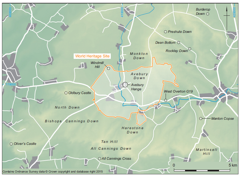
This may not be entirely surprising, as the evidence for Middle Bronze Age activity in the region is sparse, Barber (2005, 139) listing only 21 metalwork finds for the Marlborough Downs area, the majority of which are without firm provenance or context. In contrast, Barber (ibid., 143–4) points out the increasing importance of this period at a national level, in particular the identification of landscapes of fields and houses originating in the 2nd millennium cal BC. Avebury is located close to a major Middle Bronze Age domestic landscape, which has largely survived undamaged into the late 20th century due to a lack of deep ploughing. Occupation evidence was recovered from Preshute Down (Piggott 1942), where a D-shaped enclosure associated with Deverel Rimbury ceramics pre-dated an adjacent field system, whilst a series of sites excavated by Chris Gingell in the 1980s also produced evidence for both enclosed and unenclosed settlements (Gingell 1992). At Dean Bottom and Rockley Down, at least five house platforms which had been terraced into the hillside were enclosed by incomplete earthworks and associated with blocks of fields, whilst the settlement site at Bishops Cannings Down appears to have been open, but again set within fields. Despite the excavation of several settlement sites, and the large- scale mapping of field systems from aerial photographs, the relationships (both spatial and chronological) between field systems and settlements remains poorly understood, as does the nature of the activities which went on inside them and the organisation of the society which produced them.
Whilst it is clear from these sites that there is a shift away from the construction of visible monuments to the dead during the Early Bronze Age towards the organisation of the agricultural landscape during the Middle Bronze Age, this may not have been entirely separated from earlier landscapes. In some cases field boundaries deliberately encompass round barrows, which may have had continuing significance. In addition to the (currently un- published) Middle Bronze Age cremation cemetery associated with the bowl barrow West Overton G19, at least 10 round barrows have produced Middle and Late Bronze Age pottery. These include four on Monkton Down (PRN 7446, 7574, 7578, 7575), two on Avebury Down (PRN 7445, 7571), as well as examples on All Cannings Down (PRN 3592), Harestone Down (PRN 6744), North Down (PRN 3686) and Tan Hill (PRN 4032). The majority of these finds were recovered from surface collection by Owen Meyrick and they may represent ongoing engagement with barrows within the landscape. This is at odds with the apparent dearth of evidence for later Bronze Age activity within the Avebury monument complex itself, although it is not clear if this is simply due to a lack of evidence or a genuine avoidance of the monument during this period. Gillings and Pollard (2004, 86) have suggested that the lack of evidence of later Bronze Age activity from the stone circles and henge may indicate that they were a ‘taboo’ space, possibly associated with dangerous spirits, and point out that other henges, such as Durrington Walls and Mount Pleasant, were treated differently. There are, however, parallels with Stonehenge which, like Avebury sits within a landscape of later Bronze Age fields and farms. As at Avebury, these features barely enter the visual envelope of Stonehenge, which, for all intents and purposes, is abandoned.
The Late Bronze Age evidence from the Avebury region is slightly more abundant, with Barber (2005, 139), listing a total of 25 metalwork finds from the Marlborough Downs. Again, however, these nearly all lack clear provenance. Barber (ibid., 144) does point out the difference in types of metalwork being deposited, with the Middle Bronze Age material being almost equally split between spearheads and axeheads, whereas the Late Bronze Age material is dominated by axeheads, which also dominate the few recorded hoards. This is certainly true of the recently published hoard recovered from south-west of Marlborough at Manton Copse, Preshute (Lawson et al. 2011), where a total of 17 axeheads were recovered from excavation subsequent to metal detecting in 1999. A further 10 axeheads are known from nearby, although it is impossible to be certain if the deposition of these objects, which are chronologically identical, is related. The excavators also, again, note the absence of swords and spearheads from the Manton Copse hoard, suggesting that the different forms were treated differently.
There is evidence for Late Bronze Age metalworking from Bishops Cannings Down and Burderop Down (Gingell 1992, 105–11) and querns may also have been manufactured at Dean Bottom (Gingell 1992, 30).
Settlement sites continue to be constructed during the Late Bronze Age, with McOmish (2005, 134) suggesting that there may have been a shift towards the enclosure of settlement sites during the later Bronze Age and this appears to have occurred at Rockley Down. Whilst Middle Bronze Age Deverel Rimbury ceramics were recovered from the site (Gingell 1992), the majority of the pottery was of Post Deverel Rimbury style, suggesting continuing occupation into the Late Bronze Age. Possibly Late Bronze Age pottery was recovered from pits in Area D, North Field, Windmill Hill during excavations in 1993 (PRN 18720) and pottery of a similar date was recovered from a rectangular enclosure on Harestone Down (PRN 6635). Whilst evidence for a possible Late Bronze Age phase has been found outside the area considered here, at Liddington, there is no evidence for earlier phases to any of the Iron Age hillforts in the Avebury area. Late Bronze Age metalwork has, however, been recovered from Oliver’s Castle, Oldbury and Martinsell Hill (Barber 2005, 147), but this does not necessarily imply earlier construction phases. Indeed, Barber (2005) has pointed out the high number of bronze finds from Tan Hill (the highest point in the area), which is not occupied by an enclosure and suggests that there is a preference for deposition on prominent landscape features such as spurs and hilltops. A similar observation has been made by Field (2001, 61), who suggests that certain hilltops (including Tan Hill) may have been ‘special places’ where gatherings and assemblies took place.
by A.P. Fitzpatrick
The Iron Age of the Avebury WHS is poorly understood.
Chadburn and Corney 2001, 19
The opening sentence of Amanda Chadburn and Mark Corney’s assessment of the Iron Age in the WHS bears repeating. Today as then, few sites of the period have been the subject of investigation and research and it has been suggested that the Neolithic monuments that are at the heart of the WHS were deliberately avoided in the later Bronze Age and Iron Age.
But a lack of investigation and a limited understanding does not necessarily imply a lack of evidence for the periods and this is reviewed below according to site and find category (Fig. 14). It is based on the information held in the Wiltshire Historic Environment Record, the Portable Antiquities Scheme and Celtic Coin Index databases, Historic England’s Pastscape website, and a literature review.
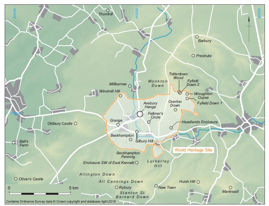
Nine enclosed settlements identified by aerial photography in and close to the WHS have been suggested to be later prehistoric in date (Chadburn and Corney 2001, tab. 1). Two of these enclosures lie within the WHS and may be confidently dated to the Early Iron Age.
The only excavated settlement is at Overton Down where a small part of a large enclosure, which survives as an earthwork, was excavated in the 1960s revealing several roundhouses (Overton Down X/XI enclosure 7: Fig. 15). Although it is suggested that the occupation is dated to the Late Bronze Age and Earliest Iron Age, between the 9th–7th centuries cal BC (Fowler 2000a, 89–91; 2000b), the diagnostic pottery is Earliest–Early Iron Age, of 8th–6th centuries cal BC date, not Late Bronze Age; and the presence of two stratified La Tène I brooches indicates activity in the 5th century cal BC or later.
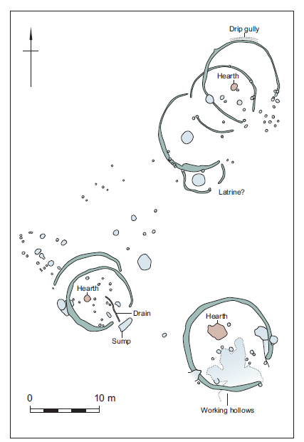
A little under 2 km to the south-west, at North Farm or ‘Headlands’, an enclosure with ‘antennae’ is known from aerial photography (Pl. 32) and a geophysical survey has confirmed the presence of a large number of pits. Early Iron Age pottery has been recovered from the surface of the site and its immediate vicinity (Fowler 2000a, 56, 224, pl. xi; Pollard and Reynolds 2002, 147, fig.59; enclosure 6).
A third, undated enclosure identified by aerial photography is known to the south-west of East Kennett (SU 1066: enclosure 1). In addition Fowler suggests the presence of another enclosure by the south-west corner of Totterdown Wood (Fowler 1966, fig. 9; 2000a, 224, fig. 5.3) and, more tentatively, a possible one on Lurkeley Hill (2000a, 224).
To the south of the WHS a number of enclosures are represented by earthworks and cropmarks. Although suggested possibly to be of Iron Age date by Corney and Chadburn (2001, 21–2), the two enclosures at New Town and north-west of New Town are likely to be medieval and Late Bronze Age respectively and the date of the enclosure on Huish Hill is also uncertain (Bowden 2005, 158). One enclosure lies to the north of the WHS at Preshute Down. This site is associated with a field system of uncertain date but Iron Age pottery has been recovered from the enclosure. This may be the same site as one referred to, but not accurately located, by Colt Hoare and from which pottery and querns were recovered.
A number of finds of pits containing Iron Age pottery and other domestic debris suggest the presence of settlements that are not known to have been enclosed, though it should be remembered that it is quite common for Iron Age settlements to be successively enclosed and open and vice versa (McOmish 1989; 2001).
A working hollow containing both Early and Late Iron Age and Roman pottery was found west of Grange (Young 1959) and two pits which also contained Iron Age and Roman pottery as well as a bone object, a spindlewhorl and a loomweight and animal bone were found north-west of Beckhampton Penning (Cunnington 1887a). Two pits containing Iron Age pottery and domestic debris are known from Monkton Down immediately north of the WHS (Cunnington and Goddard 1934, 158; Grinsell 1957, 126).
Meyrick recorded a number of surface finds of Iron Age pottery immediately to the south of the WHS: at Stanton St Bernard Down (1947, 258, fig. ii), north east of Allington Down and All Cannings Down. The All Cannings Down finds are described as forming an extensive scatter of pottery and animal bone (Grinsell 1957, 24), though their dating, ‘Iron Age C’, means that a Romano-British date cannot be excluded. At Thornhill sherds from a field system might indicate the site of a settlement or the presence of one in the proximity (Grinsell 1957, 106, 275).
Bowden has noted (2005, 157) that there is some uncertainty about the identification and date of a group of open settlements near Wroughton Copse on Fyfield Down. In the case of the find near Wroughton Copse, two or three possible house platforms were noted within a field system as were a few sherds of pottery initially dated to the Iron Age (Bowen and Fowler 1962, 102). At Fyfield Down, however, Owen Meyrick recovered pottery of Early and Late Iron Age date and La Tène I and La Tène III type brooches. Pits were also observed in the course of army operations (Meyrick 1947, 258–60, fig. iv) and this suggests the presence of a long-lived settlement. It is possible that a second site at Fyfield indicated by Chadburn and Corney (2001, 22, tab. 2), who wrote before the final publication of the work on Fyfield and Overton Down in 2000, is the same site as the possible enclosed settlement at Totterdown Wood (see above).
Elsewhere, some finds are known from Windmill Hill where a few sherds and perhaps also some bone gouges are of Iron Age date (Smith 1965b, 170–1, fig. 63). It is not known if these finds are related to the later prehistoric or Romano-British field system that encroaches on the monument (Whittle et al. 1999, 16). Iron Age pottery was also found in the excavation of the Millbarrow long barrow to the north-west of the WHS (Whittle 1994, 40).
The evidence is scrappy but the pits at Fyfield Down, Grange, north-west of Beckhampton Penning and Monkton Down may all be accepted as indicating the sites of settlements. The surface finds from All Cannings Down and Stanton St Bernard Down are also likely to indicate settlements. However, the precise date of these and many older finds is not known; their only publication typically being in Cunnington and Goddard’s 1934 Catalogue of Antiquities in the Museum of the Wiltshire Archaeological and Natural History Society at Devizes, brief notes by Owen Meyrick or the listings in Leslie Grinsell’s Gazetteer for the 1957 Victoria County History volume.
It may be noted that Early Iron Age or Iron Age ‘A’ material is mentioned more frequently than Iron Age ‘B’ or ‘C’ types in Meyrick’s and Grinsell’s work but this might simply be due to this material being well known locally because of the important work at All Canning Cross (Cunnington 1923). Gingell’s work on the Marlborough Downs also showed that at least some pottery that Meyrick described as Iron Age ‘A’ was Late Bronze Age in date and it is possible that is also the case in and around the WHS.
The only pottery clearly dated to the Middle Iron Age is from an evaluation undertaken in 1996 at Bell’s Farm to the west of the WHS. It is not clear how much weight should be attached to this observation, if any, though a rarity of sites clearly datable to the Middle Iron Age was noted on Salisbury Plain (McOmish et al. 2002).
There are a number of hillforts to the south of the WHS (Oliver’s Castle, Rybury, and Martinsell) and Oldbury Castle stands to the west of the WHS. To the north the nearest hillfort is at Barbury on the northern edge of the Marlborough Downs. Although excavation at the sites closest to the WHS has been limited, some pits in the interior of Oldbury were examined by Henry Cunnington in 1875 and these contained pottery, a bone comb, querns and animal bone (Cunnington 1887b, Cunnington 1894). The fort was included in the recent programme of geophysical surveys of Wessex hillforts and this work revealed a dense scatter of pits and roundhouses in the interior (Payne et al. 2006, 123–4, fig. 2.62). The analytical earthwork survey recommended by Bowden (2005, 163) was undertaken while that paper was in press (Bowden 2004).
Although extensive field systems are known to the south and east of Avebury it seems likely that these are either Bronze Age or Romano-British in date. Fowler’s work on Fyfield and Overton Down found little evidence for cultivation in the Iron Age and he wondered if the areas were used for breeding and training horses (2004, 137).
However, the Iron Age pottery collected from these and other field systems by Meyrick suggests (if dated correctly) either farming and/or settlement in the vicinity, irrespective of the date of the field systems. The date of the field system at Windmill Hill is uncertain.
A number of brooches have been found as single finds and this partly reflects the regularity with which La Tène I style brooches are found in Wiltshire. Two examples, and also a penannular brooch, were found in excavations at Overton Down X/XI and another La Tène I and a La Tène III brooch were also found at Fyfield Down (Meyrick 1947, fig. iv).
There are a few coins of 1st-century cal BC date said to have been found in the WHS but in contrast to the finds of pottery and most of the brooches, the coins and a few other pieces of Iron Age metalwork have only very general provenances, such as ‘near Silbury Hill’, and the veracity of them, particularly for recent finds, must be doubted. The fragment of a La Tène sword or dagger chape from Beckhampton is an uncommon find but the provenance may be genuine (Grinsell 1957, 34). This is unlikely to be the case with the bronze brooch from Avebury Down which, while it was made in Italy in the Bronze Age and accepted by Christopher Hawkes as an ancient import (Hull and Hawkes 1987, 12, pl. 1; Robinson 2007), seems unlikely to have reached Wiltshire before the age of the Grand Tour.
Although the head of the Kennet has been suggested as a possible location for Iron Age votive offerings (Powell et al. 1996, 83), relatively few Iron Age objects from watery contexts come from springs and most come instead from major east- flowing rivers.
Radiocarbon dates from two Neolithic sites have indicated activity at them in the Iron Age but there are no associated artefacts to suggest what these activities might have been. Two dates are from the Avebury henge. Charcoal from stakeholes on the edge of stone-hole 8 in the south-west sector of the Outer Circle from Keiller’s excavations returned a date in the Early–Middle Iron Age (770–390 cal BC: HAR- 10061, 2430±70 BP) and charcoal from an ash layer in stone-hole 44 in the north-west sector of the Outer Circle from Keiller’s work returned a Middle Iron Age to early Romano-British date of 400 cal BC–cal AD 150 (HAR-9696, 2080±110 BP). Another date from the same feature returned a date in the Late Neolithic–Early Bronze Age. While of no relevance to the development and date of the henge in the Neolithic (Pitts and Whittle 1992, 204) these dates do indicate activity in the Iron Age (Cleal and Pollard 2004, 127). At Falkner’s Circle there was a single pit (F1) of Middle Iron Age date (Wk-17356, 2283±35 BP) and while this did not contain any settlement-related material it indicates some activity at a Neolithic monument. It should also be noted that there is a Late Bronze Age date from Silbury Hill.
While there are few Iron Age finds from the heart of the WHS (Powell et al. 1996, 13), these dates suggest that a taboo was not necessarily exercised over the monuments as is sometimes suggested (Chadburn and Corney 2001, 67; Gillings and Pollard 2004, 85). Henges, stone circles and avenues are not without limitations as locations for settlements and this may explain why the certain and probable settlement sites are towards the edge of the WHS. Hillforts were the most common form of monumental architecture in the Iron Age and there was no hesitation in building these on the sites of causewayed enclosures, including at Rybury Camp (Bonney 1964). Elsewhere Neolithic monuments were sometimes reused (Hingley 1996) and there was clearly an awareness of ancient objects (Stead 1998; Hingley 2009).
by Mark Corney and Bryn Walters
Although overshadowed by the prehistoric remains, the Avebury environs also contain a significant Romano-British archaeological resource (Fig. 16). A number of substantial settlements are known in the region and they will have undoubtedly influenced the local economy, society and administration. To the north of the region the ‘small town’ at Wanborough has a regular grid and at least one public building (Burnham and Wacher 1990; Phillips and Walters 1977). To the west the poorly understood site of Verlucio (Sandy Lane) is a focus for villa and other settlement types, whilst recent work in the Silbury Hill (Fig. 17) area has demonstrated the presence of a substantial settlement here (Powell et al. 1996; Corney 1997a). On the eastern fringe of the discussion area the ‘small town’ of Cunetio (Mildenhall) is likely to have played an increasingly important role as a regional administration centre in the late Roman period (Corney 1997b).
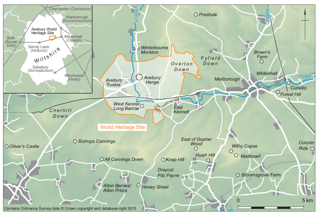
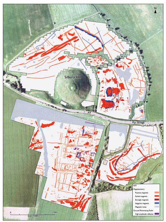
Villas and other substantial buildings are fairly evenly distributed over the area of enquiry, with known or probable examples at Cherhill (SU 0370), Bishops Cannings (SU 0465), Avebury Trusloe (SU 0870), West Overton (SU 1368), Preshute (SU 1670), Brown’s Farm (SU 1967), Forest Hill (SU 2068), Draycot (SU 1463), and Alton (SU 1361). Further probable sites in the Vale of Pewsey have been noted on recent aerial photographs taken by RCHME, most notably at Huish (SU 1363) and Wilcot (SU 1361). At least one of the above sites (Brown’s Farm, SU 1967), may be associated with a temple or shrine.
A large number of other settlements of varying characteristics are known or suspected: for example, Fyfield Down and Overton Down (Fowler 2000a), All Cannings (SU 0764), Knap Hill (SU 1263), Honeystreet (SU 1061), Cherhill Down (SU 0569), east of Gopher Wood (SU 1464), Huish Hill (SU 1564), Martinsell Hill (SU 1763 and 1864) and Marlborough (SU 1968). Additionally, a number of cropmark enclosures of probable Iron Age date are, by analogy with similar sites elsewhere in Wiltshire, likely to have continued into the Romano-British period, for instance, the enclosure complex at East Kennett (SU 1066). Similarly, finds of Romano- British pottery from hillforts such as Oliver’s Castle (SU 0064) and Oldbury (SU 0469) suggest continued use of Iron Age locations. In the case of Oldbury, the further discovery of pennant roof tiles raises the possibility of a substantial Romano-British building adjacent to the hillfort. Extensive spreads of Romano-British material noted by local fieldworkers such as Meyrick (Swanton 1987) suggest a well- settled landscape. Notable concentrations occur at West Overton (SU 1268), Alton (SU 1163), East Kennett (SU 1165), All Cannings Down (SU 0966) and Winterbourne Monkton (SU 1274–1275) (Swanton 1987).
Evidence of industrial activity is concentrated on the eastern fringe of the region; most notable is the Savernake Pottery industry, a ceramic tradition of probably Late Iron Age origin (Hopkins, pers. comm.), continuing into the 3rd century AD. Major kiln groups exist around Column Ride (Annable 1962) and Broomsgrove Farm, with a possible further group immediately to the west of Martinsell hillfort and at Withy Copse, Oare (Swan 1984).
The Romano-British period is the closest historically recorded period with which an obtainable resource might be compared with prehistoric ceremonial and religious practices. Consequently, the collating of Roman evidence is of paramount importance. The possibility of continued reverence of the Avebury complex should be given serious consideration (cf. Williams 1998). Ritual and ceremonial sites in the region are strongly suggested at a number of locations. A major shrine associated with a spring is probable at Mother Anthony’s Well (ST 9964), located at the foot of Oliver’s Castle; Oldbury hillfort (see above); Brown’s Farm, Marlborough (SU 1967) – where a close association with the find spot of the Savernake Hoard suggests a Late Iron Age origin; Winterbourne Monkton Down (SU 1272); and close to Silbury Hill (SU 0968– 1068). An unusual Roman barrow burial tradition has been identified through excavation on Overton Hill (Smith 1964) and Roman activity around prehistoric funerary monuments is suggested by finds from West Kennet long barrow (Piggott 1962; Williams 1998). The possibility of Roman re-use of the Avebury henge is discussed in more detail below. Burials of Roman date are known from a number of locations such as Honeystreet (SU 1061), Marlborough (SU 1969) and Silbury Hill (SU 1068).
The general background pattern of ‘stray’ finds from the region suggests a landscape during the Romano-British period with settlements of many forms. The potential wealth of the area in the late Romano-British period has been recently demonstrated by the discovery of the large hoard of siliquae from Bishops Cannings (Guest 1997). The results of Peter Fowler’s work on Fyfield Down and Overton Down (Fowler 2000a) are of great interest and importance in providing an insight into the evolution of the chalk downland economy.
by Mark Corney
The original Avebury Resource Assessment, published in 2001 and repeated above, succinctly summarised the evidence for the Romano-British landscape of the Avebury area. It noted the evidence for villas, rural settlement, communications and, beyond the boundary of the WHS, the ‘small towns’ and nucleated settlements such as Cunetio and Verlucio which may have serviced the area as centres of trade, exchange and administration.
Characterisation of the villa settlement pattern within the WHS and its environs remains minimal with no modern investigations apart from the limited work on the site beneath Cherhill Church in 1984. Equally, no further fieldwork has been undertaken on the Romano-British agrarian landscape since Peter Fowler’s publication of the Fyfield and Overton Down project in 2000. This volume established a firm base for further investigation and raised important questions regarding the Late Iron Age – Roman transition and potential continuity of Romano-British rural settlements and their landscapes into the 5th century or beyond.
Since 2001 two major episodes of investigation have provided important new data on the character of two nucleated settlements: the defended ‘small town’ of Cunetio to the east of Marlborough and, within the WHS, the settlement around the Swallowhead Spring, between Silbury and Waden Hill.
At Cunetio, investigation by Time Team included a geophysical survey of the entire walled area and part of the extra-mural zone. This major investment in resources has provided considerable new detail of the town landscape and has added significantly to the earlier plan derived from air photographic data. The complexity of the site is now very evident. Targeted excavation demonstrated the monumental character of the 4th-century defences and the south gate; and demonstrated the variable survival of structures within the town defences and the sometime severe impact of continued cultivation on the archaeological deposits (Wessex Archaeology 2011; the results have since been published – Seager Smith and Wakeham 2015).
Of even greater interest and importance to the Romano-British archaeology of the WHS are the results of the geophysical survey and subsequent evaluation excavation undertaken by English Heritage over the settlement adjacent to Swallowhead Spring and Silbury Hill (Leary et al. 2013b). The detail revealed of the settlement layout west of Swallowhead Spring and to the south of Silbury Hill and the modern A4 significantly increases the known extent of the settlement, previously thought to be focused on the western flank of Waden Hill (Fig. 17). The settlement is regular in plan with rectangular ditched enclosures, some with evidence for stone structures. Although referred to as a ‘ladder’ type layout, the alignments revealed suggest a degree of planning, being set at 90º to the line of the Roman road beneath the modern A4. The alignments recorded by the geophysical survey are also in broad agreement with the features plotted from air photographs on the western flank of Waden Hill and suggest an extensive area of organised occupation.
The characterisation of the status and function of this settlement must be a priority in understanding the nature of Romano-British activity in the immediate vicinity of the Avebury complex. The Silbury settlement is equidistant from Cunetio and Verlucio, being 12 km from each site. This spacing is probably too short for the settlement to be seriously considered as a location for a mansio or mutatio. It has previously been noted that the Silbury settlement also appears to include a series of wells or shafts which feature ‘structured’ deposits and the possibility of a Romano-British ritual complex acknowledging the sanctity and antiquity of the prehistoric monuments remains an attractive hypothesis worthy of further investigation. Although the top of Silbury Hill was altered by late Saxon terracing and fortification and has suffered severely from antiquarian investigations and the recent collapse, the presence of a Romano-British shrine on the summit with attendant facilities and related features at its foot must remain a distinct possibility.
The incidence and frequency of Roman material from the prehistoric monuments in the Avebury landscape requires further study to ascertain the character and nature of the deposits, especially metalwork. Although many are stray finds lacking a precise archaeological context, the objects may display patterns which could point to votive activities: a good example being the late Roman coins recovered from the façade area of the West Kennet long barrow (see for instance Moorhead 2011) which could be interpreted as deliberate deposits and part of the broader phenomenon of later Roman material encountered on prehistoric monuments in Wessex and beyond. Comparisons with other Neolithic and Early Bronze Age complexes across Britain and France should be made and, in this respect, note should made of the amount of Gallo-Roman material from the Carnac complex in Brittany.
by Bruce Eagles
There is only limited evidence for these periods from within the area of the WHS (Fig. 18). The Anglo- Saxon sunken-featured buildings excavated in 1976 by Faith and Lance Vatcher in the Avebury southern car park, outside the henge, are not yet fully published but, on the basis of the date of three associated glass beads, they have been assigned to the 6th century (Guido 1999, 164). Another, similar, building was excavated nearby in 1988 (Pollard and Reynolds 2002, 192–8; Wilts. HER SU06NE402; see also SU16NW404, SU17SW402). Other evidence for early Anglo-Saxon settlement in the area is provided by two clay loomweights of ring-doughnut type from East Kennett (Goddard 1929; HER SU16NW405).
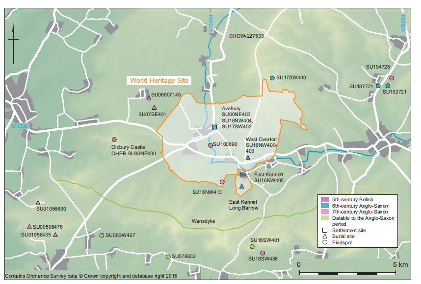
Inhumation burials of men, a woman and children at West Overton were intrusive in a Bronze Age round barrow and three Romano-British tombs of the 2nd century AD. They were sited on the east side of the Ridgeway, just above its crossing with the Roman road from Bath to Silchester (Eagles 1986; Semple 2003, 86–7). The Ridgeway may have developed as a north to south through route in the early Anglo-Saxon period (Fowler 2000a, 22). The grave goods from the male burials at West Overton include shields, spearheads, knives and an iron finger-ring; they belong to the 6th century. The grave of the adult female accompanied by a small zoomorphic penannular brooch (Youngs 2010, 38), Roman key, beads of amber and one of blue glass may, however, date to the late 5th century, the earliest date that an Anglo-Saxon presence has been recognised in this area. Loose finds, in all likelihood from further, disturbed, burials, include organic-tempered pottery and a fragment of a triangular-lugged copper alloy cauldron. The latter is probably of the Westlandkessel type, which was manufactured in the Namur region, but was widely distributed throughout the Germanic world. The Westlandkessel was in production from the late 4th until at least the mid-6th century, though it clearly remained in use later (Richards 1980, 13; Eagles 1986; HER SU16NW400–403). There also appear to have been intrusive interments in the East Kennet long barrow, for an anonymous illustrated manuscript letter (Pl. 33) of c. 1840–50 states ‘Long Barrow (beyond 360 feet) on the Eastern summit of which I discovered 3 skeletons with iron spears and knives similar to the adjoining sketch – [socketed] spearhead, ‘about 9 inches’; knife, ‘4 inches’ ’ (J. Pollard pers. comm. who notes that the identification of the barrow is made probable by the dimensions cited in the letter and the accompanying sketch profile, and also by the details of the East Kennet round barrow Beaker grave group, which are reported separately but immediately below in this letter; see also Semple 2003, 87). An applied disc brooch, whose frontal silver disc – almost certainly in origin a bracteate (pendant) – is decorated with repoussé Germanic Style II animal ornament, was found near the boundary between the parishes of East Kennett and Avebury. Its closest parallel is a 7th- century silver bracteate from Sittingbourne in Kent (Hattatt 1989, 214–5; Speake 1980, pl. 13b; HER SU16NW413). The decorative mount from a bronze hanging bowl from the River Kennet (SU 100690) by Waden Hill is also likely to belong to the 7th century (Youngs with Eagles 1998). The name Waden (Old English wēo(h)-dun) means ‘the shrine on the hill’, though not necessarily a pagan one, as the term continued to be used of wayside shrines in Christian times (Gover et al. 1939, 295; Wilson 1992, 10; Gelling 1997, 259).
To the north and beyond the limits of the WHS, Temple Down, Preshute, may be the provenance of a complete, plain, hand-made Anglo-Saxon pot in the Wiltshire Museum, Devizes; its completeness suggests that it once accompanied a burial (Robinson 1991; HER SU17SW400). There is also a 7th- century, copper alloy gilded mount decorated in Germanic animal Style II from Winterbourne Bassett (PAS Database IOW-227533, where the provenance is incorrectly given as Wootton Bassett).
Looking eastwards, unassociated finds of the 6th century are recorded from two sites at Ogbourne St Andrew (a small-long brooch (HER SU187721): Anon. 1991a, 148; and a saucer brooch with six-spiral decoration (HER SU192721): Anon. 1988, 185). The Marlborough area has produced another copper alloy bowl with triangular lugs. This example is of rounded, rather than the angular profile of the Westlandkessel, of which it is a typological development, and is classifiable as a Gotlandkessel; it was found with a knife (PAS Database WILT- 7E5176). Such bowls are again likely to have been made in the Namur region and they too have an extensive distribution. They date to the 6th century, up to c. 600 (Richards 1980, 13–14). A gold wire bead (HER SU194725), possibly 7th to early 8th century in date, also from Ogbourne St Andrew probably derives from a high status burial there (Marzinzik 2005/6).
To the south-west and south of Avebury, the landscape is dominated by the great earthwork of East Wansdyke, its west to east course keeping, for the most part, to the crest of the chalk escarpment. The post-Roman date of the Dyke was established by General Pitt Rivers at the end of the 19th century, but its precise context continues to elude us. It has recently been shown that, at least in some places, it is of two-phase construction and, furthermore, that it may have origins in prehistory, though not necessarily as a continuous earthwork (Eagles and Allen 2011). East Wansdyke, it has been argued, marked part of the boundary between the Roman civitates of the Belgae, whose capital lay at Venta Belgarum (Winchester), and the Dobunni, who were centred upon Corinium Dobunnorum, Cirencester (Eagles 2001). It has been considered that it may have reached its present form only in the 8th century, as a frontier between the West Saxons and the Mercians (Reynolds and Langlands 2006, to whose arguments may be added the point that this may be the context for the Old English name of the River Marden (‘the boundary valley’: Gover et al. 1939, 8–9), a tributary of the Wiltshire Avon, which replaced its earlier name of Calne (Coates and Breeze 2000, 340).
A saucer brooch is recorded from Bourton in Bishops Cannings parish (Anon. 1991a, 148, fig. 3; HER SU06SW407) and a disc brooch (Anon. 1990, 229: SU 078632) from All Cannings. Cannings is an early Old English name with the ‘-ingas’ suffix and refers to the Can(n)ingas, the people of an individual called Cana (Gover et al. 1939, xiv, 249–50). Their name also survives in Caningborough Hill, between Avebury and Yatesbury and to the north of Wansdyke. In 2001 a gilded silver pyramidal fitting, with niello decoration and inset garnet, of the late 6th or the 7th century and probably from a sword belt, was found to the south-east of Knap Hill (Evans 2003, no.60; HER SU16SW406). At Knap Hill itself, a sword, two-edged, but with no other distinguishing features (it has not been x- radiographed), of early Anglo-Saxon date but not more closely datable, was found during excavations in 1908–9 (HER SU16SW401; Cunnington and Goddard 1934, 135, fig. 25, no. E27a).
It has been argued that, from the later 5th century, the Avebury area lay just to the east of the frontier between the expanding Anglo-Saxons and the Britons (Annable and Eagles 2010, 107–9). It is from this frontier, too, that there is the only archaeological information about the post-Roman Britons themselves. The evidence takes the form of two large penannular brooches, both with zoomorphic terminals. One of them was excavated from a ‘hollow’, one of a number once recognisable, within the Iron Age hillfort of Oldbury Castle on Cherhill Down (Cunnington 1887: the hollow is marked m.2 on the plan; Cunnington and Goddard 1934, 255–6; HER SU06NE400). Recent analytical field survey of Oldbury Castle has revealed a possibly late enclosure within its north-east quadrant, the highest part of the hill and also the area where m.2 was located (Bowden et al. 2005; Oldbury has also produced Roman finds, with coins up to AD 383–385, of the reign of Magnus Maximus). Another, similar, brooch, but enamelled, is recorded as from ‘near Calne’, but it is possible that it too is from the hillfort. It is an early example of a type introduced and developed in Ireland from c. 400 (Youngs 2012, 268–9). Following late Roman practice, in the 5th-century brooches such as these were worn at the shoulder by high-ranking British males to fasten a cloak (Youngs 2010, 39–40; for dating of the large penannular brooches see Mackreth 1986, 30).
There are also indications of a late Roman site at the foot of Cherhill Down, to the north-east. Metal- detected finds there include a copper alloy spoon and a number of late 3rd- and 4th-century coins, the latest of them of Gratian (367–383), and a fragmentary silver penannular brooch, also with zoomorphic terminals, but smaller than the others and of 4th- century date (now in Wiltshire Museum, Devizes). Silver examples of zoomorphic penannular brooches are extremely rare (Youngs 2012, 259: WILT- 809E32 in the PAS Database, which also holds records of the other finds). This frontier marks the most westerly limit of Anglo-Saxon penetration, as determined by material culture, until the late 7th century. It is also defined to the west and south-west of Avebury by high status burials of the later or the end of the 7th century at Roundway Down and Yatesbury (HER SU07SE401) and other, primary, burials which also date to the 7th century at Heddington and at another location in Roundway, References to these four sites will be found in Semple 2003, respectively, under ‘Roundway Down 7’ (SU 00596476) possibly a bed-burial (for which see also Speake 1989, 107); ‘Yatesbury 2’, ‘King’s Play Down, Heddington’ (SU 01056600); and ‘Roundway Down 3’ (SU 01956435). Semple also notes that another burial at Yatesbury, her ‘Yatesbury 1’ (SU 06807145), may have been another primary burial in this area.
In addition, there is a marked concentration of Brittonic and even more ancient place-names in north-west Wiltshire, a distribution emphasised in the Avebury area by the names Cherhill, Calne, Quemerford and, possibly, Penn (High and Lower Penn farms) to the west and north-west of Oldbury Castle (Coates and Breeze 2000, 112–6, 339–40, 391 (map); Eagles 2001, 208, fig. 11.2). These names indicate the late persistence of the British tongue in that region: ‘Brittonic was still spoken here in the 7th century by people capable of influencing the linguistic behaviour of the West Saxon overlord class and its administrators’ (Coates and Breeze 2000, 113). The territory of the Can(n)ingas, it has been suggested (Reynolds 2005), stretched westwards beyond Calne, and so across this frontier, although the names directly associated with them are all further to the east.
Organic-tempered, hand-made, potsherds, which, if plain, cannot be dated more closely than between the 5th and the early 10th centuries, have been recovered from within Avebury henge and from the building and an adjacent pit found in the car park in 1988 (Pollard and Reynolds 2002, 191–2, 196–7). Similar potsherds have also been found at many other sites across the wider region under discussion here: West Overton, as already noted, Winterbourne Monkton (HER SU07SE402), to the north of Avebury, Compton Bassett to the north-west, Cherhill, Yatesbury and East Kennett (Pollard and Reynolds 2002, 211; Anon. 1995, 154), and also the Neolithic Palisade Enclosure 2, West Kennet (Whittle 1997a, 83, and also 84 ‘Anglo-Saxon’ sherds).
by Andrew Reynolds
Avebury is one of the few places in north Wiltshire for which excavated and standing structural evidence exists for an Anglo-Saxon settlement with a long history, that then developed into the medieval period and later. The research potential is high and it is a matter of some concern that no full synthesis has been published. Consequently, the importance of the Anglo-Saxon and medieval remains has yet to be fully realised.
The only work to attempt to draw together all forms of evidence for Anglo-Saxon and medieval settlement at Avebury is that prepared by Professor Martyn Jope and intended for publication in Isobel Smith’s 1965 volume Windmill Hill and Avebury. The absence of Jope’s paper from the volume has meant that an important aspect of Avebury’s archaeology has remained without public assessment, although a version of the article has been published (Jope 1999). An undergraduate dissertation undertaken at Uni- versity College London has listed the unpublished excavations and provided a useful overview of the current state of knowledge based upon the work of the present writer (Harward 1997).
The documentary evidence for Avebury and its parish has been synthesised and published in the VCH account of the Hundred of Selkley (Freeman 1983), whilst the evidence for transport and communications in and around the monument has been clarified and expanded (Reynolds 1995).
Excavations to the west of the henge monument at the present visitor car park have provided evidence for settlement in the early Anglo-Saxon period, although the density, character and dating of occupation is hard to determine on the basis of current knowledge. Dating rests on three glass beads considered by Margaret Guido to be of 6th-century date associated with at least two sunken featured buildings identified in excavations inside the entrance to the Glebe Field car park in 1976 (Department of the Environment 1977, 32–3). Further structural evidence, probably broadly contemporary, includes a sunken featured building in the northern part of the car park, found in 1985, and a further example adjacent to the Vatchers’ earlier excavation found in 1988 (Borthwick 1985; Leah 1988).
The 1985 excavations revealed further features which were not excavated owing to time constraints – a situation to be very much regretted given Avebury’s potential for understanding settlement processes in the pre-Conquest period. The 1988 excavations revealed a series of postholes, which might represent either fence-lines or perhaps fragments of earthfast timber halls; the former would indicate a date in the 6th century or later, when property boundaries became common again on rural settlement sites (Reynolds 1999, 48–50). Anglo-Saxon interest in the henge itself is revealed by the finding of chaff- tempered pottery in the upper fills of the henge ditch during St George Gray’s excavations in the earlier part of the 20th century (Gray 1935). This type of pottery, however, can only be broadly dated to between the 5th and early 10th centuries (Hamerow et al. 1994, 15) in the absence of sherds displaying diagnostic decoration or form.
Excavations by John Evans et al. to the north of the car park settlement in Butler’s Field have provided a series of radiocarbon dates between AD 800 and AD 1200, which indicate occupation in the middle to late Anglo-Saxon period and beyond (Evans 1993 et al., 146, table 1). Of particular importance is a calibrated date of cal AD 680–1030 (OxA-1220; 1160±80 BP) obtained from faunal remains apparently in an occupation deposit (Evans et al. 1993, 146, table 1 and 190).This middle to late Anglo-Saxon date was obtained from Evans’s Cutting J, which lay on the south side of an eliptical plan-form arguably of this period (see below).
At the School site, on the south side of the west entrance of the henge, Faith and Lance Vatcher revealed occupation earlier than, contemporary with, and later than that found by Evans, including a date of cal AD 660–1020 (HAR-1696; 1200±80 BP) from a pit containing grain in association with occupation debris (Wilson 1970, 200–1; R. Cleal pers. comm.). Although the Vatchers’ excavations remain unpublished, the excavation plan indicates dense and successive occupation phases. Timber structures are seemingly represented, although the stratigraphic relationships between the various features are not shown. Structures and boundaries are clearly perpendicular to the current high street but little more can be ascertained without a detailed analysis of all aspects of the excavation archive.
Medieval Assize Rolls of 1289 describe the henge itself as waledich (ditch of the Britons; Kempson 1955, 60–1), and it seems highly likely that the modern place-name of Avebury refers to an Anglo- Saxon settlement to the west of the monument rather than the henge itself. The English Place-Name Society interpretation of the name meaning ‘fortified place by the Avon’ (Gover et al. 1939, 293–4) would fit well with the evidence from the RCHME survey (Fig. 19) which shows a rectangular enclosure, surrounding the church and regular house plots, extending westward from the west entrance of the henge toward the Winterbourne. The most likely historical context for such a settlement plan is the later 9th or early 10th century, when fortified settlements, or burhs, were either refortified or newly established across southern England in response to the Viking threat after Alfred’s defeat of Guthrum and his army at Edington in Wiltshire in 878 (Anglo-Saxon Chronicles s.a. 878). The RCHME survey appears to show an underlying, and thus earlier, settlement extending to the west of the suggested burh; a situation of no small academic importance.
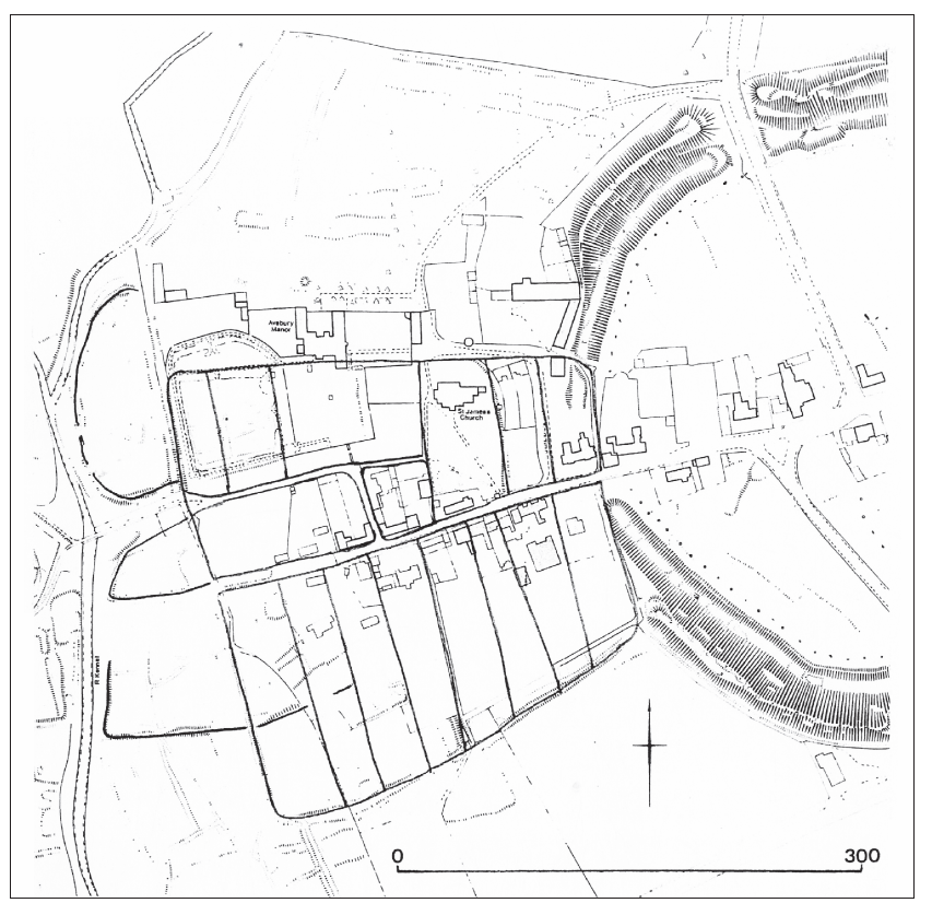
It may be significant that the morphology of the earlier layout is comparable with the elliptical plans of both Ramsbury and Kintbury to the east; both important Anglo-Saxon towns with minster churches and burh suffixes. To the south, at Tilshead, and at Winchcombe in Gloucestershire, further elliptical plan forms can be observed in combination with later Anglo-Saxon administrative centres and minster churches, although there is no documented minster at Tilshead (Haslam 1984, 117–18, fig. 49; Bassett 1985).
Within the suggested burh, which survives as an earthwork along the southern and western sides of the enclosure, regular plots of land are laid out perpendicular to the east–west herepað route that passes through both the henge and the burh: the course of the herepað itself can be reconstructed from a variety of sources (Reynolds 1995). Settlement planning of this type is commonly found in the Burghal Hidage towns, such as Cricklade and Wallingford, but not in normal rural settlements. It is of interest to note that the area encompassed by the proposed burh is comparable to estimations made for the extent of Anglo-Saxon Marlborough and Wilton (listed in the Burghal Hidage) (see Haslam 1984, 99, fig. 39 and 126, fig. 52). It might also be suggested that the henge itself served as anarea where stock could be kept in times of emergency. The plan forms of many of the larger burghal towns indicates open spaces within the major fortifications, but the henge would have served the purpose perfectly and thus have minimised the labour requirement for the initial building of the burh.
On the basis of plan form, the existence of a substantial church, the association of the henge and settlement with a herepað, and the various archaeological discoveries, it is possible to suggest that Avebury is a failed small town of 9th- and 10th- to early 11th-century date (Reynolds 2001). The early radiocarbon date from the School site could just as easily belong to the initial phase of settlement within the proposed burh as to the underlying plan- form, particularly as the earthwork phases at most excavated burh sites are undated. Jeremy Haslam has suggested that the decline of Chisbury and Bedwyn (both east of Marlborough) can be ascribed to the growth of Marlborough and Ramsbury in the late Anglo-Saxon period (Haslam 1984, 140). It seems equally likely that competing settlements to the west of Marlborough could have experienced decline to the benefit of Marlborough and perhaps also to Calne. By 1086 the Domesday Survey records only the presence of the church and its holding of two hides of land under the entry for Avebury, itself an indicator of the former’s minster status (Blair 1985, 108, fig. 7.1).
St James’s Church (Pl. 34) itself contains displaced sculpture of the 9th–10th centuries. Recent work on the building by the Compton Bassett Area Research Project and (independently) Professor Rosemary Cramp has revised both the dating and recording of the structure undertaken by Harold and Joan Taylor (Taylor and Taylor 1965, 32–4; Semple in prep.). The north-west corner of the present nave is composed of side alternate megalithic quoins incorporating a fragment of Anglo-Saxon sculpture, of later 9th- or 10th-century date and originally part of either a cross shaft or a coffin lid. This displaced stone indicates that the standing Anglo-Saxon fabric might represent the second masonry church on the site. Monumental sculpture is more likely to be associated with an important church rather than, for example, representing an isolated preaching cross as is often presumed (cf. Jope 1999, 61 who mistakenly refers to the sculpture being set into the tower rather than the north-west corner of the nave). It may be further conjectured that the displaced sculpture is related to a church contemporary with the building of the putative burh. The rebuilding of c. AD 1000 described below, therefore, apparently occurred shortly before Avebury’s decline to a settlement of a more rural character.
The 10th- or 11th-century fabric of St James’s includes single splay windows, with external rebates for wooden frames, on either side at the west end of the nave. Circular windows with holes for wicker formers appear to have been positioned above the single-splay windows and it seems probable that each side of the nave was furnished with four single-splay windows with circular lights above each one. The chancel of the Anglo-Saxon church was apparently discovered during restoration in 1878 as being shorter than the present chancel and probably of a single bay (see Taylor and Taylor 1965, 32–4 for a fuller description; and Semple 2003 for a revision of aspects of the Taylor’s work). St James’s Church (dedicated to All Saints in the 13th century) would have been an impressive building by local standards in the years around AD 1000.
The medieval settlement can only be viewed in terms of continuity from the Anglo-Saxon period as its location (and that of later settlement) was clearly established by the late Anglo-Saxon period. This is evidenced by the Vatchers’ School site excavations and by the often-substantial finds of medieval pottery from the majority of excavations within and adjacent to the henge monument (Jope 1999). Clearly though, the medieval settlement was complex and dynamic with a number of foci and the precise chronology of expansion and contraction is not yet established. The finding of a late Anglo-Saxon coin brooch at Avebury Trusloe may indicate that the origins of that settlement lie in the pre-Conquest period, although the find might equally well represent a casual loss (Wilts SMR SU06NE404). A sherd of ‘possibly Saxon’ pottery was found on the south side of Beckhampton Road at Avebury Trusloe in 1997 (Wilts SMR SU06NE405).
St James’s Church was comprehensively remodelled in the Norman period, during the early to mid-12th century, when aisles were added on both sides of the nave. Towards the end of the 12th century, the church acquired its finely decorated font. The font is seemingly not Anglo-Saxon as is often claimed (cf. Powell et al. 1996, 59), although certain stylistic details of the upper band of decoration do suggest Anglo-Scandinavian influence/survival/revival and there are indications that the lower band of decoration might be a later addition. There is 13th- century work, including the chancel and a lancet window at the west end of the north aisle, but also several reset groups of encaustic floor tiles at the east end of both aisles. The tower is late medieval (15th century), with archaeological indicators that its west door is a later insertion, perhaps of the 16th century. Both aisles were widened during the 15th century, presumably on different occasions as they are of differing widths, and the south doorway (of the second half of the 12th century) which gave access into the Norman church was reset into its current position. The rood loft at the east end of the nave is 15th century, but much of the screen itself is later, probably Victorian.
The presence of an alien priory at Avebury in the medieval period is of significance yet remains uninvestigated by archaeological techniques (excepting the RCHME survey). Traditionally the priory is thought have occupied the site of Avebury Manor, ie, immediately adjacent to the Parish church (Burl 1979, 34). Avebury was one of only two English holdings (the other being Edith Weston in Rutland) of the Benedictine Abbey of St Georges de Boscherville near Rouen (Kirby 1956, 392). The priory at Avebury was set up soon after grants of land were made for its support in 1114. The peculiar position of the French monks is borne out by the fact that they were granted leave from Shire and Hundredal jurisdiction by Henry I; privileges which were later confirmed by Henry II and Richard I in 1189 and 1198 respectively. The priory seems to have been a small-scale operation, probably with a small staff, but a series of disputes with the Parish church (and its owner by 1133, Cirencester Abbey) is recorded throughout the Middle Ages.
A number of potentially medieval vernacular buildings survive in the village, but only a thorough investigation behind the present frontages would enable this aspect to be elucidated. A small amount is known about medieval domestic structures from excavations over a wide area including the Vatcher’s School site excavations noted above for their earlier remains. The recent Kennet Valley Foul Sewer pipeline revealed apparently dense occupation in Butler’s Field, to the south and west of the henge, characterised by pits, ditches and a possible sarsen wall-foundation sealed by a layer containing a single sherd of 13th–14th-century pottery (cf. Powell et al. 1996, 63–5). These results concur with those from the cuttings made in Butler’s Field by Evans et al. (1993), which suggest that the dry valley floor either side of the Winterbourne was cultivated and settled from the mid-12th to late 13th century, with the subsequent consolidation of settlement on higher ground on either side of the river, Avebury Trusloe to the west and Avebury to the east (Powell et al. 1996, 61). The recent RCHME survey has recorded complex and well-preserved earthworks in and around the monument with features of several phases clearly visible west of the henge. These latter features include water meadow earthworks and the well- preserved remains, seemingly of at least two phases, of the settlement earthworks of Avebury Trusloe.
The use of the henge up to the 14th century is largely unremarkable in archaeological terms. Pottery of 12th- and 13th-century date has been recovered with frequency from excavations and other interventions within the monument, both from excavated boundary banks and ditches, largely in the south-east sector of the henge, but also from what was presumably ploughsoil (Burl 1979, 37; Jope 1999, 68). During the 14th century interest in the stones themselves is brought sharply into focus via evidence for the burial of up to 40 (and perhaps more) of the stones (Smith 1965b, 176–8). Jope’s analysis of medieval ceramics from stone burial pits concluded that there was little material earlier than the late 13th or 14th century (Jope 1999, 67), whilst the recent discovery and excavation of buried stones of the Beckhampton Avenue has revealed at least four as yet undated stone burials which are probably con- temporary with those found within the henge (Gillings et al. 2000, 7).
There is a tendency to ascribe the destruction of stones at Avebury by medieval populations to ecclesiastical concerns about pagan practices or revivals, but to view the better documented stone burning and burial of the 18th century in more practical terms cf. Burl 1979, 66–7 and Gillings et al. 2000, 7. Impressive as the prehistoric stone settings are in terms of scale, if medieval populations driven by religious fervour desired the removal of the stones this could surely have been done in totality quickly and relatively easily. Of particular interest is the discovery of the so-called ‘barber-surgeon’ found during Keiller’s campaign in 1938 (see Burl 1979, 39–40 for a description and discussion of this remarkable find).The burial is dated to c. 1320–1350 on the basis of associated coins (Ucko et al. 1991,
178) and concurs well with that suggested by ceramics for the general period of medieval stone burial at Avebury. Further, a buried stone along the line of the Kennet Avenue was associated with a worn silver penny of Henry III, minted between 1222 and 1237 (Burl 1979, 37). The condition of the coin indicates its loss after a considerable period of circulation and a date of deposition c.1300 is not unlikely.
The late middle ages at Avebury are represented largely by additions and alterations to St James’s Church, as described above. Interestingly, Jope notes that late medieval ceramics are largely absent from excavated assemblages at Avebury, although this most likely reflects the reversion to pasture of the henge interior as opposed to a contraction of settlement (Jope 1999, 69).
From the evidence available, it can be argued that early medieval settlement began immediately to the south-west of the henge monument, probably during the 6th century, and most likely comprised a single farmstead. By the early 9th century the settlement had moved northwards and eastwards, up to the west entrance of the henge itself. During the 8th or perhaps the 9th century an elliptical plan-form developed, with evidence for further enclosures to the north and south, which perhaps included the precinct of a minster church (the present-day St James’s). In the 9th century the settlement was arguably replanned on a major scale and the minster church, either rebuilt or newly built, leaving the fragments of Anglo-Saxon sculpture which survive today incorporated into the late Anglo-Saxon church and the present south porch. The extent of the proposed 9th-century settlement indicates speculative urban development, but by the time of the Domesday Survey the rural character of Avebury, which has persisted into modern times, was established. With the exception of property boundaries, settlement lay largely without the henge until the post-medieval period, but extended and expanded westwards and northwards in the form of Avebury Trusloe and the growth of Avebury village itself.
Archaeological evidence for Anglo-Saxon settlements of the period up to c. 950 in the vicinity is poorly researched and almost entirely unpublished. Settlement sites have been recognised at Yatesbury, Liddington, Swindon and Littlecote among other less well investigated examples (Fig. 20). Burial sites of the early period comprise intrusive interments in round barrows such as those at Yatesbury and West Overton (Smith 1884; Eagles 1986), although flat cemeteries are known to the east at Blacknall Field, Pewsey and in the south of the county, most notably in the Salisbury region (Eagles 1994).
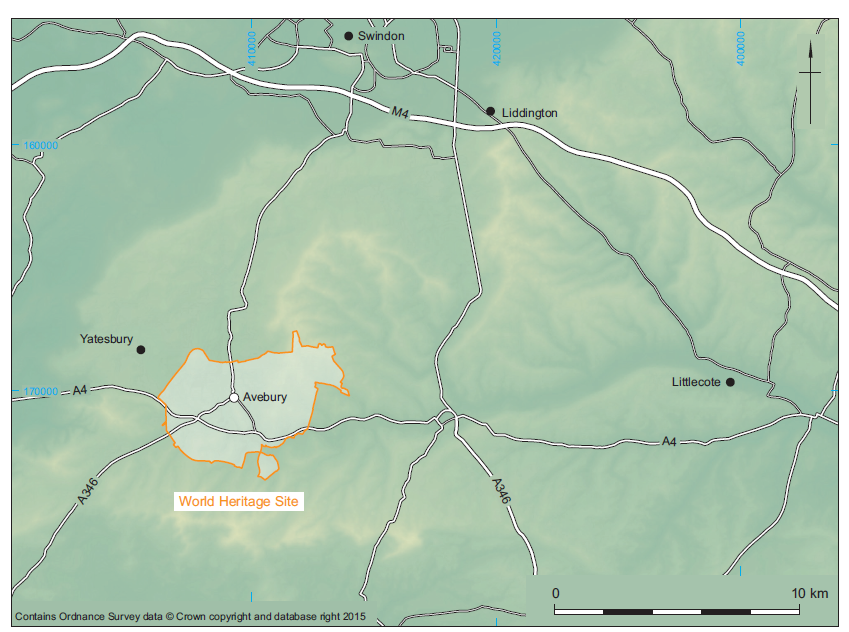
The late Anglo-Saxon timber fortification on the top of Silbury Hill is of considerable interest as studies of Anglo-Saxon civil defence have relied almost wholly upon the evidence from the major fortified sites listed in the Burghal Hidage of the early 10th century. Richard Atkinson’s discovery of postholes, associated with iron nails and a coin of Æthelred of ‘about 1010’, on the shelf of the upper terrace of the hill indicate a fortified site (Atkinson 1970, 313–14) suggesting that the name Silbury is best interpreted as OE sele-burh meaning ‘fortified structure or hall’. The presence of a Viking burial on the top of Silbury Hill has been suggested on the basis of the finding of human bones, including a skull, ‘deers horns’, an iron knife with a bone handle, two ‘brass bits of money’ and an iron horse-bit on the summit of the hill in 1723 (Stukeley 1743, 158). Stukeley’s draft manuscript for his 1743 Abury, however, describes the horse-bit as being found separately and seemingly on the slopes of the hill rather than the summit (Evison 1969, 335–6, note 9). The condition of the skeletal remains and the ‘deers horns’ is described as ‘excessively’ and ‘very’ rotten by Stukeley, and all of the finds, with the apparent exception of the horse-bit were made in the area of a ‘great hole’ sunk into the top of the hill in 1723. In other words, none of the finds need be associated with the human and animal bones, which may well be prehistoric to judge by their condition. The horse-bit itself is probably not of 9th- or 10th-century date as suggested by Vera Evison, but more likely an 11th- century piece (J. Graham-Campbell pers. comm.) associated with late Anglo-Saxon military activity on the summit of the hill.
Fieldwork at Yatesbury to the north-west of Avebury has suggested that the region was defended by a network of minor fortifications which relied on intervisible signal stations and military roads (Reynolds 1999, 92–4; 2000, 113–18). Viking activity in the vicinity of Avebury is recorded in Anglo-Saxon Chronicle entries for 1006 and 1010.
Archaeological evidence for late Anglo-Saxon settlement in the locality is notably sparse, although this is probably due to a lack of fieldwork rather than any other factor. The Pewsey Vale in particular possesses an impressive number of Anglo-Saxon land charters, largely of the 10th century, which indicate that the basic framework of the landscape in the Avebury region is a product of that period. The origins of the manorial system, viewed more clearly in the Domesday Survey a century later, lie in the 10th century during which time the medieval settlement pattern was largely fixed. Two substantial field projects, on Fyfield and Overton Downs to the east of Avebury and at Yatesbury to the west, provide important comparative data from which to assess the relative economies and status of nearby Anglo-Saxon and medieval settlements (Fowler 2000a; Reynolds in prep.).
Apart from existing settlements with medieval or earlier origins, there are also extensive traces of deserted or shrunken settlement in the region (for example Bupton, Richardson and Beversbrook to the west and Shaw to the east). Medieval archaeologists now view such sites as part of the continuum of human settlement and not as a phenomenon in their own right. Work on the individual settlements of the region has tended toward morphological analysis in recent years (Lewis 1994), although the deserted settlements of the broader western region have recently been reviewed (Aston 1989) along with aspects of medieval settlement in general (Aston and Lewis 1994). There are limitations with morphological approaches and it is clear from the archaeological record that settlements were subject, in many cases, to continual morphological change. There has been only limited work in the market towns. Jeremy Haslam’s 1984 review of Wiltshire’s Anglo-Saxon towns still provides the research agenda as little new data has become known, apart from that, for example, at Warminster and Wilton (Smith 1997; Andrews et al. 2000), although Wiltshire County Council are currently preparing a new assessment of the urban archaeological resource in the county.
The potential of the pre-Conquest charter evidence for landscape reconstruction has been clearly demonstrated (Hooke 1998; Costen 1994), although much remains to be done with this material and with the later cartographic and documentary sources. Of particular importance is the recon- struction of the agrarian landscape in both the early and middle Anglo-Saxon periods, prior to the establishment of open field systems in the region.
The precise chronology of the introduction of open fields in the broader Wessex region is a fundamental research issue, which requires extensive fieldwork if broader patterns are to be understood. The recent discoveries of buried stones along the line of the former Beckhampton Avenue highlights this aspect given that extensive traces of ridge and furrow were found underneath the modern ploughsoil over the area in which buried stones were found (Gillings et al. 2000, 3, fig. 1). If the Beckhampton stones were buried during the early 14th century (see above), then a late date is apparent for the ridge and furrow given that the field would be difficult to plough if the stones were still present. Open fields are generally considered to develop from the 10th century (Reynolds 1999, 155–6). The social and settlement organisation that their existence implies emphasises the importance of establishing chronologies, particularly when settlement evidence is sparse. Medieval strip-lynchets have been recorded in the Avebury area, recently at Waden Hill, Beckhampton and Compton Bassett, but one of the most extensive excavations undertaken on such field remains is close by at Horton (Powell et al. 1996, 65–6; Soffe 1993, 145; Reynolds 1994, 180–5; Wood and Whittington 1959).
In conclusion, the Anglo-Saxon and medieval archaeology of Avebury and its environs is complex and varied, but also of a high quality and with significant potential for addressing national research questions in addition to local and regional issues. The potential to examine long-term trends in the development of settlement at Avebury from the post- Roman period through to the end of the middle ages and beyond makes the medieval archaeology of Avebury very special indeed.
by David Hinton
The previous ‘Resource Assessment’ (above), ‘Resource Strategies’ and ‘Research Strategies’ for this period were written by Andrew Reynolds (2001, 28–34; 52–4; 69–70), who has subsequently published or jointly published a number of relevant books and papers, notably on the administrative arrangements of the Avebury region in general (Reynolds 2005), and on fieldwork and monuments within the WHS specifically (Pollard and Reynolds 2002). There are interim reports and discussion papers both in print and in press, but not yet the full report, on the Yatesbury project. Other contributions include Gillings and Pollard (2004) and Gillings et al. (2008) on Beckhampton Avenue and the post-prehistoric treatment of the standing stones. The general discussion of the research framework appropriate for the south-west of England, which includes Wiltshire, does not make more than passing reference to Avebury in the medieval period (Webster 2008).
Relevant contributions by other scholars include Simon Draper’s on Roman and post-Roman Wiltshire (2006; 2011b), and fieldwork on the Downs has been published (eg, Fowler 2000a; McOmish et al. 2002). The late Anglo-Saxon use of Silbury Hill has been published (Crosby et al. 2013); and there has been much discussion of the East Wansdyke, with a variety of possible dates and reasons for it now under review, two of which would see it within the mid-Anglo-Saxon period (Draper 2006, 60; Reynolds and Langlands 2006), but others not abandoning the traditional immediately post- Roman period (Fowler 2011, 141). Furthermore, less reluctance to consider ‘superstitions’ in the Middle Ages (eg, Gilchrist 2008) permits further reconsideration of some of the behaviour witnessed at Avebury by such discoveries as the ‘barber-surgeon’ burial.
Since 2001, the Wiltshire Historic Environment Record records only minor archaeological evaluation work in Avebury parish as having produced medieval evidence – a sherd at the United Reformed Chapel, three sherds in South Street, Avebury Trusloe. Not in the Record, however, are two coins and an enamelled brooch which the database of the Portable Antiquities Scheme (http://finds.org.uk/ accessed June 2011) lists as found in the parish. Recent fieldwork, therefore, has not tested Reynolds’s hypotheses (2001), in particular that a settlement with an elliptical plan- form partly underlies a rectangular defensible burh with tenement plots that are evidence of a ‘failed town’.
Reynolds postulated an ellipse on the basis of parallels with other places in Wiltshire and beyond, and on the existence of earthworks west of the present village, between it and the River Kennet. There are three distinct earthworks in that area, the largest being the most northerly, now roughly a semi-circle. If that extended eastwards, taking in the sites of the present church and manor house, what is now the east–west village street would lie well to its south. At Ramsbury, the obvious parallel, the equivalent street forms the southern edge of the postulated ellipse. If that had been the case at Avebury, what is now a back lane would have been the original route, and the line of a documented here-path. The case for that is supported by the way that routes approaching from the west focus on a river crossing at the lane’s west end (and not on the suggested line of Beckhampton Avenue). Against it is that one of the two middle Anglo-Saxon sites known would be outside it, and the other, the ‘School site’ and the west entrance into the henge, would only be within it if it was not elliptical at its east end. In that case, the present ‘main’ street would result from replanning.
If an earlier plan is to be sought, another possibility would be to take the second of the western earthworks, the central one, and project that along the ‘back lane’ and the ‘main street’. Any such enclosure would exclude the church, manor house and the School site, but in using the two lanes as its boundaries would be more like Ramsbury. The most southerly earthwork is different again, as it is right- angled; it seems to extend into the croft of the most westerly of the house plots south of the street, so is likely to predate it. Unfortunately, that is the only stratigraphical evidence that can be cited. Until any and all of these earthworks are dated, the ‘ellipse’ cannot be taken as established.
Avebury Church has late Anglo-Saxon structural elements, but the existence of an earlier church is argued for in the 2001 Agenda, on the basis that a carved stone built into one of the corners is likely to be part of an originally free-standing cross-shaft, or a coffin, subsequently ascribed to the 9th or 10th century by Rosemary Cramp (2006, 200–1); it was argued that such an important work would not have been on its own, or in a cemetery without an attached church. An earlier church building, perhaps in timber, may well have predated the present masonry structure, but whether it was on the same site remains to be established, though in the normal course of events it is more likely than not. That it was a ‘minster’ by the time of the Norman Conquest seems very likely, as Rainbold the priest held two hides in Avebury and the church is relatively large, though it is not such a strong case as to have deserved discussion by Blair (2005). That need not mean that an early and regionally important church was placed alongside the henge to ‘christianise’ the stones (this was not proposed by Reynolds, but has been proffered elsewhere: Gillings et al. 2008, 286–7 for a critical review); it looks much less exceptional when seen in relation to the other churches strung out along the Kennet Valley west of Marlborough, which reflect stream-side settlement patterns.
The precise date, status or location of Avebury’s first church may never be established; equally, it is not certain that there was an Anglo-Saxon manorial centre on the site of the present manor house. Although close to the church, it is not as directly adjacent as is often the case. Alfred of Marlborough had a Kennet estate in 1086, which may have included land in Avebury that came to be used in 1114 for the foundation of an alien priory; but only in 1294 is there mention of a house, and the identification of medieval structure within the present manor house shows where that was located (Freeman 1983, 91–2). Even if Alfred of Marlborough had some sort of manorial centre in Avebury, however, that Anglo-Saxon/early Norman predecessor might not have been on the same site; recent work at Bishopstone, Sussex, has shown that what is likely to have been a manorial complex was abandoned in the 11th century, probably for a new location on the opposite side of the church (Thomas 2010). Early medieval settlements were more fluid than used to be thought.
The 11th-century Rainbold the priest presumably had a base in Avebury from which to run the two hides credited to him by Domesday Book. His holding became Cirencester Abbey’s ‘rectory estate’, and its house in 1307 was near the church, the evidence for that being a rigmarole about creating an access path (Freeman 1983, 95). Stukeley’s ‘plot’ shows a house immediately east of the church with a tree-lined avenue leading to it, suggesting something more than an ordinary farm. Was it the older of the two centres? Even if it were, it would not fall comfortably within either possible ‘ellipse’.
Reynolds argued that the middle Anglo-Saxon elliptical settlement was replaced by a fortified late Anglo-Saxon rectilinear burh enclosed by a bank and ditch. The defensible capability of any such enclosure is open to question, however. Pollard and Reynolds published a 1985 photograph of a section through the south side of the bank and ditch, noting that it is ‘not exactly massive’ (2002, 206–9). Indeed, a ditch no more than 1.5 m deep is directly comparable to excavated ditches between tofts and village streets elsewhere (Astill 1988, 51–3; few excavations have examined the boundaries between croft ends and fields), a barrier against hungry beasts rather than ravenous vikings. Draper (2006, 76; 2011, 99–103) has pointed out that -bury place-name suffixes are as often applied to manorial enclosures, with or without an associated ‘minster’, as to defended settlements (see also Rippon 2011, 46–50 for other examples of mid-Saxon manorial complexes). Furthermore, serious replanning would surely have included a refocusing of the routes on the west side of the Kennet, so that they entered the burh at the west end of the main street. Instead, they seem to have stayed where they were.
The interesting case for a ‘failed town’ was made largely on the basis of the very regular tenements on the south side of the east-west ‘main’ street. Aston and Gerrard’s work at Shapwick (Gerrard with Aston 2007), however, suggests an alternative, that this is a planned village, perhaps an extension to a late Saxon core round the church. Such replanning could have been coeval with the introduction of open fields to the area, a much-debated current topic which is considered in a different context in the 2001 Agenda. Gillings and Pollard suggest that similar regular tenements were established within the stone circle. This could represent expansion or be part of the same planning process; in either case, post-Conquest estate management by the alien priory might be responsible.
It may never be possible to find convincing new evidence about medieval attitudes to the henge and its stones, but the very detailed review of the evidence about their burial and other forms of destruction by Gillings et al. shows that their treatment varied and that no pattern of deliberate extermination can be seen (2008, 232–363). They also point out that the first documentary mention of the stones, in the 1307 concord about the path from the church, merely calls them magnas petras veteres, ‘big old stones’, implying that they were viewed as no more than landmarks, not something redolent of superstitious fears. The villager who was referred to as John de la Stone presumably had no concern about his identifier. The burial of the ‘barber-surgeon’ – who may have been a tailor or a shepherd (Gillings et al. 2008, 276–7) – is no longer seen as resulting from an unfortunate accident to someone who was helping to lower the stone when it fell and trapped him, leaving the locals too frightened of the stone’s malice to free its unhappy victim, but as the deliberate concealment of a murder.
Reynolds’s point that the stones would have been a hindrance to arable and the development of open fields is valid, and some indeed seem to have been removed to clear the way for the plough. Others probably served as boundary markers (Gillings et al. 2008, 276–84). The post-Conquest pottery sherds found are indicative of manuring, their variation in distribution and size reflecting differential cultivation within the henge interior (ibid., 277).
The newly excavated Beckhampton Avenue stone, its ‘ugly’ side down and a cow-bone, radiocarbon- dated to the 12th/13th centuries, pushed into a natural hole in it, seems to require some other explanation, possibly to do with superstitious practices about passing babies through such holes, to heal them. Someone may have taken exception to some rural practice of this sort, and determined to prevent it, leaving the cow-bone as a mockery … or to bless the land … but as there is no certainty that the hole was visible when the stone was upright, it is unprofitable to speculate (Gillings et al. 2008, 278–9). Reynolds’s reluctance to see any religious antipathy to the stones, or all would have been destroyed, is certainly hard to counter.
Another murder was responsible for the first mention of the henge, for John the spinner met his death at the waledic in 1289. In 2001, Reynolds translated this as ‘ditch of the Britons’, from OE weala, but subsequently discussed the more prosaic alternative that it is simply ‘wall-ditch’ (Pollard and Reynolds 2002, 203–4). The ‘e’ could point to the weala origin, but at such a late date is far from conclusive, and it would run counter to the general southern English practice of naming earthworks after people, gods or the devil (the 1304 document has ‘waldich’, which does not help further; one might note that the ‘barber-surgeon’ had three coins with him which post-date 1289, otherwise the document and the archaeology would almost certainly have been claimed as an example of the two sorts of evidence confirming each other – if he were indeed a tailor, and John was really a spinner, Avebury was a particularly dangerous place for textile workers!).
There is little comment to be added to Reynolds’s 2001 statement. The 11th-century evidence on Silbury Hill is remarkable; presumably it acted as a ready-made watchtower from which to observe the road, and perhaps to be a beacon site. Recognition that the mound at Marlborough is a prehistoric construction does not preclude similar late Saxon use, with the difference that it subsequently became part of a royal castle. It will be interesting to see if it can be used to revise sightlines suggested for the area.
Expansion of settlement and continued intensification of agriculture is not very different in the WHS area from any other, and it also has its share of deserted and shrunken later medieval sites.
by Joshua Pollard
Consideration of the post-medieval period was omitted from the original Archaeological Research Agenda for the Avebury World Heritage Site published in 2001 (Chadburn and Pomeroy-Kellinger 2001), and indeed its archaeology is often not reviewed in synthetic accounts of the region (eg, Pollard and Reynolds 2002; Brown et al. 2005). There are exceptions (eg, Burl 1979; Ucko et al. 1991; Gillings and Pollard 2004), although when dealing with the last five centuries these focus as much on documentary sources as archaeological. Academic interest in post-medieval (or ‘historical’ to borrow North American terminology) and recent and contemporary archaeology has flourished over the last two decades (eg, Hicks and Beaudry 2006; Tarlow and West 1999), but its potential is yet to be realised in the context of the WHS. This may seem rather perverse given the wealth of the material record – the ubiquity of buildings, landscape features and material culture – from the period under consideration; yet it is perhaps its omnipresence and the archaeological tendency to focus on the prehistoric (which has, after all, given the region its pre-eminent status) which has led to its being ignored. Recognising this gap in research potential, in his preface to the recent Avebury Landscape volume Fowler stressed the need to engage with ‘landscape issues of the modern period’ [his emphasis], and defined a four-fold and thematic chronology of the ‘mid-16th to early 18th century (post-Dissolution), mid-18th to early 19th century (Enclosure), 19th to mid-20th century (‘industrial- isation’), and mid-20th century – present (‘com- modification’)’ (Fowler 2005, xvi). Other schemes could be adopted, even ones that take a disciplinary frame of reference (pre- and post-antiquarian encounter, for example), but they do highlight a number of research strands such as social, economic and religious change, the working and inhabitation of the landscape, and material entanglement, that run through the thematic sections adopted here. At one level, the area comprises a fairly unremarkable piece of rural southern England; but because of the early recognition of the importance of its prehistoric archaeology, and the varying responses this engendered, it has developed a very peculiar character of its own.
Here, the focus is upon the material record of human activity from 1500 to 1950; though only passing reference will be made to historic standing buildings. The WHS boundaries incorporate the medieval and later parishes of Avebury (including the tithings of Beckhampton and West Kennett), East Kennett, Winterbourne Monkton and Overton (including the tithing of West Overton). Historical background is provided by a number of sources, principally Crowley 1983, Fowler and Blackwell 1998, Chandler 2001, Edwards 2003 and Parslew 2004; and these are drawn upon to provide context. That this is a short section does not reflect the wealth of known or potential archaeological evidence for the period, rather its poor realisation. To date, there has been only limited archaeological interest in the post-medieval archaeology of the Avebury component of the WHS (contrast with that of Stonehenge; Darvill 2005), and where encountered through mostly development-led fieldwork its reporting has been minimal, if undertaken at all. An exception, which hints at the research potential of the region, is provided by Fowler’s archaeological and historical landscape study of Fyfield and Overton Downs (‘Fyfod’) in the eastern part of the WHS (Fowler 2000a).
Resources include published and unpublished fieldwork reports, artefact assemblages, environ- mental remains, earthworks, sub-soil features and deposits, landscape features such as roads/tracks and hedgelines, and standing structures. Early maps (estate, county and Ordnance Survey) and drawings, along with other documentary material, provide a rich source of information on the development of settlements, changing patterns of road com- munication and landscape organisation (for early estate and enclosure maps of Avebury see Ucko et al. 1991; for Fyfield and West Overton see Fowler 2000a, 39–41). Another important, if currently little utilised, source of information comes from early antiquarian records, particularly those made by William Stukeley between 1719 and 1724. As well as producing rich visual documentation of ancient monuments, Stukeley faithfully recorded the contemporary surrounding landscape in which sites occurred; perhaps in order to provide points of geographic reference in an age before the availability of detailed maps. His records of Avebury in particular show houses, barns, plots and even the locations of orchards and stands of trees with a level of hobbyist accuracy (cf. Stukeley 1743, frontispiece; Ucko et al. 1991). It has even proved possible to translate this record onto a modern map base (Gillings and Pollard 2004, fig. 15). The background detail preserved in Stukeley’s drawings of the megalithic complex (eg, Gillings et al. 2008, figs 12.1–12.8) can similarly be used to reconstruct the wider early 18th-century landscape, especially when combined with data obtained through fieldwork. Such an exercise has already been undertaken for the area to the west of Avebury (ibid., fig. 12.9).
Other antiquarian/early archaeological mapping exercises are equally useful. Colt Hoare’s 1821 plan of the Avebury complex, prepared by Philip Crocker (Colt Hoare 1821, pl. X), gives excellent detail of not just archaeological features, but of contemporary roads, the settlements of Avebury, South Street, West Kennett and part of Beckhampton; while A. C. Smith’s admittedly schematic maps of the area include field names and show areas where sarsen spreads remained during the later 19th century (Smith 1885).Aerial survey has made a major contribution on a landscape scale, through both transcription of photographs and more recently lidar. An example is the plotting of the incidence of ridge and furrow cultivation and valley-bottom watermeadow systems in the eastern part of the WHS by English Heritage for the ‘Fyfod’ project (Fowler 2000a, figs 2.3 and 15.3).
The structure of settlement in the area was established during the medieval period (Fig. 21), in the case of Avebury being shaped by monastic holdings that included three manor houses and associated premises (including the alien priory in the hands of the abbey of St Georges de Boscherville that was to become Avebury Manor). This had generated a complex pattern that included more than one focus: the main village stretching along the High Street/Green Street axis within and outside the henge; several early post-medieval cottages along Frog Lane and out along South Street (probably part of a shrunken medieval settlement); and around and to the north-west of Truslowe Manor. Other smaller settlements were present at Beckhampton, West Kennett, East Kennett and West Overton (Fig. 22). In the case of Avebury significant 19th-century infill occurred along roads such as Green Street, though more systematic development in the second half of the century was prevented through purchase of land by John Lubbock (later Lord Avebury). Also reflecting growing concerns over the impact of expanding settlement on the prehistoric complex, Avebury Trusloe became more populous and nucleated from the 1930s with the relocation of families from the Avebury henge to a new estate here in advance of Keiller’s restoration of the monument. The process of piecemeal demolition of structures within the henge and relocation of residents was to be continued by the National Trust after the War.
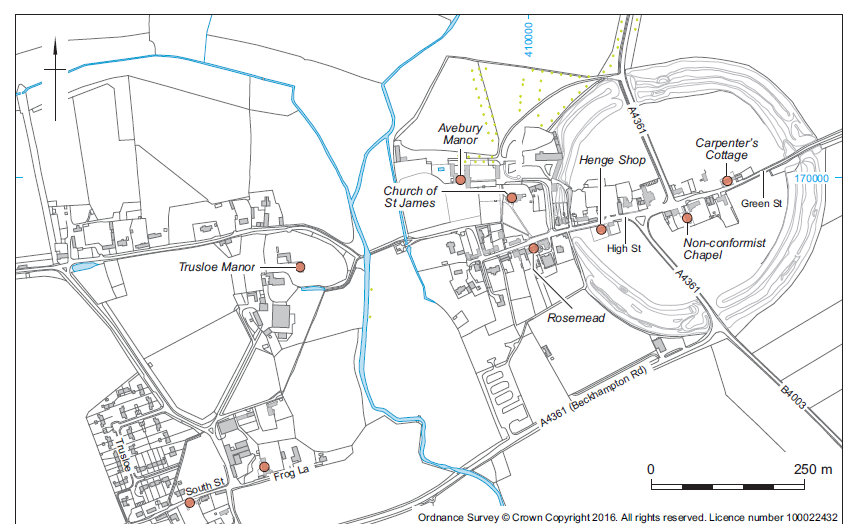
A good number of early post-medieval buildings survive within Avebury and other parts of the WHS. Of note are the complexes at West Kennett Farm and Avebury Manor. The former includes a substantial farmhouse of the 17th century and later, ranges of 18th- and 19th-century barns around a courtyard (part of which contained the former Kennet brewery), a dovecote and cartshed. Avebury Manor (Pl. 35) developed from the alien priory. The manor itself is mid–late 16th century with 17th century and later additions. Contemporary are a dovecote, the Great Barn and early 18th-century components such as the stables now converted to house the Alexander Keiller Museum. A recent survey of the Manor complex by English Heritage (McOmish et al. 2005) has shown that while medieval and possible Anglo-Saxon earthwork traces are present, much of the visible complex is post-1600. Visible/surviving features include an 18th-century pond, drive, tracks and surviving tree-lined avenues; much of the work having been undertaken by Sir Richard Holford in the early 18th century. The gardens still preserve much of the ‘room’ format established by the Dunches during the late 16th and early 17th century (Mowl 2004, 14–7).
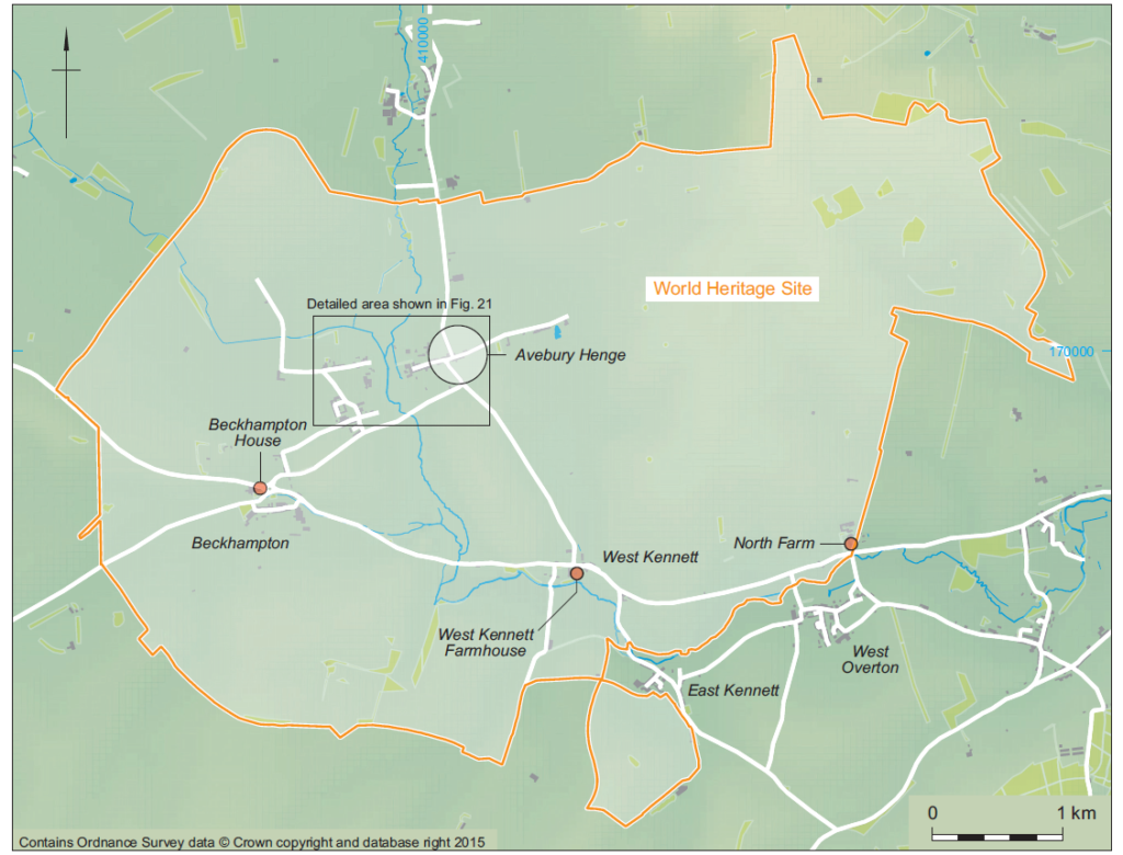
As much as can be determined, early (pre-1650) vernacular building was in timber-frame (eg, Carpenter’s Cottage, Avebury). Sarsen and brick became favoured materials from the late 17th century, and there are also surviving examples of cob construction such as barns at North Farm, West Overton. The development of technologies to split sarsen, first by fire-setting, later by cold splitting, led to its wide-spread adoption as a building material, not just for houses, but also ancillary buildings, walls and paving. Numerous styles of sarsen building are evident.
There has been only limited excavation within areas of post-medieval settlement. Keiller’s work at Avebury recorded building foundations against the High Street in the SW sector of the henge, along with property walls and ditches first established during the medieval period (information from Alexander Keiller Museum). Development-led excavations during 1982 at the rear of the Avebury ‘Gift’ shop (now the ‘Henge’ shop) and ‘Rosemead’ on the High Street revealed an expected range of small pits, gullies, building extensions and a brick-lined well (Harrington and Denham 1986). Work around the non-conformist chapel at Avebury has produced traces of mostly late (19th century) surfaces, structures and a pit (Anon. 1991b; 2003). 18th- to early 20th-century refuse deposits were encountered against the stones of the Cove during reinstatement work in 2003, along with wall footings and small pits (Gillings et al. 2008). Some at least of the refuse had accumulated in the backspace between the rear of the original Rawlins’ garage and the Cove. In each instance the scale of excavation was limited, but enough to establish the recurrent presence of post-medieval features and deposits in the spaces behind properties.
An economy of sheep (wool) and corn was prevalent on the chalk of the Upper Kennet Valley during the late medieval and early post-medieval periods (Smith 2005). Open fields were cultivated on the valley floor and sheep grazed on the downland. This pattern is neatly depicted in the background of Stukeley’s field drawings of the Avebury monuments which show very extensive open field cultivation across low ground to the west and south of Avebury (the West and East fields), and open downland beyond, dotted with what appear to be hedged square and rectangular sheep pens (cf. Stukeley 1743; Gillings et al. 2008, figs. 12.1–12.8). Such earthwork sheep enclosures – pennings – were constructed and used into the early post-medieval period but were redundant by the mid-19th century. They occur in numbers across the Marlborough Downs, examples surviving on Horton Down, Avebury Down and Hackpen (Smith 2005). The large square earthwork of the Delling enclosure, on the high down of West Overton parish, may have served as an animal enclosure, though intimately linked to a farmstead. Limited excavation here in the early 1960s revealed traces of a house in one corner with an associated midden containing 16th- to 17th- century ceramics (Fowler 2000a, 128–31).
Plant macrofossil and faunal evidence, as limited as it is, provides more detail. The most intensively studied assemblages come from the excavation of stone destruction pits of 16th- to 18th-century date at Falkner’s Circle and along the Beckhampton Avenue. Faunal remains from the early 18th-century Beckhampton pits are dominated by sheep and cattle, with much smaller numbers of horse, pig and dog (Coward and Gouldwell 2008, 319). Oak, ash roundwood, maple, elm and willow/poplar charcoal represent the range of wood fuel used in the stone burning process on the Beckhampton Avenue, with the presence of relatively fast-growing roundwood indicating coppice probably from managed woodland (Gale 2008, 323–4). The Falkner’s Circle charcoal includes a rather different range of wood species, being dominated by small oak roundwood and a limited amount of cherry, yew, hazel, hawthorn and ash (Young 2008, 324–5). What is not known is the distance from which wood might be procured. Fuel debris from Beckhampton also included much burnt straw, grain, and peas/beans, the latter almost certainly accidentally incorporated remnants of crop.
Grains of six-row barley, intrusive in stone-hole fills, and radiocarbon dated to AD 1480–1660, were recovered from excavations at the Cove in Avebury (Gillings et al. 2008).
Enclosure came in the late 18th century (of Avebury and Beckhampton in 1795); more or less contemporary with a shift from sheep wool to meat production, and so different grazing regimes (Smith 2005). The requirement to provide early grass for sheep and hay for over winter led to the establishment of floated water meadows in the Kennet Valley floor. Extensive remnants of water meadow systems survive to the west of Avebury against the Winterbourne, and along the Kennet to the east of Overton Hill and at West Overton (Fowler 2000a, fig. 15.3). Survey of the latter suggests more than one phase to the earthwork channels (Anon. 2001, 253). Downland dew ponds are another water management technology widely utilised during the 19th and early 20th century for watering ‘grass sheep’ kept on the downs throughout the year and fattened for meat (Smith 2005). There are, however, good indications that some ponds may have a much greater antiquity, being first created during the Late Bronze Age (Gingell 1992).
The period under consideration saw various episodes of landowner sponsored ‘improvement’ of estates and farmland. Cannon suggests that both aesthetic sentiment and antiquarian interest during the later 18th and 19th centuries lay behind the planting of copses of trees on barrows, as on Overton Hill and the East Kennet long barrow. Providing game cover for hunting, these transformations could be seen as improving and evoking the past (Cannon 2005, 209).
Agricultural improvement involved progressive clearance of extensive spreads of sarsen stone within valley bottoms. There is little information on how this was enacted on arable land prior to the 19th century, but through excavation and contemporary accounts the details of stone removal are well documented in the case of megaliths making up the Neolithic monument complex (Smith 1965b; Gillings et al. 2008). From the 14th to the later 17th centuries obstructing megaliths of the Avebury henge and West Kennet and Beckhampton Avenues were toppled and carefully buried in bespoke pits. Contrary to earlier interpretations, there is no evidence that such clearance was Church sponsored. By the late 17th century demand for sarsen as a building material led to the adoption of fire-setting and breaking as a preferred technique. In the case of Avebury and its avenues, the main period of stone breaking came in the last quarter of the 17th century and first quarter of the 18th century; though radiocarbon evidence indicates the use of fire-setting at Falkner’s Circle to the south of Avebury somewhere between the early
15th to mid-17th century (Gillings et al. 2008, 336). The main phase of landscape clearance came between 1850 and 1939, led by Edward Free and family in response to demand for stone for kerbs and tram setts in Swindon and elsewhere (King 1968). During this period sarsen blocks were split using steel wedges, the blocks being ‘quartered’ into manageable sized lumps that could be removed and further worked down elsewhere. A number of partially split blocks remain on the downs in the eastern part of the WHS (see Fowler 2000a, pl. IV).
Since prehistory the area has been traversed by an important east–west routeway, defined during this period as the London–Bath coach road (the current A4). Prior to improvement and formalisation with the 1742/3 turnpike, the main east–west route comprised a braided road network that ran over Manton, Overton and Avebury Downs, along Green Street through the east entrance of the Avebury henge, and exiting through the southern entrance towards Beckhampton, in places then following the Roman road. Traces of the coach road still survive as a network of hollow-ways on the downs to the east of Avebury (Fowler 2000a, 22; pl. VI). Of other communication routes, those running north–south from Swindon, through Avebury, then to Devizes (the current A4361) and into the Vale of Pewsey became turnpike roads in 1767 and 1840 respectively (Chandler 2001, 89). The present-day Ridgeway (Pl. 36) is best understood as one of a series of mainly north–south downland droveways cutting across the Marlborough Downs that were utilised during this period for the controlled movement of sheep (Fowler 2000a, 256). Other downland paths and fieldways in active use during the post-medieval period are preserved as contemporary trackways; while redundant routes can occasionally be detected through geophysical survey, as with the north–south fieldway at Beckhampton (Gillings et al. 2008, figs 2.76–7).
Of the infrastructure associated with major communication routes, there exists a series of mid- 18th-century milestones in colour-washed sarsen with painted legends to the north, east, south and west of the present Beckhampton roundabout. During the early decades of the 20th century garages were established in Avebury and on the A4 to the west of Silbury Hill. The site of the original Rawlins garage adjacent to the Cove in Avebury was cleared as part of pre-War improvements to the monument and remains open. Its Deco-inspired successor, located outside the north entrance, has since been lost to redevelopment.
The period covered here incorporates the Dissolution, the formation of the Church of England and the rise of non-conformism. As elsewhere, the English Reformation will have led to changes to the fabric of St James’s Church at Avebury, though these remain to be investigated in detail. The churchyard contains a range of later 18th–20th-century tombstones that would also repay examination (Mytum 2000). Avebury itself witnessed an influx of non-conformists during the later 17th century as a result of the 1665 Five Mile Act; and it was members of the non-conformist congregation who led the process of stone breaking during the late 17th and early 18th centuries. Their chapel, in sarsen and brick of c. 1707 with early 19th century additions survives on Green Street.
Physical traces of more profane practices are present, such as the site of the village maypole excavated in the area of the Southern Inner Circle at Avebury during 1939 (Smith 1965b). An important annual sheep fair was relocated from Tan Hill to a spot adjacent to another prehistoric monument, Silbury Hill, in 1932 (Smith 2005, 196). Reflecting its landscape prominence and roadside position, Silbury also provided the focus for a number of gatherings and sporting events during the 19th century. The breeding and training of racehorses has been a feature of the region over the last two centuries. Early stables and gallops are still in use at Beckhampton, and former gallops are visible as runs of marker stones and carefully levelled strips of ground on the Marlborough Downs (Fowler 2000a, 253).
Selective recovery and partial reporting affects our knowledge of material culture consumption (acquisition, use and discard) in the WHS during this period. Those assemblages that have been reported, principally from Avebury, display a range of ceramic and glass types that would be expected from a reasonably prosperous large rural settlement. Excavations at the rear of two post-medieval buildings in Avebury – the ‘Henge’ shop and Rosemead – produced 17th-century and later stoneware bottles and tankards, coarseware iron- and lead-glaze pancheons, along with mocha and transfer- printed wares (Harrington and Denham 1986). More distant imports comprise sherds from several early 18th-century Westerwald tankards from Keiller’s excavations adjacent to the High Street in 1938. Though not fully reported, there is a reasonably large assemblage of 17th–19th-century ceramics, glass, clay pipe and coins excavated in the paddock immediately across the Calne road from Beckhampton House (Gillings et al. 2008, 113). In part this may have been generated by activities at the building during its various uses as an inn (The Catharine Wheel), then meeting place of the political ‘Beckhampton Club’ in the early 19th century, and finally racing stables (Parslew 2004, 38).
The most thoroughly reported post-medieval finds assemblages derive from the excavation of stone destruction pits within the henge and along the Beckhampton Avenue (Smith 1965b; Gillings et al. 2008). Keiller’s excavations at Avebury produced a substantial number of clay pipes, mostly spanning the period 1660–1710 and produced by Marlborough makers, which appear to have a strong contextual and chronological link to the process of stone-breaking (Gillings et al. 2008, 300–2). Material from the fills of the Beckhampton Avenue stone-breaking pits includes items that might again be related to the process of fire-setting and reducing megaliths (such as clay pipes, and ironwork such as nails and roves from timbers), to incidentally lost dress fittings (copper alloy buttons and a spur), and things that might have been introduced to the field through manuring (sheet and bottle glass and ceramics). Here, the small ceramic assemblage is dominated by Verwood-type earthenwares, but with lesser quantities of slipwares (Bristol or Staffordshire) and Rhenish stonewares; with later stonewares, pearlwares and industrial white wares as topsoil finds. That the process of stone- breaking could generate its own material culture is illustrated by the find of a unique hooked iron implement recovered from a pile of broken sarsens outside the southern entrance of the henge (Smith 1965b). Contemporary depictions by Stukeley of megaliths being fire-set show labourers holding hafted versions of this implement, which was probably used for raking out burning straw (Gillings et al. 2008, fig. 10.1).
By the late 1930s archaeology was rapidly recon- figuring parts of the landscape – sites were being excavated and reinstated, housing shifted to accommodate restoration of the prehistoric monument complex, and facilities created for growing numbers of tourists. Needless to say, this all produced a distinct set of material signatures that are now becoming both heritage in their own right and important physical records of the development of an academic discipline. Traces take two forms: the modifications made to monuments through excavation; and the modifications made to monuments in their reconstruction and presentation. While often characterised as ‘damage’, re-excavated antiquarian trenches such as those at Silbury Hill, the Avebury Cove and various round barrows on Overton Hill provide an important resource detailing emerging investigative practices linked to a development of understanding of monument sequence, morphology and deposit content. In the case of monument reinstatements, those at the Sanctuary (Pl. 37) (1930), Avebury henge, West Kennet Avenue and Windmill Hill (1934–9) provide records of quite innovative responses – permanent marking of timber post positions in concrete in the case of the Sanctuary, redefinition of earthworks at Windmill Hill (ultimately unsuccessful), and full-blown reconstruction in the case of Avebury and the West Kennet Avenue. There is a need to shift disciplinary histories away from those that are histories of ideas to ones that take account of field practices, their material dimensions, the physical encounter with the past and its imagination as realised through presentation to the public. The Avebury WHS is exceptionally well placed to do this.
by Bob Davis, Anne Upson and Rosamund J. Cleal
In contrast to the considerable body of past investigation and recording of the important prehistoric landscape, previous study of the extant built heritage of the area has been modest. However, even some early visitors to the area, such as Stukeley, although initially drawn by the prehistoric monuments, were also aware of some of the buildings of the area, evidenced by his sketch of the gabled front of Avebury Manor of 1723 and by his many detailed drawings and plans, including highly detailed and apparently accurate representations of the village, which include ‘birds eye’ views of many of the houses, other buildings and infrastructure such as roads and tracks (see Ucko et al. 1991 for a study including many previously unpublished views).
It is only in recent decades that the study of the vernacular built heritage has been given the importance that it deserves. Even the iconic Buildings of England series is subject to the criticism that the first editions of its county volumes focused disproportionately on the churches and higher status buildings of each settlement, while confining mention of the local vernacular buildings to a general passage resulting from a ‘Perambulation’. In the edition of 1975 the only houses described in Avebury parish are Avebury and Trusloe Manors, West Kennett House, and Bannings and Westbrook farmhouses; only Avebury Manor is described at any length (Pevsner, revised Cherry 1975, 96–103, 564).
Due to its considerable national and international importance, the archaeological resource of the prehistoric to medieval periods within the WHS has been investigated and surveyed in detail, while the less significant remains of its post-medieval and modern past have not been subject of any comprehensive study. Conservation Area Statements prepared for Avebury and West Kennett Conservation Areas in 2003 provide the most comprehensive analysis of the surviving built heritage of the area to date.
This heritage-rich and relatively unspoilt part of rural Wiltshire is well-represented on the List of Buildings of Special Architectural or Historic Interest. The designated area contains a total of 82 Listed buildings, only four of which are listed at above Grade II. The higher grade buildings are all situated at the heart of the village of Avebury and comprise:
A total of 14 of the 82 Listed buildings are associated with Avebury Manor, and include the house, former stables, racquets court, garden walls, gates and statuary. Other built heritage ‘types’ well represented in the group of Listed buildings are farmhouses (6), other farm buildings (6), cottages (14), milestones (5) and boundary walls, gates and railings (18).
The vast majority of the Listed buildings are situated within one of the nucleated settlements; the notable exceptions being a series of milestones along the A4 and A361, and Down Barn Cottage in an isolated location on Overton Down. The village of Avebury has a total of 44 Listed buildings, Avebury Trusloe has nine, and Beckhampton and West Kennett have eight each.
The Avebury area of the WHS also contains two Conservation Areas: the settlements of Avebury and West Kennett, both of which were designated in 1975 (Fig. 24).
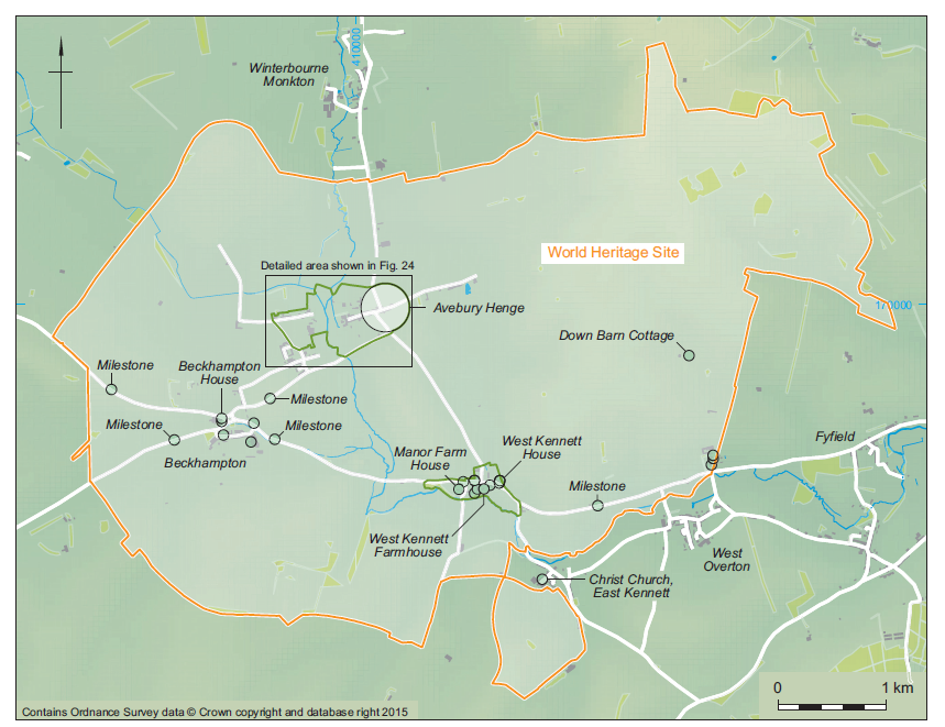

The Avebury Conservation Area includes the prehistoric circle, the entire village centre and lands to north and south, and extends westwards over the line of the River Kennet to include the northern part of Avebury Trusloe, including Trusloe Manor and the buildings along Bray Street. It also extends south to include Chapel Cottages on the edge of the later settlement core (Fig. 23).
The West Kennett Conservation Area includes Manor Farm and West Kennett Farm to the south of the A4, and West Kennett House and all other developed sites to the north of the main road (Fig. 24).
Both settlements contain a varied mix of architectural styles and materials, reflecting the range of locally available materials, and the utilisation of imported materials in later buildings. Conservation Area Statements have been prepared for both of these areas, and provide a good level of information about the development of the built heritage, locally distinctive materials, and their deployment in different periods.
The settlement pattern within the WHS is characterised by a small number of villages located in the Winterbourne and Kennet River valleys, and a few isolated farmsteads. The villages are traditionally of nucleated form, though in some cases this has been affected by later ribbon development along major routes.
The pattern of settlement has generally been dictated by the need for water and only the village of Avebury itself appears to have been sited deliberately in close association with the prehistoric monument. Even then, the village is also close to the Winterbourne which flows from north to south to the west of the village.
The vernacular built heritage resource is dominated by dwellings and farm buildings constructed from a variety of readily available and local materials. These predominantly include timber framing, sarsen and limestone, while flint, chalk and cob were also traditionally used. Lime has been the traditional bonding material and this has also added a distinctive character to the appearance of the area.
One of the most notable features of the built heritage of the area is the known use of components of the prehistoric stone circle and avenues to provide vernacular building materials. The process was well known, with some local families specialising in stone- breaking, which was also carried out by farmers. The tradition was described by Stukeley, with reference to specific local families, and demonstrates that this activity was carried out over a number of centuries up to and including the 18th century. This provides one of the most tangible links between the prehistoric monuments of the area and the built heritage (see Gillings et al. 2008 for a fuller description of stone breaking).
Traditional roofing was again generally typical of the southern region, with simple steep pitched roofs covered in thatch; in this case long straw wheat. Many examples of the traditional thatched roof (Pl. 40) covering still exist within the WHS, but examples of the modern vernacular, dating to the 18th, 19th and 20th centuries demonstrate the availability of a greater range of materials such as plain tile and slate, giving the roofscapes of the various villages their existing diverse appearance. Traditional windows and doors are also typical of the southern region with mainly small timber framed casements used.
Surviving historic farm buildings contain timber framing of both oak and elm and are also built to regional plan types such as rectangular threshing barns, cart sheds and stables. However, no extensive survey has been made of the plan form and layout of farm complexes within the WHS. Farm buildings in the area reflect the many agricultural improvements imposed by government and fashion and show the characteristic expansion of farm yards and buildings required to keep pace with the needs of agriculture. Together with surviving examples of traditional farm buildings, there are numerous examples of more modern and functional buildings alongside. There is also a predominance of modern external cladding to barns (Pl. 41) and this includes timber weatherboarding and corrugated metal and asbestos sheet.
Whilst the farms have been the subject of major changes and expansions the individual houses of the nucleated settlements retain their traditional form and are generally set within their well-defined enclosures or boundaries. The dwellings are characterised by typically modest one- and two- storey cottages built to a post-medieval rectangular plan form with end or central chimney stacks.
There are also examples of 19th-century estate buildings in Avebury and the surrounding area which provide a distinctive and recognisable stylistic element to the built heritage, and also reflect the changing land ownership of the area. The rest of the built resource is typified by pre-fabricated farm buildings and modern houses, including local authority stock, which form part the modern element of the settlements.
A number of houses within the WHS were built or developed by gentry families and were used, in some cases only occasionally, by those families. Avebury Manor is the largest of these, and appears to have been built or rebuilt in the mid-16th century, considerably enlarged around 1600, enhanced internally in the first half of the 18th century and substantially restored and enlarged in the early 20th century (Treasure 1991; Upson with Davis 2011). Smaller examples are found at Avebury Trusloe, Beckhampton, East Kennett and West Kennett and this architecture is represented in all of the settlements as well as being located along the main east–west A4 road.
Stylistically these buildings range in date from the 16th century to the 18th and 19th century, and those earlier houses, such as Avebury Manor, demonstrate architecture of successive periods through their incremental extension and embellishment. The quality of this architecture is partly a reflection of traditional styles mixed with modern design and the availability of materials. The 18th and 19th centuries saw significant advances in both design and materials. The Avebury WHS has excellent examples of these types of buildings. Architectural features such as sash windows and slate-covered low pitched roofs together with rendered exteriors and brick elevations are all well represented. Landscaped formal gardens have been laid out and in many cases their proportions maintained by historical boundaries.
Christian foundations are also represented within the WHS. The site on which Avebury Manor and Garden stands was that of a Benedictine alien cell, but no certain tangible remains of this survive (an example of possibly in situ pre-16th-century stonework mentioned by Sir Francis Knowles as found during his work on the house (Knowles 1958, 360) cannot now be identified although it is possible that it is buried under a small area of late 20th-century render). St James Church at Avebury has origins in the Saxon period with later Norman and post- medieval additions and alterations (see Anglo-Saxon and Medieval section, above). The Nonconformist movement is also represented in Avebury by the United Reformed Church (Pl. 42) in Green Street. Material used in the fabric of St James includes flint, sarsen, limestone and brick, largely reflecting and maintaining the local character, while the roofing material is largely slate.
As a result of the modern expansion of farming techniques in the area, the overriding impression of the open landscape field boundaries is of modern fencing such as post and wire. The more established boundaries, particularly within and around the settlements, demonstrate the local vernacular of the area with a variety of materials and styles employed. These include, most notably, rendered cob on sarsen footings with traditional thatched, stone and clay tile copings. These are mainly employed around farmyard enclosures and domestic property boundaries, and a particularly notable example is the thatched sarsen wall around Truslowe Manor. Avebury Manor Old Farmyard also includes an unusual example of an inscription in sarsen, on the boundary wall between the ‘Plough Way’ or South Drive and the farmyard. A large sarsen within the wall is inscribed ‘Sr AW Kt 1797’, Sir Adam Williamson being at that time the owner of Avebury Manor, recently returned from the West Indies.
The significance and quality of boundary features within the WHS is demonstrated by their inclusion on the statutory list. There are a total of 18 Listed hard landscape features within the WHS, including walls, gates and railings, as well as the very locally distinctive drainage channels using sarsen setts along the High Street in Avebury village. Iron railings set on low stone (Pl. 43), and later brick walls, are a particular feature of Avebury village, and survive in association with quite modest houses. A local anecdote records that the survival of iron railings at Avebury Manor, and perhaps elsewhere in the village, during the metal-collections of World War II, was due to the refusal of Alexander Keiller, the then owner of Avebury Manor, to allow them to be taken, but there appears to be no documentation to support this.
Features relating to transport also add distinctiveness to the local scene. Avebury was at the centre of an important east–west crossroads for many years. By the late 18th century the popularity of Bath to the west was at its height and the road to the west was improved by this time. Traditional roadside coaching inns are represented within the area, and a group of five listed milestones relating to the 18th-century turnpikes survive.
Street furniture is chiefly represented by period telephone and Royal Mail post boxes (Pl. 44). These traditional red features, once taken for granted within the English village, are now becoming a rarity. The World Heritage status of the Avebury area has helped to preserve these iconic items and they continue to form an important part of the streetscape.
There is little or no evidence of specific military features within the WHS. However, there are features relating to the Second World War period located just outside the WHS area to the west. These features principally relate to the abandoned RAF airfield at Yatesbury and include hangars, buildings and defensive structures such as pill boxes. A single post- Second World War Royal Observer’s post survives on Waden Hill.
The Church of St James, Avebury, dates from the 10th century, with alterations in the 12th and subsequent centuries up to the 15th. The nave is Anglo-Saxon, with 15th-century aisles replacing late 12th-century narrower ones, and a 13th-century chancel.
While this is the only known extant built fabric of the period within the Avebury area of the WHS, there is considerable further evidence of contemporary building in the form of complex earthworks, including building platforms, especially to either side of the River Kennet between Avebury Manor and Trusloe Manor. A hollow-way running north through Avebury Manor Park may represent an early extension of settlement in that direction.
A small group of buildings date securely to the 16th century:
While a further two date to the late 16th/early 17th century:
The 16th-century east range of Avebury Manor, its dovecote, and the surviving elements of Trusloe Manor are all constructed of the local sarsen rubble – the former rendered, the second previously rendered, and the last lined with chalkstone – and all have stone slate roofs. The dovecote at West Kennett Farm is also of sarsen, and the central early range of the Red Lion is of rendered sarsen rubble. Due to the very hard and unworkable nature of the sarsen rubble, most quoins and all dressings were of limestone or chalkstone.
Fourteen of the listed buildings within the area date to the 17th century, and another three to the late 17th/early 18th century. It is to be assumed that any building of this date, which survives in anything like authentic condition, will be Listed and therefore a considerable amount of information about this period of building is available through listing descriptions. However, the descriptions written some decades ago were regularly prepared from an external inspection only, leaving a considerable proportion of the evidence untapped.
The majority of the Listed buildings of this date are cottages; regularly found in pairs or short linear ranges, and are of low, linear proportions, with first floor windows immediately below the eaves. Many retain their thatched roofs, which would originally have been ubiquitous and of long straw wheat. Dormers are not a feature of this period of cottage, and ‘eyebrows’ in the eaves line are very rare.
Three Listed farmhouses also date to this period – Manor Farmhouse and West Kennett Farmhouse in West Kennett, and Westbrook Farmhouse in Avebury Trusloe. Although Westbrook Farmhouse is thatched, the other two have plain tile roofs.
These 17th-century farmhouses and cottages are almost exclusively built of sarsen rubble, though in the case of West Kennett Farmhouse, the sarsen has been squared and coursed. Some of the higher status dwellings have limestone or brick dressings, while many of the cottages have been colour- or white- washed. While the majority of buildings of this date were of sarsen, a small number of cottages introduced brick to the local scene.
Another notable building dating to this period is the Barn which was originally part of Avebury Manor Farm and is now part of the National Trust’s ‘Old Farmyard’ area. This large, nine-bay thatched, aisled barn is of timber frame with weatherboarding set on stone dwarf walls and is nationally a relatively rare and therefore significant survival of this date.
Dendrochronology has dated some of the principal timbers to a felling date of around 1300, with the timbers representing at least two previous buildings, one probably an aisled barn, and one a cruck building (of which two partial blades survive). The majority of the Barn is in elm, and documentary sources record it as ‘New Barn’ in 1695.
Developments which may be classed as part of the built heritage in the sense that they involve considerable construction include the creation or ‘floating’ of watermeadows within the WHS. There are extant traces of at least one carrier alongside the Winterbourne north of New Bridge and the 1924 edition of the Ordnance Survey map of the area shows an aqueduct crossing the Winterbourne just upstream of the bridge. Water is shown at least along one stretch of the carrier in a plan of Avebury Manor of 1695 (Wiltshire and Swindon History Centre), indicating that much of the system was in place by then. The OS map of 1924 seems to show a fairly simple system, probably with overbank flooding from the carrier.
Water meadows were established quite early in Wiltshire and it is entirely likely that a system was operating in the Avebury area before the end of the 17th century, but there is also some indication that systems were being used and maintained into the late 18th century.
By far the majority of the Listed buildings within the Avebury WHS area date to the 18th century. This period includes the listed milestones, a number of monuments in St James’ churchyard, and several hard landscape features including boundary walls, gates and railings.
The domestic buildings of this period begin to demonstrate to a greater degree the use of imported materials, in particular brick and plain tile. A number of fine houses displaying high quality brickwork, such as Bannings Farmhouse, West Kennett House, Beckhampton House and Silbury House were built during this period. In Avebury, some fine 18th- century houses were built along the High Street. These buildings were not subject to the 20th-century clearance activities, and therefore the built heritage character of the High Street within the monument is disproportionately of this type of property.
Although still often related to the agricultural economy, these houses display reference to the national fashions in building of their day, made possible by access to a greater range of non-indigenous building materials. The houses became taller, with more generous floor to ceiling heights, and with habitable attic spaces over two principal floors such as at Bannings Farmhouse, and even three principal floors at West Kennett House. The construction of these houses introduced a mix of materials and variety of building forms and architectural detail which characterises the area today.
A number of farm buildings dating to this period also survive. Whilst most of these would traditionally have been timber-framed and weatherboarded with thatched roofs, a small but significant group of stone- built farm buildings also survives, most notably those belonging to Avebury Manor Farm.
The 18th century also saw the establishment of one of the very few industries within the area, evidenced by reference to a malthouse on the lands of West Kennett Farm in 1745.
At least one structure in the landscape, a small but elegant brick-built bridge over the Winterbourne from Waden Hill to Silbury Meadow appears to have been built in 1793/4 as part of the arrangements for enclosure and at least in part financed as part of the process, as documented in correspondence between Richard Hickley, steward to the owners of Avebury Manor, and the owners, Anne and Adam Williamson (Wiltshire and Swindon History Centre 184/7).
New development in the area during the 19th century appears to have been relatively modest, though the century did see the growth of another of the very few industries in the area – George Butler’s Brewery, with buildings on both sides of the main road through West Kennett and associated worker’s cottages.
At least one building, known in the late 20th/early 21st centuries as ‘Avebury Antiques’ still carries the traces of an advertising sign on its western gable end, advertising ‘Perry’s Hotel’, an important village business through much of the 20th century. Other industries, including Titcombe carpenters, a butcher’s, a baker’s and a rope walk, have left no visible traces externally. Rawlins Garage, which stood in the early 20th century adjacent to the Cove stones, was moved in the 1930s to a site just outside the circle, partly funded by Alexander Keiller, and was finally demolished in the early 21st century by the then owners.
One of the most notable impacts on the built heritage of Avebury was that instigated by Alexander Keiller in the 1930s. His ambitious programme of works to improve the understanding and condition of the stone circle led to a move to reduce the number of buildings within the monument, although demolitions by Alexander Keiller were a very minor element in the eventual removal of a number of buildings. Documentation in the Alexander Keiller Museum – principally an annotated map – shows that most removals and demolition took place during the 1950s when a large part of the site was in National Trust ownership and the Ministry of Works supported this work. The demolitions took place alongside the development of alternative housing at Avebury Trusloe to the west (Pl. 46), establishing the 20th-century character of the southern part of that detached settlement.
by Ronald Hutton
In 1800 Avebury was essentially a village with a prehistoric monument somewhat awkwardly dispersed through it. In 2000 it was a World Heritage Site formed around a prehistoric monument, with a village somewhat awkwardly tacked onto it: and in the contrast lies the best and the worst of its modern history, and most of the opportunities and problems that characterise it at the present day.
Scholarly publications on the monument continued to appear through the 19th century as they had through the 18th, but in larger quantity and with a return to the conflict of opinion which had marked attitudes to it before 1740. Certainly the orthodoxy was still that established by William Stukeley – that monuments like the Avebury complex had been built by the Druids – but within this model many different permutations were possible. Thus, Thomas Maurice in 1801 thought the Avebury henge to be an astronomical observatory; William Lisle Bowles in 1828 made it a calendar and temple of the Gaulish god Teutates as well; Edward Duke in 1846 found it to be a planetarium and in 1857 J. M. Kemble pronounced it to be a cemetery. At the same time the Druidic interpretation became challenged once more. In 1823 Henry Browne declared that it was a memorial to the events in the Garden of Eden, raised by Adam himself. Longer-lived and more influential was a school of thought which arose in the middle of the century and returned to the medieval idea that megalithic monuments were post-Roman. The first major exponent of this theory was Algernon Herbert in 1849, but the best-known and most prolific was James Fergusson, who between 1860 and 1872 made the Avebury henge into a memorial to the British war dead in the struggle against the invading Anglo-Saxons.
Meanwhile the villagers continued quietly going about their daily lives, which at times occasioned the destruction of more of the monument. In 1812 Sir Richard Colt Hoare had the site surveyed for the first time since Stukeley’s day and found that a dozen more stones had vanished since then, leaving only 17 in place. During the following two decades, tenant farmers broke up two fallen megaliths and a landowner directed the removal of three stones of the northern inner circle which obstructed cultivation of his property. Between 1841 and 1871 the population of the settlement virtually doubled, so that it pressed ever harder on the ancient remains. Small wonder that visiting antiquaries began to refer to the village as a whole with resentment or concern, Joseph Hunter calling it a ‘vile hamlet’ in 1829 and Sir John Lubbock a ‘beautiful parasite’ in 1865. Lubbock was one of the greatest of Victorian scholars, the one who first applied Darwin’s new concept of human evolution to the study of the ancient European past, and introduced a large reading public to the model of a European prehistory severed from Biblical narratives and divided progressively into the Palaeolithic, Neolithic, Bronze Age and Iron Age. He also inaugurated a new epoch in the history of Avebury, by intervening in 1872 when land containing some of the remaining stones was offered for sale as a potential housing development. Lubbock bought some himself, to block construction, and thereafter lobbied for the passage of the first national legislation to protect ancient monuments in 1882, which included the henge, the surviving part of the West Kennet Avenue, the two Longstones and Silbury Hill in its schedule. Lubbock’s affection for the place was signalled when he was subsequently awarded a peerage, and took the title of Baron Avebury, which is still held by his family.
Having secured the safety of the complex, the next step to be taken by modern scholarship was to commence systematic investigation of it. A trial excavation was made in 1865 to 1867, which merely confirmed that it was not a cemetery, and a thorough survey added in 1881 which detected many buried stones. In 1899 the British Association for the Advancement of Science formed a committee to settle the age of stone circles, and this commissioned a more ambitious programme of exploration at the henge. It was entrusted to the curator of the Taunton Museum, Harold St George Gray, who had learned the most advanced archaeological techniques of the time from their pioneer, General Pitt Rivers. He applied them well at Avebury, directing a team of diggers there at periods between 1908 and 1922 which focused on the ditch and bank which promised the best evidence for a date of construction. This was arguably to prove the most important single excavation at the henge thus far, because it established, once and for all, that the monument belonged to the Neolithic. Gray’s work proceeded without any discernible disturbance of the village, and indeed provided some benefit to it, although not of a kind which he himself desired: he left open one of his ditch cuttings for eight years to discover how quickly it filled with earth, and returned to find that local people had dumped several tons of domestic rubbish in it instead.
After the process of study was well advanced, a parallel scholarly enterprise, that of reconstruction, could commence. In 1911 ‘Adam’, the surviving megalith of the Longstones Cove, fell over, and the Wiltshire Archaeological and Natural History Society decided to re-erect it, and followed this by putting up a stone in the West Kennet Avenue which had toppled in 1899. Such work was continued on a grand scale in the 1930s, and at the behest of a personality who arguably ranks with Stukeley as one of the two most colourful and influential yet associated with the henge: Alexander Keiller. He was born rich, the heir to a fortune made in the manufacture of Dundee marmalade, and equipped with enormous energy, confidence, curiosity, aggression and libido. His enthusiasms embraced some of the traditional pastimes of the wealthy, such as grouse-shooting, but more that were distinctively a creation of the 20th century, including fast cars and skiing. Fortunately, the latter category also included archaeology, in which he displayed his general love of novelty and innovation. He was first attracted to it in 1922 by reading in a newspaper of O. G. S. Crawford’s pioneering work in the use of aerial photography to identify ancient sites and offered to sponsor this. Two years later, Crawford drew his attention to a scheme to erect a radio mast on Windmill Hill, where signs of extensive prehistoric occupation had been noted. Keiller purchased some of the land (although by the time he did so the radio mast scheme had been abandoned) and this allowed him to pay for a major excavation, which revealed a Neolithic causewayed enclosure and such a rich assemblage of bones and artefacts that it became regarded as the definitive site for the main Early Neolithic culture of southern Britain, throughout the mid-20th century. Keiller was personally responsible for introducing practices of sectioning of ground and general retention of finds which were in advance of even most reputable contemporary archaeologists.
He also had to reckon with two problems in the process. The first was the immediate suspicion and hostility of the county’s existing experts in prehistory, assembled in the Wiltshire Archaeological and Natural History Society, and above all Maud and Benjamin Cunnington, who had earlier re-erected the fallen stones described above. Crawford brokered a deal whereby they allowed the Windmill Hill excavation if Gray were brought back to supervise it. In 1927 Gray withdrew, or was pushed out, and Keiller took over directly, only to hit his second problem, a car crash in 1929 which left him incapable of the work. Meanwhile his antipathy towards the Cunningtons had remained as powerful, and as fully reciprocated, as before, and provoked Maud to compete with him by locating and excavating the site of the Sanctuary, an undoubted service to scholarship, although her methods were well below Keiller’s standards. Keiller himself responded to both setbacks by turning his attention to the Avebury complex itself, hiring one of the finest archaeologists of the rising generation, Stuart Piggott. Piggott suggested an excavation of the section of the West Kennet Avenue nearest to the henge, but it seems to have been Keiller himself who now decided to buy the chunk of avenue outright, and with it the whole henge, and to re-erect fallen stones and repair and set up broken stones, in order to restore as much of the complex as was possible. The section of avenue was the first part of the complex to be given this treatment, in 1934–5, with dramatic effect: only three of its megaliths were still standing, but Keiller put up nine more that had fallen and 13 which had been buried, and set concrete markers on the sites of those completely lost, to give a sense of the whole monument. For the rest of the decade he applied the same treatment to the henge, restoring all that could be located of the megaliths of the outer circle, for more than half of its circuit, and the southern inner circle. Some startling incidental discoveries were made, such as the body of the ‘barber-surgeon’, and the complex was turned back into a much more spectacular monument. He managed to do this, moreover, without alienating the villagers. He was a good landlord, providing employment, buying drinks regularly and playing a full part in the social world of the community. He demolished a few modern buildings as part of his restoration of the prehistoric site, but the only one not already derelict at the time was a garage which he rebuilt handsomely outside the earthwork. He served both scholarship and the public by establishing a museum to house the finds from his excavations, and, though his perfectionism prevented him from publishing the results of those, they were well recorded enough to be brought into print by Isobel Smith in 1965.
The one, fatal, flaw in his plan was that even he could not afford it. In 1941 his fortune began to collapse, after he had spent the equivalent of £2,500,000 in current money on reconstructing the henge. He gave up the grand design with almost half of it incomplete, and with it any further interest in Avebury. In 1943 he sold all his land there to the National Trust for its agricultural value alone, bearing permanently himself the full cost of all his restoration work. The Trust thus found itself in charge of what he had turned back into one of the world’s most impressive prehistoric structures, just at the moment at which the increase in private motor transport allowed it to become a major tourist attraction. In an important sense, Keiller had transformed the henge from being the concern of people with a special interest in prehistory to one of the iconic sites of ancient Britain. It suddenly became prominent in every textbook on the subject, and the National Trustand the government’s Ministry of Works set about, in parallel, developing it further for this changed role. Some of this process was destructive: the Trust went much further during its first 20 years of ownership than Keiller had done, in demolishing parts of the village and relocating the inhabitants in order to open up spaces around the megaliths. It removed several buildings in good repair and some of historic value, such as a row of 18th-century cottages, transplanting the inhabitants to a new housing development at Avebury Trusloe. The most constructive aspect of the work consisted of developing a selection of sites around the henge to make up a package with it which could be offered to visitors as the best representative sample of Neolithic ceremonial structures in England.
This was carried out by the Ministry, and a portfolio of four satellite attractions resulted, each taken directly into Government care and conserved by it, with footpaths, signposts and interpretative panels set up for tourists. Windmill Hill and Silbury Hill were two of these, and a third was the Sanctuary, where nothing had survived above ground since the 1720s, but concrete blocks were installed to mark both the positions of the stone circles and of the timber posts which preceded them. The result, based on Maud Cunnington’s interpretation, was to give a deceptive impression of four coherent stages of construction including two roofed buildings – corrected by Mike Pitts’s re-excavation at the end of the century – but it made a vanished monument seem imposing and meaningful. The fourth satellite monument was to become the most exciting for many visitors. It was created after 1955–6, when Stuart Piggott, by now probably the leading British expert on the Neolithic, supervised the thorough re-excavation of one of the largest long barrows still visible in the district, that above West Kennett. It proved to be a transepted gallery grave, the most elaborate and impressive kind of stone-chambered barrow, with chambers of unusual size even for the kind. After the dig was complete, the Ministry restored them carefully, with deft additions of concrete, gravel and Perspex (Pl. 47), as a tourist attraction. The alteration in the site’s reputation was striking: before the mid- 1950s it does not feature in the guides to English prehistoric monuments, while thereafter it was the most famous, and frequently visited, long barrow of all. Although a thoroughly exceptional specimen of a rare variety of this class of structure, it has come to be the type one for very many people. When it had taken its place on the visitor trail, the latter was essentially complete, and all that was needed to activate it was a comprehensive, learned and accessibly-written official guide book, which was duly provided in 1959 by Richard Atkinson (1959), who stood second only to Piggott as an expert in the Neolithic of England.
The odd one out in the assemblage of ‘honey-pot’ monuments was Silbury, which had not undergone any 20th-century excavation and whose purpose remained a complete enigma. In 1969 Atkinson therefore took it on, with ample funding accompanied by maximum media exposure, resulting in a two-year programme to bore a tunnel laterally through to the core, reported stage by stage on national television. The result was an anticlimax, and perhaps a disaster. No spectacular discoveries were made to satisfy the viewing public, and the mound remained almost as much an enigma as before. It was confirmed that no remains of a burial or of chambers existed in the centre, but that was also the conclusion drawn by antiquaries who had dug a shaft in 1776 and a tunnel in 1849. For a time it was believed that Atkinson’s ‘Silbury Dig’ had still yielded important information, but it never received proper publication and was superseded by a much more effective if less publicity- conscious excavation in the 2000s. Its most important and least expected result was, perhaps, to inspire a lecturer in art history, Michael Dames, to offer his own, fluent and confident, interpretation of the hill. In 1976 he suggested that it represented the body of a great mother goddess, the empowering spirit of the earth, who had been the paramount deity of the European Neolithic (Dames 1976). The concept of such a deity had been orthodoxy among archaeologists themselves in the 1950s, having grown up slowly during the century before then. Ironically, it had been abandoned by them over the 10 years before Dames published, for lack of any unequivocal supporting evidence, but he was apparently unaware of this, and proceeded to link the cult of this presumed being with both Silbury and a nearby spring, at Swallowhead, which had hitherto not featured as significant in accounts of local prehistory. The success of his book inspired him to publish another, in 1977, which combined the Avebury henge with Silbury, the West Kennet long barrow and the Sanctuary as the focal points of a cycle of festivals, based on the opening of the seasons, which united all four monuments in one religious system.
What Dames had done, of course, was to impose an imagined ancient festive system on sites picked out by the Ministry of Works in the mid-20th century as its sample for tourist consumption. Archaeologically, his cycle did not work, because it put together monuments from different millennia, such as the henge and the long barrow, and ignored the western parts of the complex, such as the Longstones. His interpretation of Silbury, on the other hand, remains feasible, but only as one among many others. Such considerations are largely beside the point of his true significance, which was to open up Avebury as a focus for modern spirituality, and especially that associated with Paganism, the earth mysteries movement and the Goddess movement, three cultural phenomena which appeared in Britain between 1950 and 1980.
All were associated with radical counter-cultures, and all drew on that yearning for a reconnection with the natural world and with former inhabitants of one’s land which was one result of the dislocation produced by industrialisation and urbanisation in the Western world. Dames had provided these groups with a festive cycle which spoke to those needs and could be celebrated in the monuments so helpfully restored and opened to the public since 1930. In particular, his interpretation of Silbury as a representation of a great goddess made a natural appeal to the Goddess movement, a religious wing of American feminism which arrived in Britain in the 1970s. He turned the hill into a site for its rituals and made the Swallowhead Spring another (Pl. 48). Henceforth, management of the Avebury complex had to reckon with a fourth interest group, to join the villagers who had been there for over a millennium, the scholars who had arrived in the 17th century and the tourists who had begun to appear in numbers during the mid- 20th century: practitioners of forms of newly-evolved religion who regarded prehistoric remains as their sacred sites.
Archaeological investigation remained vibrant and very productive: indeed, excavations were conducted in or around Avebury in every decade of the 20th century except the 1940s and continued into the 21st century. Since 1980, four stand out as especially noteworthy, the first being the investigation of outlying sites led by Alasdair Whittle in the years around 1990, the greatest discovery of which was the pair of palisaded Late Neolithic enclosures at West Kennett, used for assemblies which included feasting. This added a major, and hitherto unsuspected, component to the complex. The second was Mike Pitt’s re-examination of The Sanctuary in the 1990s, which revealed that the stone circles had been preceded not by a sequence of timber buildings but by a succession of pits and posts, which were renewed at intervals ad hoc. The Longstones Project of the late 1990s and early 2000s, which included Joshua Pollard and Mark Gillings, proved the existence of the Beckhampton Avenue and Cove and added to knowledge of the West Kennet Avenue and Avebury Cove. Finally, the sudden collapse of the 18th- century shaft through Silbury Hill, on the 29th May 2000, enforced repairs which allowed a more thorough examination of the mound led by Jim Leary and David Field. This established the long sequence of construction, involving successive changes of plan, which eventually resulted in its permanent form. In 1986, of course, the set of protected and conserved monuments and their landscape at Avebury was designated a World Heritage Site by the United Nations, coupled with Stonehenge and its environs (see Introduction).
None of these important accretions of knowledge, however, resulted in any addition to the sites offered to visitors. They were duly incorporated into the latest guidebook to the henge, issued by the National Trust in 2008, and into the display of information on the Avebury monuments established in the 2000s in the Great Barn near the museum. In sharp contrast to the policy of the mid-20th century, however, no attempt was made to add the sites investigated to the tourist landscape. The West Kennet palisade enclosures remain as invisible as they were before their discovery, with no concrete markers and signboards to indicate their position. The Longstones Project found a number of buried megaliths along the line of the Beckhampton Avenue, but there is neither the funding nor the willpower available to re-erect them or any of those still lying beneath the ground within the henge. An early 21st-century system of interpretation is therefore resting rather uneasily upon a mid-20th-century set of conserved monuments. Indeed, access to those has diminished rather than increased. Silbury was climbed by local people, sometimes on annual festive occasions, for centuries, and during the middle of the 20th century it was still accessible to visitors. The swelling numbers of those, however, meant that from the 1970s it was barred off with ever greater care, and treated as an attraction to be viewed from a distance. The growing press of people in the West Kennet long barrow produced sporadic proposals to close it, happily not implemented to date; while sections of the henge bank at Avebury were showing serious signs of erosion by the 1990s and needing closure to allow regeneration of soil. In that decade the henge had begun to attract more than half a million visitors a year, a number which represented the absolute maximum that it could sustain without serious levels of damage. A crisis was averted by the simple and brutal tactics of making the parking of visitors’ vehicles both more restricted and more expensive; but the problem has not wholly gone away.
The strain upon the monuments was accompanied, of course, by a growing one upon the village, which was a compound of three different, but converging, developments. The first was the obvious drawback of living in a growing major tourist attraction: of having strangers present in one’s neighbourhood throughout the year and crowding it during the holiday season. This popularity did not rescue it from the second development, the general decline of facilities which beset rural England in the late 20th century, as local employment dwindled and commuting became a norm for residents. Businesses which could cash in on the tourist boom did well, such as the pub, and the café which opened opposite the museum in 1984. So did shops selling commodities related to the prehistoric heritage (Pl. 49). Those which provided the necessities of life, however, almost all closed down, along with the social and sports clubs and the school. The National Trust is now the main employer. These losses did not prevent the third pressure on the community, of a steep rise in property values as wealthy outsiders, attracted by the prospect of living within a spectacular ancient landscape, increasingly bought up the houses. For a southern English village at the present time, Avebury remains unusually prosperous, and campaigns of local opposition have seen off some of the worst threats of tourist development, such as a grand hotel complex and a theme park. Even so, the inhabitants prepared to chat with a stranger have tended to express a sense of unease and grievance.
If those expressions are rooted in general social and economic changes, their largest single focus at the end of the 2000s was often on the specific problems created by forms of avant-garde spirituality. It should be stressed that practitioners of these represent only an extreme distillation of a very widespread popular tendency to regard the complex of monuments as places of mystery (which is justified in that we still have no access to the belief system which inspired their construction or the rites enacted there), possibly associated with arcane forces. At the time at which Michael Dames was starting to reactivate it as a place for pagan worship, in 1976, Harlech Television screened a series entitled The Children of the Stones, set in a fictional village which was Avebury in all but name and investing its prehistoric remains with occult forces, including the earth energies so dear to the earth mysteries movement. This attracted a large viewing public, and certainly enhanced the henge’s reputation as a place on the tourist trail. During the 1970s and 1980s, counter-cultural religious activity tended to focus on Silbury, the Swallowhead Spring and the West Kennet long barrow (Pl. 50), following Dames’s books, but in the 1990s it entered the henge itself. This was largely because of the banning, in 1985, of the midsummer rites at Stonehenge, which modern Druids had held for most of the 20th century and which had been accompanied by a pop festival since 1974. In 1993 one of the most colourful and visionary characters among Druid chiefs, Tim Sebastion, began to hold regular ceremonies within the Avebury circle, which settled thereafter into eight gatherings a year, at the festivals observed by modern Pagans. Many different Druid orders engaged in these, and hundreds of people attended them from a spectrum of Pagan traditions: in effect, they provided a full range of religious facilities, within a Pagan milieu, including seasonal rites, weddings and child- namings. Some of the celebrants camped locally, and not all of these treated the environment and monuments with care, resulting in moments of tension with the guardians of both.
These eased in the later 1990s, as the huge groups who had joined together in the eight annual assemblies divided into different factions celebrating in parallel, and as the small element of bad behaviour more or less disappeared. None the less, some villagers remain unhappy with the element of noise and intrusion at the Pagan festivals. This problem was enhanced once more in the new century, ironically as a result of the reopening of Stonehenge for midsummer festivity and ritual. The very large numbers which subsequently celebrated there discouraged some people from further attendance, and they began to observe the night and dawn of the summer solstice in the quieter, larger and less heavily policed setting of the Avebury henge itself. By 2010 several hundred people were doing so in a carnival atmosphere of drumming, dancing, street theatre, bullroarers and other boisterous entertainments. The police were attempting to control the numbers attending by preventing car-parking in the area on that evening, and many villagers were arranging to stay elsewhere in order to get any sleep. Like the issue of overall visitor numbers, that of use of the monuments by religious groups teeters on the brink of the unsupportable.
In view of all this, it needs to be emphasised how harmoniously and effectively the WHS has been managed since its establishment. Responsibilities are complex: the henge, the West Kennet Avenue, Windmill Hill, Silbury Hill, The Sanctuary and West Kennet long barrow are in State guardianship and therefore under the control of English Heritage, along with the Alexander Keiller Museum (Stables building) and most of the collections. Local Management Agreements and a Local Management and Loan Agreement are in place between English Heritage and the National Trust for all of the above except Silbury Hill, which is directly managed by English Heritage. The ownership of these guardianship monuments is yet more complicated – some are owned by the National Trust, some by the State and some by private owners. Wiltshire Council also has a role to play, not least since the main road between Swindon and Devizes still twists through the centre of the henge and is the Council’s responsibility. It can therefore be considered a considerable achievement that all have thus far managed to work together, and in the process to balance the wishes and needs of villagers, archaeologists, tourists and Pagans in such a way as to accommodate all. Stonehenge is, intrinsically, a monument, but Avebury is a community, and its modern history is one of successful accommodation of an ever-growing complexity and diversity in the components, permanent and transitory, which comprise it.